 |
|
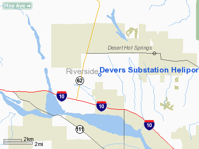
Devers Substation Heliport |
Location
& QuickFacts
|
FAA
Information Effective: |
2006-06-08 |
|
Airport
Identifier: |
91CA |
|
Longitude/Latitude: |
116-34-29.0470W/33-56-23.0500N
-116.574735/33.939736 (Estimated) |
|
Elevation: |
1150
ft / 350.52 m (Estimated) |
|
Land: |
0
acres |
|
From
nearest city: |
3 nautical miles SW of Desert Hot Springs,
CA |
|
Location: |
Riverside County, CA |
|
Magnetic Variation: |
14E (1985) |
Owner
& Manager
|
Ownership: |
Privately owned |
|
Owner: |
Southern California Edison Co |
|
Address: |
62030 16th Ave
North Palm Springs, CA 92258 |
|
Phone
number: |
760-329-6531 |
|
Manager: |
Art Bradbury |
|
Address: |
2161 East Avion St
Ontario, CA 91761 |
|
Phone number: |
909-974-4691 |
Airport
Operations and Facilities
|
Airport
Use: |
Private |
|
Wind
indicator: |
Yes |
|
Segmented
Circle: |
No |
|
Control
Tower: |
No |
|
Attendance
Schedule: |
UNATNDD |
|
Landing
fee charge: |
No |
|
Sectional
chart: |
Los Angeles |
|
Region: |
AWP - Western-Pacific |
|
Boundary
ARTCC: |
ZLA - Los Angeles |
|
Tie-in
FSS: |
RAL - Riverside |
|
FSS
on Airport: |
No |
|
FSS
Phone: |
951-351-3020 |
|
FSS
Toll Free: |
1-800-WX-BRIEF |
|
Runway Information
Helipad H1
|
Dimension: |
20
x 20 ft / 6.1 x 6.1 m |
|
Surface: |
ASPH, |
|
|
Runway H1 |
Runway |
|
Traffic
Pattern: |
Left |
Left |
|
Radio Navigation
Aids
|
ID |
Type |
Name |
Ch |
Freq |
Var |
Dist |
|
SJY |
NDB |
San Jacinto |
|
227.00 |
14E |
22.9 nm |
|
SB |
NDB |
Petis |
|
397.00 |
14E |
40.1 nm |
|
NXP |
TACAN |
Coyote |
063X |
|
14E |
29.9 nm |
|
RIV |
TACAN |
March |
077X |
|
14E |
34.9 nm |
|
HDF |
VOR |
Homeland |
|
113.40 |
14E |
32.0 nm |
|
RAL |
VOR |
Riverside |
|
112.40 |
15E |
43.6 nm |
|
PSP |
VORTAC |
Palm Springs |
102X |
115.50 |
13E |
8.4 nm |
|
TRM |
VORTAC |
Thermal |
109X |
116.20 |
13E |
27.9 nm |
|
TNP |
VORTAC |
Twentynine Palms |
089X |
114.20 |
15E |
41.4 nm |
|
PDZ |
VORTAC |
Paradise |
059X |
112.20 |
15E |
47.7 nm |
|
JLI |
VORTAC |
Julian |
087X |
114.00 |
15E |
48.0 nm |
Remarks
Devers Substation Heliport
Address:
Riverside County, CA
Tel:
760-329-6531,
909-974-4691
Images
and information placed above are from
http://www.airport-data.com/airport/91CA/
We
thank them for the data!
| General
Info |
| Country |
United
States |
| State |
CALIFORNIA
|
| FAA ID |
91CA
|
| Latitude |
33-56-23.050N
|
| Longitude |
116-34-29.047W
|
| Elevation |
1150 feet
|
| Near City |
DESERT
HOT SPRINGS |
We don't guarantee the information is fresh and accurate. The data may
be wrong or outdated.
For more up-to-date information please refer to other sources.
|
|


