 |
|
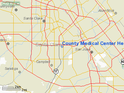
County Medical Center Heliport |
|
|
Location
& QuickFacts
|
FAA
Information Effective: |
2006-06-08 |
|
Airport
Identifier: |
CA33 |
|
Longitude/Latitude: |
121-56-03.0000W/37-18-51.0000N
-121.934167/37.314167 (Estimated) |
|
Elevation: |
148
ft / 45.11 m (Estimated) |
|
Land: |
208
acres |
|
From
nearest city: |
0 nautical miles N of San Jose, CA |
|
Location: |
Santa Clara County, CA |
|
Magnetic Variation: |
16E (1985) |
Owner
& Manager
|
Ownership: |
Publicly owned |
|
Owner: |
Co Of Santa Clara |
|
Address: |
70 West Hedding St
San Jose, CA 95110 |
|
Phone
number: |
408-299-2323 |
|
Manager: |
Santa Clara Med Center |
|
Address: |
751 S. Bascom Ave
San Jose, CA 95128 |
|
Phone number: |
408-299-6827 |
Airport
Operations and Facilities
|
Airport
Use: |
Private
MEDICAL. |
|
Wind
indicator: |
Yes |
|
Segmented
Circle: |
No |
|
Control
Tower: |
No |
|
Attendance
Schedule: |
ALL/ALL/ALL |
|
Lighting
Schedule: |
PHONE REQ
FOR PERIMETER LGTS CALL 408-299-6900. |
|
Landing fee charge: |
No |
|
Sectional chart: |
San Francisco |
|
Region: |
AWP - Western-Pacific |
|
Boundary ARTCC: |
ZOA - Oakland |
|
Tie-in FSS: |
OAK - Oakland |
|
FSS on Airport: |
No |
|
FSS Phone: |
510-273-6111 |
|
FSS Toll Free: |
1-800-WX-BRIEF |
Airport
Services
|
Airframe
Repair: |
NONE |
|
Power
Plant Repair: |
NONE |
|
Runway Information
Helipad H1
|
Dimension: |
65 x 65 ft / 19.8 x 19.8 m |
|
Surface: |
CONC,
ROOFTOP CIRCULAR PAD. |
|
|
Runway H1 |
Runway |
|
Elevation: |
148.00
ft |
0.00 ft |
|
Traffic
Pattern: |
Left |
Left |
|
Radio Navigation
Aids
|
ID |
Type |
Name |
Ch |
Freq |
Var |
Dist |
|
PDG |
NDB |
Pajar |
|
327.00 |
17E |
24.8 nm |
|
LV |
NDB |
Reiga |
|
374.00 |
16E |
25.7 nm |
|
TCY |
NDB |
Tracy |
|
203.00 |
15E |
32.6 nm |
|
NUQ |
TACAN |
Moffett |
123X |
|
17E |
9.2 nm |
|
SJC |
VOR/DME |
San Jose |
088X |
114.10 |
16E |
3.7 nm |
|
SFO |
VOR/DME |
San Francisco |
105X |
115.80 |
17E |
27.9 nm |
|
CCR |
VOR/DME |
Concord |
117X |
117.00 |
17E |
44.2 nm |
|
OSI |
VORTAC |
Woodside |
086X |
113.90 |
17E |
17.2 nm |
|
OAK |
VORTAC |
Oakland |
115X |
116.80 |
17E |
28.3 nm |
|
SNS |
VORTAC |
Salinas |
120X |
117.30 |
17E |
42.2 nm |
|
SAU |
VORTAC |
Sausalito |
109X |
116.20 |
17E |
42.9 nm |
|
ECA |
VORTAC |
Manteca |
107X |
116.00 |
17E |
47.9 nm |
|
SFO |
VOT |
San Francisco Intl |
|
111.00 |
|
27.9 nm |
Remarks
- USERS
CTC SAN JOSE MARPT ATCT.
APCH & DEP PATHS 180-315 DEG.
County Medical Center Heliport
Address:
Santa Clara County, CA
Tel:
408-299-2323,
408-299-6827
Images
and information placed above are from
http://www.airport-data.com/airport/CA33/
We
thank them for the data!
| General
Info |
| Country |
United
States |
| State |
CALIFORNIA
|
| FAA ID |
CA33
|
| Latitude |
37-18-51.000N
|
| Longitude |
121-56-03.000W
|
| Elevation |
148 feet
|
| Near City |
SAN JOSE
|
We don't guarantee the information is fresh and accurate. The data may
be wrong or outdated.
For more up-to-date information please refer to other sources.
|
|


