 |
|
Location
& QuickFacts
|
FAA
Information Effective: |
2006-06-08 |
|
Airport
Identifier: |
55CL |
|
Longitude/Latitude: |
119-02-44.3720W/35-15-47.8610N
-119.045659/35.263295 (Estimated) |
|
Elevation: |
346
ft / 105.46 m (Estimated) |
|
Land: |
20
acres |
|
From
nearest city: |
7 nautical miles SW of Bakersfield, CA |
|
Location: |
Kern County, CA |
|
Magnetic Variation: |
14E (1985) |
Owner
& Manager
|
Ownership: |
Privately owned |
|
Owner: |
H H Costerisan |
|
Address: |
Route 6, Box 68g
Bakersfield, CA 93307 |
|
Phone number: |
805-834-4408 |
|
Address: |
|
Airport
Operations and Facilities
|
Airport Use: |
Private |
|
Wind indicator: |
Yes |
|
Segmented Circle: |
No |
|
Control Tower: |
No |
|
Attendance Schedule: |
UNATNDD |
|
Landing fee charge: |
No |
|
Sectional chart: |
Los Angeles |
|
Region: |
AWP - Western-Pacific |
|
Boundary ARTCC: |
ZLA - Los Angeles |
|
Tie-in FSS: |
RIU - Rancho Murieta |
|
FSS on Airport: |
No |
|
FSS Phone: |
916-354-0161 |
|
FSS Toll Free: |
1-800-WX-BRIEF |
Airport
Services
|
Airframe
Repair: |
NONE |
|
Power
Plant Repair: |
NONE |
|
Runway
Information
Runway N/S
|
Dimension: |
2500 x 50 ft / 762.0 x 15.2 m |
|
Surface: |
TURF, |
|
|
Runway N |
Runway S |
|
Traffic
Pattern: |
Left |
Left |
|
Radio Navigation
Aids
|
ID |
Type |
Name |
Ch |
Freq |
Var |
Dist |
|
TTE |
VOR/DME |
Tule |
029X |
109.20 |
16E |
39.1 nm |
|
EHF |
VORTAC |
Shafter |
101X |
115.40 |
14E |
13.5 nm |
|
GMN |
VORTAC |
Gorman |
108X |
116.10 |
16E |
29.1 nm |
|
FLW |
VORTAC |
Fellows |
122X |
117.50 |
16E |
41.6 nm |
|
LHS |
VORTAC |
Lake Hughes |
021X |
108.40 |
15E |
41.8 nm |
|
BFL |
VOT |
Bakersfield |
|
111.20 |
|
9.7 nm |
Remarks
- ESTABD
PRIOR TO MAY 1959.
Based Aircraft
|
Aircraft
based on field: |
2 |
|
Single
Engine Airplanes: |
2 |
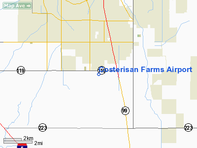
Costerisan Farms Airport
Address:
Kern County, CA
Tel:
805-834-4408
Images
and information placed above are from
http://www.airport-data.com/airport/55CL/
We
thank them for the data!
| General
Info |
| Country |
United
States |
| State |
CALIFORNIA
|
| FAA ID |
55CL
|
| Latitude |
35-15-47.861N
|
| Longitude |
119-02-44.372W
|
| Elevation |
346 feet
|
| Near City |
BAKERSFIELD
|
We don't guarantee the information is fresh and accurate. The data may
be wrong or outdated.
For more up-to-date information please refer to other sources.
|
|


