 |
|
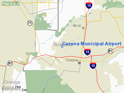
| Corona Municipal Airport |
| IATA: none – ICAO: KAJO – FAA LID: AJO |
| Summary |
| Airport type |
Public |
| Operator |
City of Corona |
| Location |
Corona, California |
| Elevation AMSL |
533 ft / 162 m |
| Coordinates |
33°53′52″N 117°36′09″W / 33.89778°N 117.6025°W / 33.89778; -117.6025 |
| Runways |
| Direction |
Length |
Surface |
| ft |
m |
| 7/25 |
3,200 |
975 |
Asphalt |
| Statistics (2004) |
| Aircraft operations |
68,000 |
| Based aircraft |
414 |
| Source: Federal Aviation Administration |
Corona Municipal Airport (ICAO: KAJO, FAA LID: AJO), formerly L66, is a public airport located three miles (4.8 km) northwest of Corona, serving Riverside County, California, United States.
Although most U.S. airports use the same three-letter location identifier for the FAA and IATA, Corona Municipal Airport is assigned AJO by the FAA but has no designation from the IATA (which assigned AJO to Aljouf, Yemen). Facilities and aircraft
Corona Municipal Airport covers an area of 98 acres (40 ha) which contains one asphalt paved runway (7/25) measuring 3,200 x 60 ft (975 x 18 m).
For the 12-month period ending December 31, 2004, the airport had 68,000 aircraft operations, an average of 186 per day, all of which were general aviation. There are 414 aircraft based at this airport: 90% single engine, 6% multi-engine, 2% helicopters and 1% ultralight.
January 21, 2008
On January 21, 2008 two private planes collided in Corona killing five people, including one on the ground. The collision occurred about a mile away from the Corona Municipal Airport above Serfas Club Drive. The crash wreckage left debris strewn along a commercial strip near the 91 Freeway. Eyewitnesses claim to see an explosion in the air and two different bodies fall from the sky. The aircraft involved were both single-engine Cessnas, a two-seat Cessna 150 and a four-seat Cessna 172. Investigators from the National Transportation Safety Board, local Corona Police Detectives as well as the Federal Aviation Administration began their probe the following day. As of January 23 a cause for the accident is yet to be determined.
The crash began a debate about the safety of the Corona Municipal Airport as it does not have an operating Control Tower. The city of Corona has had seven fatal aircraft accidents since 1998.
On July 26, 2008 at approximately 13:47 local time, a baby blue and white 1947 Ercoupe stalled upon takeoff when turning crosswind and crashed into the forest on the southwest side of the airport. Eyewitnesses say that the two elderly pilots had minor injuries, with one of them bleeding from his right cheek where the yoke struck him upon impact. Both are alive, but the airplane is said to have sustained considerable damage.
An image of a WWII Ercoupe: http://www.youngeagles.org/photos/gallery/Monoplanes/Ercoupe415C.jpg
The above content comes from Wikipedia and is published under free licenses – click here to read more.
Location
& QuickFacts
|
FAA
Information Effective: |
2006-06-08 |
|
Airport
Identifier: |
AJO |
|
Longitude/Latitude: |
117-36-08.7831W/33-53-51.5547N
-117.602440/33.897654 (Estimated) |
|
Elevation: |
533
ft / 162.46 m (Surveyed) |
|
Land: |
98
acres |
|
From
nearest city: |
3 nautical miles NW of Corona, CA |
|
Location: |
Riverside County, CA |
|
Magnetic Variation: |
14E (1985) |
Owner
& Manager
|
Ownership: |
Publicly owned |
|
Owner: |
U.s. Army Corps Of Engrs.
ON LEASE TO CITY OF CORONA. |
|
Address: |
Civic Center 815 W 6th St.
Corona, CA 92882 |
|
Manager: |
Richard Brodeur
PHYSICAL AIRPORT ADDRESS: 1900 AVIATION DRIVE, CORONA, CA
92880. |
|
Address: |
400 South Vicentia Ave.
Corona, CA 92882 |
|
Phone number: |
951-736-2289 |
Airport
Operations and Facilities
|
Airport
Use: |
Open to public |
|
Wind
indicator: |
Yes |
|
Segmented
Circle: |
Yes |
|
Control
Tower: |
No |
|
Attendance
Schedule: |
ALL/MON-SAT/0700-1700 |
|
Lighting
Schedule: |
DUSK-DAWN
ACTVT MIRL RY 07/25 VASI & REIL RY 25 - CTAF. |
|
Beacon
Color: |
Clear-Green (lighted land airport) |
|
Landing
fee charge: |
No |
|
Sectional
chart: |
Los Angeles |
|
Region: |
AWP - Western-Pacific |
|
Traffic
Pattern Alt: |
1000
ft |
|
Boundary
ARTCC: |
ZLA - Los Angeles |
|
Tie-in
FSS: |
RAL - Riverside |
|
FSS
on Airport: |
No |
|
FSS
Phone: |
951-351-3020 |
|
FSS
Toll Free: |
1-800-WX-BRIEF |
|
NOTAMs
Facility: |
AJO (NOTAM-d service avaliable) |
|
Federal Agreements: |
N |
Airport
Communications
|
CTAF: |
122.700 |
|
Unicom: |
122.700 |
Airport
Services
|
Fuel
available: |
100LLA |
|
Airframe
Repair: |
MAJOR |
|
Power
Plant Repair: |
MAJOR |
|
Bottled
Oxygen: |
NONE |
|
Bulk
Oxygen: |
NONE |
|
Runway Information
Runway 07/25
|
Dimension: |
3200 x 60 ft / 975.4 x 18.3 m |
|
Surface: |
ASPH, Good Condition |
|
Weight
Limit: |
Single wheel: 12000 lbs. |
|
Edge
Lights: |
Medium |
|
|
Runway 07 |
Runway 25 |
|
Longitude: |
117-36-27.7686W |
117-35-49.8166W |
|
Latitude: |
33-53-51.3496N |
33-53-51.8347N |
|
Elevation: |
515.00
ft |
533.00
ft |
|
Alignment: |
89 |
127 |
|
Traffic
Pattern: |
Right |
Left |
|
Markings: |
Basic, Fair Condition |
Basic, Fair Condition |
|
Crossing
Height: |
0.00 ft |
31.00
ft |
|
Displaced
threshold: |
194.00
ft |
196.00
ft |
|
VASI: |
|
4-box on left side |
|
Visual
Glide Angle: |
0.00� |
4.00� |
|
Runway
End Identifier: |
|
Yes |
|
Obstruction: |
40 ft trees, 400.0 ft from runway, 265 ft left
of centerline, 5:1 slope to clear
RWY 07 APCH RATIO TO DSPLCD THR 15:1. |
6 ft fence, 200.0 ft from runway
APCH RATIO TO DSPLCD THR 50:1. |
|
Radio Navigation
Aids
|
ID |
Type |
Name |
Ch |
Freq |
Var |
Dist |
|
SB |
NDB |
Petis |
|
397.00 |
14E |
15.2 nm |
|
EMT |
NDB |
El Monte |
|
359.00 |
15E |
24.2 nm |
|
SJY |
NDB |
San Jacinto |
|
227.00 |
14E |
30.7 nm |
|
CPM |
NDB |
Compton |
|
378.00 |
15E |
32.2 nm |
|
PAI |
NDB |
Pacoima |
|
370.00 |
15E |
45.9 nm |
|
RIV |
TACAN |
March |
077X |
|
14E |
16.4 nm |
|
NFG |
TACAN |
Camp Pendleton |
055X |
|
13E |
39.0 nm |
|
RAL |
VOR |
Riverside |
|
112.40 |
15E |
8.3 nm |
|
HDF |
VOR |
Homeland |
|
113.40 |
14E |
22.1 nm |
|
ELB |
VOR/DME |
El Toro |
119X |
117.20 |
14E |
14.8 nm |
|
SMO |
VOR/DME |
Santa Monica |
045X |
110.80 |
15E |
43.1 nm |
|
VCV |
VOR/DME |
Victorville |
031X |
109.40 |
14E |
43.2 nm |
|
VNY |
VOR/DME |
Van Nuys |
078X |
113.10 |
15E |
48.4 nm |
|
PDZ |
VORTAC |
Paradise |
059X |
112.20 |
15E |
3.8 nm |
|
POM |
VORTAC |
Pomona |
041X |
110.40 |
15E |
14.2 nm |
|
SLI |
VORTAC |
Seal Beach |
104X |
115.70 |
15E |
23.6 nm |
|
OCN |
VORTAC |
Oceanside |
100X |
115.30 |
15E |
40.6 nm |
|
LAX |
VORTAC |
Los Angeles |
083X |
113.60 |
15E |
41.4 nm |
|
PMD |
VORTAC |
Palmdale |
092X |
114.50 |
15E |
49.7 nm |
|
SNA |
VOT |
Santa Ana |
|
110.00 |
|
18.8 nm |
|
LAX |
VOT |
San Pedro Hill |
|
113.90 |
|
37.8 nm |
Remarks
- NOISE
ABATEMENT PROCEDURES: RY 25 STRAIGHT-IN APCH NOT RECOMMENDED. AVOID
FLYING OVER HOUSES ON BLUFF AT EAST END. FLY OVER WASH/CREEK. RY 07
REQUIRES A 15 DEG RIGHT TURN AT DEP END TO FOLLOW WASH/CREEK.
- UNLGTD
TWR 828 FT MSL 3 MILES E OF ARPT.
- CRANE
150 AGL 1 MILE SOUTH OF RY 7.
Based Aircraft
|
Aircraft
based on field: |
414 |
|
Single
Engine Airplanes: |
373 |
|
Multi
Engine Airplanes: |
25 |
|
Helicopters: |
10 |
|
Ultralights: |
6 |
Operational Statistics
|
Aircraft
Operations: |
187/Day |
|
General
Aviation Local: |
73.5% |
|
General
Aviation Itinerant: |
26.5% |
Corona Municipal Airport
Address:
Riverside County, CA
Tel:
951-736-2289
Images
and information placed above are from
http://www.airport-data.com/airport/AJO/
We
thank them for the data!
| General
Info |
| Country |
United
States |
| State |
CALIFORNIA
|
| FAA ID |
AJO
|
| Latitude |
33-53-51.554N
|
| Longitude |
117-36-08.784W
|
| Elevation |
533 feet
|
| Near City |
CORONA
|
We don't guarantee the information is fresh and accurate. The data may
be wrong or outdated.
For more up-to-date information please refer to other sources.
|
|


