 |
|
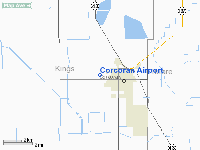
| Corcoran Airport |
| IATA: CRO – ICAO: KCRO – FAA LID: CRO |
| Summary |
| Airport type |
Public |
| Owner |
Lakeland Dusters, Inc. |
| Serves |
Corcoran, California |
| Elevation AMSL |
197 ft / 60 m |
| Coordinates |
36°06′10″N 119°35′41″W / 36.10278°N 119.59472°W / 36.10278; -119.59472 |
| Runways |
| Direction |
Length |
Surface |
| ft |
m |
| 13/31 |
3,800 |
1,158 |
Asphalt |
| Statistics (2007) |
| Aircraft operations |
5,600 |
| Based aircraft |
18 |
| Source: Federal Aviation Administration |
Corcoran Airport (IATA: CRO, ICAO: KCRO, FAA LID: CRO) is a public use airport located two nautical miles (3.7 km) west of the central business district of Corcoran, a town in Kings County, California, United States. It is privately owned by Lakeland Dusters, Inc.
Facilities and aircraft
Corcoran Airport covers an area of 220 acres (89 ha) at an elevation of 197 feet (60 m) above mean sea level. It has one asphalt paved runway designated 13/31 which measures 3,800 by 50 feet (1,158 x 15 m). For the 12-month period ending October 3, 2007, the airport had 5,600 aircraft operations, an average of 15 per day, all of which were general aviation. At that time there were 18 aircraft based at this airport: 61% single-engine, 28% jet and 11% helicopter.
The above content comes from Wikipedia and is published under free licenses – click here to read more.
Location
& QuickFacts
|
FAA
Information Effective: |
2006-06-08 |
|
Airport
Identifier: |
CRO |
|
Longitude/Latitude: |
119-35-41.4490W/36-06-08.8240N
-119.594847/36.102451 (Estimated) |
|
Elevation: |
197
ft / 60.05 m (Estimated) |
|
Land: |
220
acres |
|
From
nearest city: |
2 nautical miles W of Corcoran, CA |
|
Location: |
Kings County, CA |
|
Magnetic Variation: |
15E (1985) |
Owner
& Manager
|
Ownership: |
Privately owned |
|
Owner: |
Lakeland Dusters, Inc. |
|
Address: |
Box 926
Corcoran, CA 93212 |
|
Phone
number: |
209-992-5716 |
|
Manager: |
Reid Potter
ON AIRPORT CONTACT: ART VERDUZCO (559) 992-5716 |
|
Address: |
Post Office Box 926
Corcoran, CA 93212 |
|
Phone number: |
209-992-5716 |
Airport
Operations and Facilities
|
Airport
Use: |
Open to public |
|
Wind
indicator: |
Yes |
|
Segmented
Circle: |
No |
|
Control
Tower: |
No |
|
Attendance
Schedule: |
ALL/MON-FRI/0800-1700 |
|
Lighting
Schedule: |
RDO-CTL
ACTVT LIRL RWY 13/31 - CTAF. |
|
Landing
fee charge: |
No |
|
Sectional
chart: |
San Francisco |
|
Region: |
AWP - Western-Pacific |
|
Traffic
Pattern Alt: |
1000
ft |
|
Boundary
ARTCC: |
ZOA - Oakland |
|
Tie-in
FSS: |
RIU - Rancho Murieta |
|
FSS
on Airport: |
No |
|
FSS
Phone: |
916-354-0161 |
|
FSS
Toll Free: |
1-800-WX-BRIEF |
|
NOTAMs
Facility: |
RIU (NOTAM-d service avaliable) |
|
Federal Agreements: |
N |
Airport
Communications
Airport
Services
|
Fuel
available: |
100LLA |
|
Airframe
Repair: |
NONE |
|
Power
Plant Repair: |
NONE |
|
Bottled
Oxygen: |
NONE |
|
Bulk
Oxygen: |
NONE |
|
Runway Information
Runway 13/31
|
Dimension: |
3800 x 50 ft / 1158.2 x 15.2 m |
|
Surface: |
ASPH, Good Condition |
|
Weight
Limit: |
Single wheel: 8000 lbs. |
|
Edge
Lights: |
Low |
|
|
Runway 13 |
Runway 31 |
|
Traffic
Pattern: |
Left |
Left |
|
Markings: |
Nonstandard, Good Condition
/31 NSTD BSC MARKINGS; DSPLCD THLD MARKINGS YELLOW. |
Nonstandard, Good Condition |
|
Displaced
threshold: |
620.00
ft |
525.00
ft |
|
Runway
End Identifier: |
No |
No |
|
Centerline
Lights: |
No |
No |
|
Touchdown
Lights: |
No |
No |
|
Obstruction: |
15 ft road, 200.0 ft from runway, 50 ft right
of centerline
APCH RATIO 50:1 AT DSPLCD THR; +15' RD 650' FM DSPLCD THR
190' R APCH RATIO 43:1.
+8' FENCE 20' FM RY END 125' L TO 50' R; +15' RD 0-200' FM
RY END 27' L TO 125' R. |
20 ft sign, 200.0 ft from runway
APCH RATIO 36:1 AT DSPLCD THR.
+3' FENCE 0' FM RY END 50' L TO 50' R; +17' ROAD 0'-150' FM
RY END 100' L TO 125' R; +20' SIGN 200' FM RY END 0' L/R. |
|
Radio Navigation
Aids
|
ID |
Type |
Name |
Ch |
Freq |
Var |
Dist |
|
COR |
NDB |
Salyer Farms |
|
205.00 |
16E |
3.6 nm |
|
CUK |
NDB |
Academy |
|
266.00 |
14E |
37.8 nm |
|
FCH |
NDB |
Chandler |
|
344.00 |
15E |
39.1 nm |
|
NLC |
TACAN |
Lemoore |
080X |
|
16E |
23.1 nm |
|
VIS |
VOR/DME |
Visalia |
031X |
109.40 |
16E |
16.8 nm |
|
TTE |
VOR/DME |
Tule |
029X |
109.20 |
16E |
30.1 nm |
|
AVE |
VORTAC |
Avenal |
118X |
117.10 |
16E |
33.1 nm |
|
EHF |
VORTAC |
Shafter |
101X |
115.40 |
14E |
44.4 nm |
|
CZQ |
VORTAC |
Clovis |
076X |
112.90 |
15E |
48.2 nm |
|
BFL |
VOT |
Bakersfield |
|
111.20 |
|
48.7 nm |
Remarks
Based Aircraft
|
Aircraft
based on field: |
18 |
|
Single
Engine Airplanes: |
11 |
|
Jet Engine
Airplanes: |
5 |
|
Helicopters: |
2 |
Operational Statistics
|
Aircraft
Operations: |
108/Week |
|
General
Aviation Local: |
89.3% |
|
General
Aviation Itinerant: |
10.7% |
Corcoran Airport
Address:
Kings County, CA
Tel:
209-992-5716
Images
and information placed above are from
http://www.airport-data.com/airport/CRO/
We
thank them for the data!
| General
Info |
| Country |
United
States |
| State |
CALIFORNIA
|
| FAA ID |
CRO
|
| Latitude |
36-06-08.824N
|
| Longitude |
119-35-41.449W
|
| Elevation |
197 feet
|
| Near City |
CORCORAN
|
We don't guarantee the information is fresh and accurate. The data may
be wrong or outdated.
For more up-to-date information please refer to other sources.
|
|


