 |
|
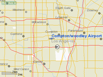
Compton / woodley Airport |
Coordinates: 33°53′24″N 118°14′37″W / 33.89°N 118.24361°W / 33.89; -118.24361
| Compton/Woodley Airport |
| IATA: CPM – ICAO: KCPM – FAA LID: CPM |
| Summary |
| Airport type |
Public |
| Owner |
County of Los Angeles |
| Location |
Compton, California |
| Elevation AMSL |
97 ft / 30 m |
| Runways |
| Direction |
Length |
Surface |
| ft |
m |
| 7L/25R |
3,322 |
1,013 |
Asphalt |
| 7R/25L |
3,322 |
1,013 |
Asphalt |
| Statistics (2007) |
| Aircraft operations |
66,000 |
| Based aircraft |
209 |
| Source: Federal Aviation Administration |
Compton/Woodley Airport (IATA: CPM, ICAO: KCPM, FAA LID: CPM) is a county-owned public-use airport located two miles (3 km) southwest of the central business district of Compton, a city in southern Los Angeles County, California, United States. According to the FAA's National Plan of Integrated Airport Systems for 2007–2011, it is categorized as a reliever airport.
The airport opened on May 10, 1924. It is used exclusively for general aviation, as an alternative to Los Angeles International Airport which is about 8 miles (13 km) to the west. Facilities and aircraft
Compton/Woodley Airport covers an area of 77 acres (31 ha) which contains two asphalt paved runways (7L/25R and 7R/25L), each measuring 3,322 x 60 ft (1,013 x 18 m). For the 12-month period ending June 25, 2007, the airport had 66,000 general aviation aircraft operations, an average of 180 per day. There are 209 aircraft based at this airport: 90% single-engine, 5% multi-engine, 3% helicopter, <1% jet and <1% glider.
References in popular culture
The Compton Airport is mentioned in the opening bars of Dr. Dre's "Big Egos" on his multi-platinum album 2001 (album).
The above content comes from Wikipedia and is published under free licenses – click here to read more.
Location
& QuickFacts
|
FAA
Information Effective: |
2006-06-08 |
|
Airport
Identifier: |
CPM |
|
Longitude/Latitude: |
118-14-37.2590W/33-53-24.0580N
-118.243683/33.890016 (Estimated) |
|
Elevation: |
97
ft / 29.57 m (Surveyed) |
|
Land: |
77
acres |
|
From
nearest city: |
2 nautical miles SW of Compton, CA |
|
Location: |
Los Angeles County, CA |
|
Magnetic Variation: |
14E (1985) |
Owner
& Manager
|
Ownership: |
Publicly owned |
|
Owner: |
County Of Los Angeles |
|
Address: |
900 S. Fremont Ave
Alhambra, CA 92803 |
|
Phone
number: |
(626)
300-46 |
|
Manager: |
Jared Fox-tuck
JEFF CHASE (626) 458-7389 COUNTY OF LOS ANGELES MANAGES
CONTRACT AIRPORT MGR. AIRPORT DATA PROVIDED BY JEFF CHASE. |
|
Address: |
901 W Alondra Blvd
Compton, CA 90220-3528 |
|
Phone number: |
310-631-8140 |
Airport
Operations and Facilities
|
Airport
Use: |
Open to public |
|
Wind
indicator: |
Yes |
|
Segmented
Circle: |
Yes |
|
Control
Tower: |
No |
|
Attendance
Schedule: |
ALL/ALL/ALL |
|
Lighting
Schedule: |
DUSK-DAWN
ACTVT MIRL RY 07R/25L, PAPI, REIL RY 25L AND NORTH AND SOUTH
PARALLEL TWYS - CTAF. |
|
Beacon
Color: |
Clear-Green (lighted land airport) |
|
Landing
fee charge: |
No |
|
Sectional
chart: |
Los Angeles |
|
Region: |
AWP - Western-Pacific |
|
Traffic
Pattern Alt: |
900
ft |
|
Boundary
ARTCC: |
ZLA - Los Angeles |
|
Tie-in
FSS: |
HHR - Hawthorne |
|
FSS
on Airport: |
No |
|
FSS
Phone: |
310-970-0102 |
|
FSS
Toll Free: |
1-800-WX-BRIEF |
|
NOTAMs
Facility: |
HHR (NOTAM-d service avaliable) |
|
Federal Agreements: |
NGY |
Airport
Communications
|
CTAF: |
123.050 |
|
Unicom: |
123.050 |
Airport
Services
|
Fuel
available: |
100LL80 |
|
Airframe
Repair: |
MAJOR |
|
Power
Plant Repair: |
MAJOR |
|
Bottled
Oxygen: |
NONE |
|
Bulk
Oxygen: |
NONE |
|
Runway Information
Runway 07L/25R
|
Dimension: |
3322 x 60 ft / 1012.5 x 18.3 m |
|
Surface: |
ASPH, Good Condition |
|
Surface
Treatment: |
Aggregate Friction Seal Coat |
|
Weight
Limit: |
Single wheel: 14500 lbs. |
|
|
Runway 07L |
Runway 25R |
|
Longitude: |
118-14-57.4100W |
118-14-17.9900W |
|
Latitude: |
33-53-24.5900N |
33-53-24.7700N |
|
Traffic
Pattern: |
Right |
Left |
|
Markings: |
Basic, Good Condition |
Basic, Good Condition |
|
Displaced
threshold: |
734.00
ft |
680.00
ft |
|
Runway
End Identifier: |
No |
No |
|
Centerline
Lights: |
No |
No |
|
Touchdown
Lights: |
No |
No |
|
Obstruction: |
19 ft street, 200.0 ft from runway
APCH RATIO TO DSPLCD THLD OVER +40 FT TREE 1195 FT FM DSPLCD
THLD 29:1.
6 FT FENCE 70 FT FM THLD PERPENDICULAR TO CNTRLN +8 FT WALL
90 FT FM THLD PERPENDICULAR TO CNTRLN; +30 FT PLINE 200 FT
FM RY END 125 FT R TO 125 FT L. |
15 ft street, 200.0 ft from runway
APCH RATIO 50:1 TO DSPLCD THLD.
+6 FT FENCE 60 FT TO 70 FT FROM THRESHOLD, +8 FT WALL 75 FT
TO 85 FT FROM THRESHOLD, +15 FT STREET 125 FT R 105 FT TO
200 FT FROM THRESHOLD THROUGH 125 FT L 120 FT TO 200 FT FROM
THR. |
|
Runway 07R/25L
|
Dimension: |
3322 x 60 ft / 1012.5 x 18.3 m |
|
Surface: |
ASPH, Good Condition |
|
Surface
Treatment: |
Aggregate Friction Seal Coat |
|
Weight
Limit: |
Single wheel: 14500 lbs. |
|
Edge
Lights: |
Medium |
|
|
Runway 07R |
Runway 25L |
|
Longitude: |
118-14-57.3900W |
118-14-17.9900W |
|
Latitude: |
33-53-22.6100N |
33-53-22.8000N |
|
Traffic
Pattern: |
Right |
Left |
|
Markings: |
Basic, Good Condition |
Basic, Good Condition |
|
Crossing
Height: |
0.00 ft |
40.00
ft |
|
Displaced
threshold: |
734.00
ft |
680.00
ft |
|
VASI: |
|
2-light PAPI on left side |
|
Visual
Glide Angle: |
0.00� |
4.00� |
|
Runway
End Identifier: |
No |
Yes |
|
Centerline
Lights: |
No |
No |
|
Touchdown
Lights: |
No |
No |
|
Obstruction: |
19 ft street, 200.0 ft from runway
APCH RATIO TO DSPLCD THLD OVER +35 FT POLE 1145 FT FM DSPLCD
THLD 130 FT RIGHT 32:1.
6 FT FENCE 70 FT FM THLD PERPENDICULAR TO CNTRLN +8 FT WALL
90 FT FM THLD PERPENDICULAR TO CNTRLN; +30 FT PLINE 125 FT
FM RY END 125 FT R TO 125 FT L. |
15 ft street, 200.0 ft from runway
APCH RATIO 50:1 TO DSPLCD THLD.
+6 FT FENCE 45 FT TO 70 FT FROM THRESHOLD, +8 FT WALL 70 FT
TO 90 FT FROM THRESHOLD, +15 FT STREET 125 FT R 120 FT TO
200 FT FROM THRESHOLD THROUGH 125 FT L 120 FT TO 200 FT FROM
THR. |
|
Radio Navigation
Aids
|
ID |
Type |
Name |
Ch |
Freq |
Var |
Dist |
|
CPM |
NDB |
Compton |
|
378.00 |
15E |
0.2 nm |
|
EMT |
NDB |
El Monte |
|
359.00 |
15E |
15.9 nm |
|
PAI |
NDB |
Pacoima |
|
370.00 |
15E |
23.8 nm |
|
SB |
NDB |
Petis |
|
397.00 |
14E |
44.9 nm |
|
NTD |
TACAN |
Point Mugu |
043X |
|
15E |
46.0 nm |
|
RIV |
TACAN |
March |
077X |
|
14E |
48.4 nm |
|
RAL |
VOR |
Riverside |
|
112.40 |
15E |
39.8 nm |
|
SMO |
VOR/DME |
Santa Monica |
045X |
110.80 |
15E |
12.8 nm |
|
VNY |
VOR/DME |
Van Nuys |
078X |
113.10 |
15E |
23.5 nm |
|
ELB |
VOR/DME |
El Toro |
119X |
117.20 |
14E |
28.7 nm |
|
VTU |
VOR/DME |
Ventura |
019X |
108.20 |
15E |
42.4 nm |
|
CMA |
VOR/DME |
Camarillo |
105X |
115.80 |
15E |
46.6 nm |
|
LAX |
VORTAC |
Los Angeles |
083X |
113.60 |
15E |
9.7 nm |
|
SLI |
VORTAC |
Seal Beach |
104X |
115.70 |
15E |
11.4 nm |
|
POM |
VORTAC |
Pomona |
041X |
110.40 |
15E |
25.4 nm |
|
SXC |
VORTAC |
Santa Catalina |
051X |
111.40 |
15E |
32.2 nm |
|
PDZ |
VORTAC |
Paradise |
059X |
112.20 |
15E |
35.6 nm |
|
FIM |
VORTAC |
Fillmore |
072X |
112.50 |
15E |
42.3 nm |
|
PMD |
VORTAC |
Palmdale |
092X |
114.50 |
15E |
45.5 nm |
|
LAX |
VOT |
San Pedro Hill |
|
113.90 |
|
9.8 nm |
|
SNA |
VOT |
Santa Ana |
|
110.00 |
|
22.6 nm |
Remarks
- PLANES
PARKED 145 FT NORTH OF CENTERLINE 07L/25R AND 158 FT SOUTH OF CENTERLINE
07R/25L.
- REQ
ALL TRAFFIC REMAIN SOUTH OF AIRPORT. AVOID OVERFLIGHT OF SCHOOLS 2900
FT EAST.
- ONLY
SOUTH SIDE OF NORTH PARALLEL TAXIWAY LIGHTED; ONLY NORTH SIDE OF SOUTH
PARALLEL TAXIWAY LIGHTED.
Based Aircraft
|
Aircraft
based on field: |
208 |
|
Single
Engine Airplanes: |
192 |
|
Multi
Engine Airplanes: |
9 |
|
Helicopters: |
6 |
|
Gliders: |
1 |
Operational Statistics
|
Aircraft
Operations: |
181/Day |
|
General
Aviation Local: |
54.5% |
|
General
Aviation Itinerant: |
45.5% |
Compton/woodley Airport
Address:
Los Angeles County, CA
Tel:
(626)
300-46,
310-631-8140
Images
and information placed above are from
http://www.airport-data.com/airport/CPM/
We
thank them for the data!
| General
Info |
| Country |
United
States |
| State |
CALIFORNIA
|
| FAA ID |
CPM
|
| Latitude |
33-53-24.058N
|
| Longitude |
118-14-37.259W
|
| Elevation |
97 feet
|
| Near City |
COMPTON
|
We don't guarantee the information is fresh and accurate. The data may
be wrong or outdated.
For more up-to-date information please refer to other sources.
|
|


