 |
|
Community Memorial Hospital Heliport |
|
|
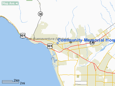
Location
& QuickFacts
|
FAA
Information Effective: |
2006-06-08 |
|
Airport
Identifier: |
CA72 |
|
Longitude/Latitude: |
119-15-25.0000W/34-16-29.0000N
-119.256944/34.274722 (Estimated) |
|
Elevation: |
175
ft / 53.34 m (Estimated) |
|
Land: |
0
acres |
|
From
nearest city: |
2 nautical miles SE of Ventura, CA |
|
Location: |
Ventura County, CA |
|
Magnetic Variation: |
14E (1990) |
Owner
& Manager
|
Ownership: |
Privately owned |
|
Owner: |
Community Memorial Hospital |
|
Address: |
147 Brent Street
Ventura, CA 93003 |
|
Phone
number: |
805-652-5011 |
|
Manager: |
Lee Ambers |
|
Address: |
6910 Hayvenhurst Avenue, 102
Van Nuys, CA 91406 |
|
Phone number: |
818-901-1434 |
Airport
Operations and Facilities
|
Airport
Use: |
Private
HOSPITAL USE. |
|
Wind
indicator: |
Yes |
|
Segmented
Circle: |
Yes |
|
Control
Tower: |
No |
|
Attendance
Schedule: |
ALL/ALL/ALL |
|
Lighting
Schedule: |
PHONE REQ
FOR PERIMETER LGTS RY H1 & ROTG BCN CALL 805-652-5051. |
|
Beacon
Color: |
Clear-Green-Yellow (heliport) |
|
Sectional
chart: |
Los Angeles |
|
Region: |
AWP - Western-Pacific |
|
Boundary
ARTCC: |
ZLA - Los Angeles |
|
Tie-in
FSS: |
HHR - Hawthorne |
|
FSS
on Airport: |
No |
|
FSS
Phone: |
310-970-0102 |
|
FSS
Toll Free: |
1-800-WX-BRIEF |
|
Runway Information
Helipad H1
|
Dimension: |
96 x 77 ft / 29.3 x 23.5 m |
|
Surface: |
CONC, Good Condition |
|
|
Runway H1 |
Runway |
|
Traffic
Pattern: |
Left |
Left |
|
Radio Navigation
Aids
|
ID |
Type |
Name |
Ch |
Freq |
Var |
Dist |
|
PAI |
NDB |
Pacoima |
|
370.00 |
15E |
41.9 nm |
|
NTD |
TACAN |
Point Mugu |
043X |
|
15E |
11.3 nm |
|
CMA |
VOR/DME |
Camarillo |
105X |
115.80 |
15E |
8.9 nm |
|
VTU |
VOR/DME |
Ventura |
019X |
108.20 |
15E |
14.1 nm |
|
VNY |
VOR/DME |
Van Nuys |
078X |
113.10 |
15E |
38.1 nm |
|
SMO |
VOR/DME |
Santa Monica |
045X |
110.80 |
15E |
42.9 nm |
|
FIM |
VORTAC |
Fillmore |
072X |
112.50 |
15E |
19.3 nm |
|
RZS |
VORTAC |
San Marcus |
096X |
114.90 |
14E |
29.1 nm |
|
GMN |
VORTAC |
Gorman |
108X |
116.10 |
16E |
37.4 nm |
|
LHS |
VORTAC |
Lake Hughes |
021X |
108.40 |
15E |
41.7 nm |
|
GVO |
VORTAC |
Gaviota |
085X |
113.80 |
16E |
44.1 nm |
|
LAX |
VORTAC |
Los Angeles |
083X |
113.60 |
15E |
45.9 nm |
Remarks
- PROVIDED
HELIPORT FOR PVT VFR OPNS ONLY.
Community Memorial Hospital Heliport
Address:
Ventura County, CA
Tel:
805-652-5011,
818-901-1434
Images
and information placed above are from
http://www.airport-data.com/airport/CA72/
We
thank them for the data!
| General
Info |
| Country |
United
States |
| State |
CALIFORNIA
|
| FAA ID |
CA72
|
| Latitude |
34-16-29.000N
|
| Longitude |
119-15-25.000W
|
| Elevation |
175 feet
|
| Near City |
VENTURA
|
We don't guarantee the information is fresh and accurate. The data may
be wrong or outdated.
For more up-to-date information please refer to other sources.
|
|


