 |
|
City Of Industry Civic Financial Center Heliport |
|
|
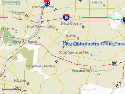
Location
& QuickFacts
|
FAA
Information Effective: |
2006-06-08 |
|
Airport
Identifier: |
40CA |
|
Longitude/Latitude: |
117-57-33.2300W/34-01-28.0400N
-117.959231/34.024456 (Estimated) |
|
Elevation: |
322 ft / 98.15 m (Surveyed) |
|
Land: |
0 acres |
|
From
nearest city: |
1 nautical miles N of City Of Industry, CA |
|
Location: |
Los Angeles County, CA |
|
Magnetic Variation: |
14E (1985) |
Owner
& Manager
|
Ownership: |
Privately owned |
|
Owner: |
Industry Urban Development |
|
Address: |
15651 East Stafford St
City Of Industry, CA 91744 |
|
Phone
number: |
213-961-6341 |
|
Manager: |
Carl Burnett |
|
Address: |
15651 East Stafford Street
City Of Industry, CA 91744 |
|
Phone number: |
213-333-2211 |
Airport
Operations and Facilities
|
Airport
Use: |
Private |
|
Wind
indicator: |
Yes |
|
Segmented
Circle: |
No |
|
Control
Tower: |
No |
|
Attendance
Schedule: |
UNATNDD |
|
Lighting
Schedule: |
DUSK-DAWN |
|
Landing
fee charge: |
No |
|
Sectional
chart: |
Los Angeles |
|
Region: |
AWP - Western-Pacific |
|
Boundary
ARTCC: |
ZLA - Los Angeles |
|
Tie-in
FSS: |
RAL - Riverside |
|
FSS
on Airport: |
No |
|
FSS
Phone: |
951-351-3020 |
|
FSS
Toll Free: |
1-800-WX-BRIEF |
|
Runway Information
Helipad H1
|
Dimension: |
50
x 50 ft / 15.2 x 15.2 m
HELIPAD WITHIN A 80' X 80' LANDING/TAKEOFF AREA. |
|
Surface: |
ASPH, |
|
Edge
Lights: |
Low |
|
|
Runway H1 |
Runway |
|
Traffic
Pattern: |
Left |
Left |
|
Radio Navigation
Aids
|
ID |
Type |
Name |
Ch |
Freq |
Var |
Dist |
|
EMT |
NDB |
El Monte |
|
359.00 |
15E |
5.3 nm |
|
CPM |
NDB |
Compton |
|
378.00 |
15E |
16.5 nm |
|
PAI |
NDB |
Pacoima |
|
370.00 |
15E |
26.7 nm |
|
SB |
NDB |
Petis |
|
397.00 |
14E |
29.6 nm |
|
GWF |
NDB |
Gen William J Fox |
|
282.00 |
15E |
44.8 nm |
|
SJY |
NDB |
San Jacinto |
|
227.00 |
14E |
49.8 nm |
|
RIV |
TACAN |
March |
077X |
|
14E |
34.9 nm |
|
RAL |
VOR |
Riverside |
|
112.40 |
15E |
25.8 nm |
|
HDF |
VOR |
Homeland |
|
113.40 |
14E |
41.4 nm |
|
ELB |
VOR/DME |
El Toro |
119X |
117.20 |
14E |
23.8 nm |
|
SMO |
VOR/DME |
Santa Monica |
045X |
110.80 |
15E |
24.8 nm |
|
VNY |
VOR/DME |
Van Nuys |
078X |
113.10 |
15E |
29.1 nm |
|
VCV |
VOR/DME |
Victorville |
031X |
109.40 |
14E |
44.4 nm |
|
POM |
VORTAC |
Pomona |
041X |
110.40 |
15E |
9.2 nm |
|
SLI |
VORTAC |
Seal Beach |
104X |
115.70 |
15E |
15.3 nm |
|
PDZ |
VORTAC |
Paradise |
059X |
112.20 |
15E |
22.3 nm |
|
LAX |
VORTAC |
Los Angeles |
083X |
113.60 |
15E |
24.2 nm |
|
PMD |
VORTAC |
Palmdale |
092X |
114.50 |
15E |
36.9 nm |
|
SXC |
VORTAC |
Santa Catalina |
051X |
111.40 |
15E |
45.3 nm |
|
SNA |
VOT |
Santa Ana |
|
110.00 |
|
21.4 nm |
|
LAX |
VOT |
San Pedro Hill |
|
113.90 |
|
25.2 nm |
Remarks
- APPROACHES
TO HELIPAD 132 DEGREES AND 295 DEGREES; DEPARTURES 115 DEGREES AND 312
DEGREES.
- VFR
PRIVATE USE; PROVIDED OBSTRUCTIONS TO FAR PART 77 ARE ALTERED SO AS
NOT TO EXCEED PART 77 CRITERIA.
City Of Industry Civic Financial Center
Heliport
Address:
Los Angeles County, CA
Tel:
213-961-6341,
213-333-2211
Images
and information placed above are from
http://www.airport-data.com/airport/40CA/
We
thank them for the data!
| General
Info |
| Country |
United
States |
| State |
CALIFORNIA
|
| FAA ID |
40CA
|
| Latitude |
34-01-28.040N
|
| Longitude |
117-57-33.230W
|
| Elevation |
322 feet
|
| Near City |
CITY OF
INDUSTRY |
We don't guarantee the information is fresh and accurate. The data may
be wrong or outdated.
For more up-to-date information please refer to other sources.
|
|


