 |
|
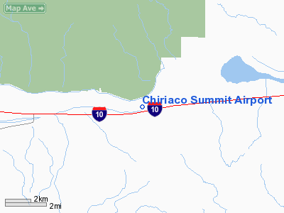
| Chiriaco Summit Airport |
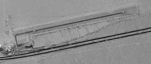 |
| USGS aerial image, 4 June 2002 |
| IATA: none – ICAO: none – FAA LID: L77 |
| Summary |
| Airport type |
Public |
| Owner |
County of Riverside |
| Serves |
Chiriaco Summit, California |
| Elevation AMSL |
1,713 ft / 522 m |
| Coordinates |
33°39′54″N 115°42′36″W / 33.665°N 115.71°W / 33.665; -115.71 |
| Runways |
| Direction |
Length |
Surface |
| ft |
m |
| 6/24 |
4,600 |
1,402 |
Asphalt |
| Statistics (2006) |
| Aircraft operations |
6,000 |
| Source: Federal Aviation Administration |
Chiriaco Summit Airport (FAA LID: L77) is a county-owned public-use airport located one nautical mile (1.85 km) northeast of the central business district of Chiriaco Summit, in Riverside County, California, United States.
The airport is maintained as a functioning airport for emergency purposes and recreational VFR use by the Riverside County government. Some west coast aero clubs use the airport (and nearby restaurant) as a "destination" site for annual week-end competitions. History
The airport was opened in April 1943 as Shavers Summit Army Airfield and was used by the United States Army Air Forces Fourth Air Force as a training base during World War II. At the end of the war the airfield was determined to be excess by the military and turned over to the local government for civil use.
Facilities and aircraft
Chiriaco Summit Airport covers an area of 570 acres (231 ha) at an elevation of 1,713 feet (522 m) above mean sea level. It has one runway designated 6/24 with an asphalt surface measuring 4,600 by 50 feet (1,402 x 15 m). For the 12-month period ending November 30, 2006, the airport had 6,000 general aviation aircraft operations, an average of 16 per day.
The above content comes from Wikipedia and is published under free licenses – click here to read more.
Location
& QuickFacts
|
FAA
Information Effective: |
2006-06-08 |
|
Airport
Identifier: |
L77 |
|
Longitude/Latitude: |
115-42-37.9640W/33-39-55.0710N
-115.710546/33.665298 (Estimated) |
|
Elevation: |
1713 ft / 522.12 m (Estimated) |
|
Land: |
570 acres |
|
From
nearest city: |
1 nautical miles NE of Chiriaco Summit, CA |
|
Location: |
Riverside County, CA |
|
Magnetic Variation: |
13E (1985) |
Owner
& Manager
|
Ownership: |
Publicly owned |
|
Owner: |
Co Of Riverside |
|
Address: |
P.o. Box 309
Riverside, CA 92502-0309 |
|
Phone
number: |
760-863-2530 |
|
Manager: |
Rob Field
ARPT MGR LOCATED IN RIVERSIDE |
|
Address: |
P.o. Box 309
Riverside, CA 92504 |
|
Phone number: |
760-863-2530 |
Airport
Operations and Facilities
|
Airport
Use: |
Open to public |
|
Wind
indicator: |
Yes |
|
Segmented
Circle: |
Yes |
|
Control
Tower: |
No |
|
Attendance
Schedule: |
UNATNDD |
|
Landing
fee charge: |
No |
|
Sectional
chart: |
Los Angeles |
|
Region: |
AWP - Western-Pacific |
|
Traffic
Pattern Alt: |
1000 ft |
|
Boundary
ARTCC: |
ZLA - Los Angeles |
|
Tie-in
FSS: |
RAL - Riverside |
|
FSS
on Airport: |
No |
|
FSS
Phone: |
951-351-3020 |
|
FSS
Toll Free: |
1-800-WX-BRIEF |
|
NOTAMs
Facility: |
RAL (NOTAM-d service avaliable) |
|
Federal Agreements: |
P |
Airport
Communications
Airport
Services
|
Airframe
Repair: |
NONE |
|
Power
Plant Repair: |
NONE |
|
Bottled
Oxygen: |
NONE |
|
Bulk
Oxygen: |
NONE |
|
Runway Information
Runway 06/24
|
Dimension: |
4600
x 50 ft / 1402.1 x 15.2 m
55 FT BY 4600 FT RY RESURFACED CENTER OF 200 FT BY 6000 FT ASPH
STRIP. |
|
Surface: |
ASPH, Fair Condition |
|
|
Runway 06 |
Runway 24 |
|
Elevation: |
1713.00 ft |
0.00 ft |
|
Traffic
Pattern: |
Left |
Left |
|
Markings: |
Basic, Good Condition |
Basic, Good Condition |
|
Runway
End Identifier: |
No |
No |
|
Centerline
Lights: |
No |
No |
|
Touchdown
Lights: |
No |
No |
|
Obstruction: |
3 ft brush, 200.0 ft from runway, 100 ft left
of centerline
+3 FT BRUSH 0 FT FM THLD 100 FT L & R. |
3 ft brush, 200.0 ft from runway, 100 ft right
of centerline
+3 FT BRUSH 0 FT FM THLD 100 FT L AND R. |
|
Radio Navigation
Aids
|
ID |
Type |
Name |
Ch |
Freq |
Var |
Dist |
|
NXP |
TACAN |
Coyote |
063X |
|
14E |
44.0 nm |
|
TRM |
VORTAC |
Thermal |
109X |
116.20 |
13E |
22.6 nm |
|
TNP |
VORTAC |
Twentynine Palms |
089X |
114.20 |
15E |
27.0 nm |
|
PSP |
VORTAC |
Palm Springs |
102X |
115.50 |
13E |
38.0 nm |
|
BLH |
VORTAC |
Blythe |
121X |
117.40 |
14E |
47.7 nm |
Remarks
- PILOTS
VISIBILITY IS LIMITED TO 1400 FT FROM EITHER END OF RY 06/24.
- ESTABD
PRIOR TO 5/15/59.
Operational Statistics
|
Aircraft
Operations: |
116/Week |
|
General
Aviation Itinerant: |
100.0% |
Chiriaco Summit Airport
Address:
Riverside County, CA
Tel:
760-863-2530
Images
and information placed above are from
http://www.airport-data.com/airport/L77/
We
thank them for the data!
| General
Info |
| Country |
United
States |
| State |
CALIFORNIA
|
| FAA ID |
L77
|
| Latitude |
33-39-55.071N
|
| Longitude |
115-42-37.964W
|
| Elevation |
1713 feet
|
| Near City |
CHIRIACO
SUMMIT |
We don't guarantee the information is fresh and accurate. The data may
be wrong or outdated.
For more up-to-date information please refer to other sources.
|
|


