|
 |
|
||||
|
USGS orthographic image showing the main runways at NAWS China Lake
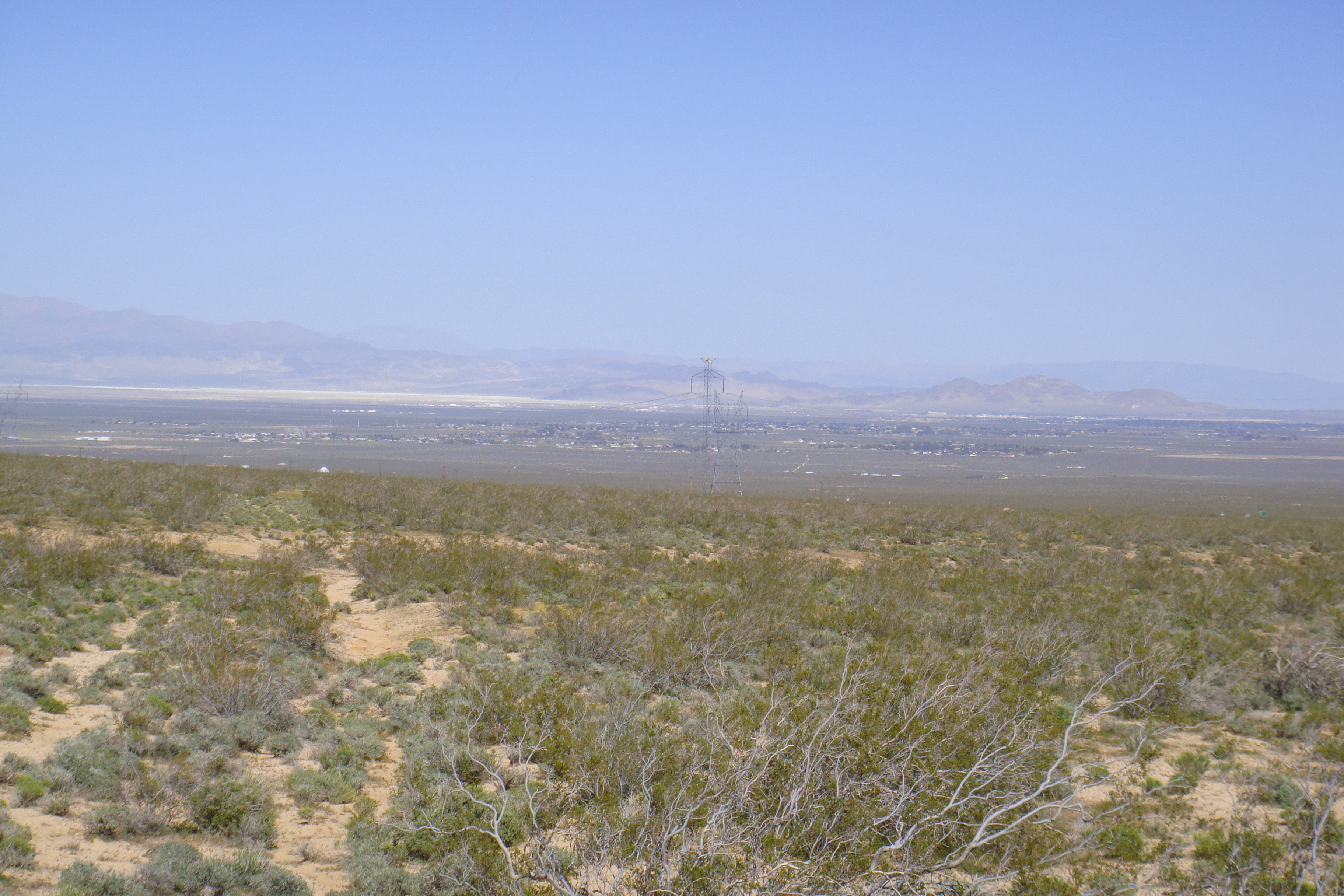
Naval Air Weapons Station China Lake or NAWS China Lake (ICAO: KNID, FAA LID: NID) is an airborne weapons testing and training range operated by the United States Navy and its contractors. It is located in the northeast of California's Mojave Desert in northwestern San Bernardino County, southwestern Inyo County, and northeastern Kern County, adjacent to Ridgecrest, California. NAWS China Lake was known as a technology leader in soldering technology, thanks to its full-spectrum weapon systems development programs. The technology was transferred to industry through its soldering technology seminars and soldering training programs at the DOD Electronics Manufacturing Productivity Facility. BackgroundThe main airfield, Armitage Field, is situated several miles from China Lake itself, an endorheic basin from which the range takes its name. It is the home base of 16 tenant commands, including the Naval Air Warfare Center Weapons Division (NAWCWD), Air Test and Evaluation Squadron Nine (VX-9), Air Test and Evaluation Squadron Thirty One (VX-31), and an Explosive Ordnance Disposal (EOD) Training Detachment. NAWS China Lake is the US Navy's largest single holding of land, comprising 1.1 million acres (4500 km²), approximately 38% of the US Navy's total land holdings in the world, and the airspace controlled jointly by NAWS China Lake, Edwards Air Force Base and Fort Irwin is the largest in the Department of Defense known as the R-2508 Special Use Airspace Complex. In addition China Lake has maintained research components in both physics and chemistry at Lauritsen and Michelson laboratories. According to the California State Military Museum Web site, the land, ranging in altitude from 2,100 to 8,900 feet (640 to 2,700 m), varies from flat dry lake beds to rugged piñon pine-covered mountains. The majority of the land is undeveloped and provides habitat for more than 340 species of wildlife and 650 plant types. In June 1963, President John F. Kennedy visited NAWS China Lake for an air show and to see Michelson Lab. Richard William Rusciolelli (father of comedian Dante) was President Kennedy's technical presentations coordinator and protocol officer for the visit. Geographical historyThe area was once also home to the Native American Coso People, whose presence here is marked by thousands of archaeological sites; the Coso traded with other tribes as far away as San Luis Obispo County, California. This locale was also a site used by European miners and settlers whose cabins and mining structures are extant throughout the Station. Among the notable archaeological sites is the National Park Service's Coso Rock Art District, an area of some 99 square miles (260 km) which contains more than 50,000 documented petroglyphs. The rock art district was declared a National Historic Landmark in 2001. Historically rich, NAWS traces its heritage to the Naval Ordnance Test Station (NOTS) established at nearby Inyokern in 1943 as a joint navy/civilian facility, and the first civilian director was L.T.E. Thompson ("Dr. Tommy"). Since then it has been one of the US Navy's premier weapons development facilities and continues to support the US fleet. A number of preserved B-29 bombers in museums were reclaimed from target airframes stored on the ranges here in the 1950s. Inventions tested and refined at China Lake include the AIM-9 Sidewinder missile, the AGM-62 Walleye TV-guided glide bomb, the AGM-45 Shrike antiradar missile, the AIM-95 Agile missile, the AGM-122 Sidearm antiradar missile, the AGM-123 Skipper II laser-guided missile, the lightstick, and the continuous-rod warhead. One of the world's largest geothermal power plants is located at China Lake at the Coso Geothermal Field. The installation currently produces 270 megawatt-hours (970 GJ) from four geothermal power plants. 166 wells have been drilled throughout the field, with production depths from 2,000 to 12,000 feet (610 to 3,700 m), and temperatures from 200 °C (392 °F) to 350 °C (662 °F). Coso began generating electricity in 1987. Tenant Squadrons
MuseumOn or near the base is the Naval Museum of Armament & Technology, which is one of fifteen official U.S. Navy museums. The above content comes from Wikipedia and is published under free licenses – click here to read more.
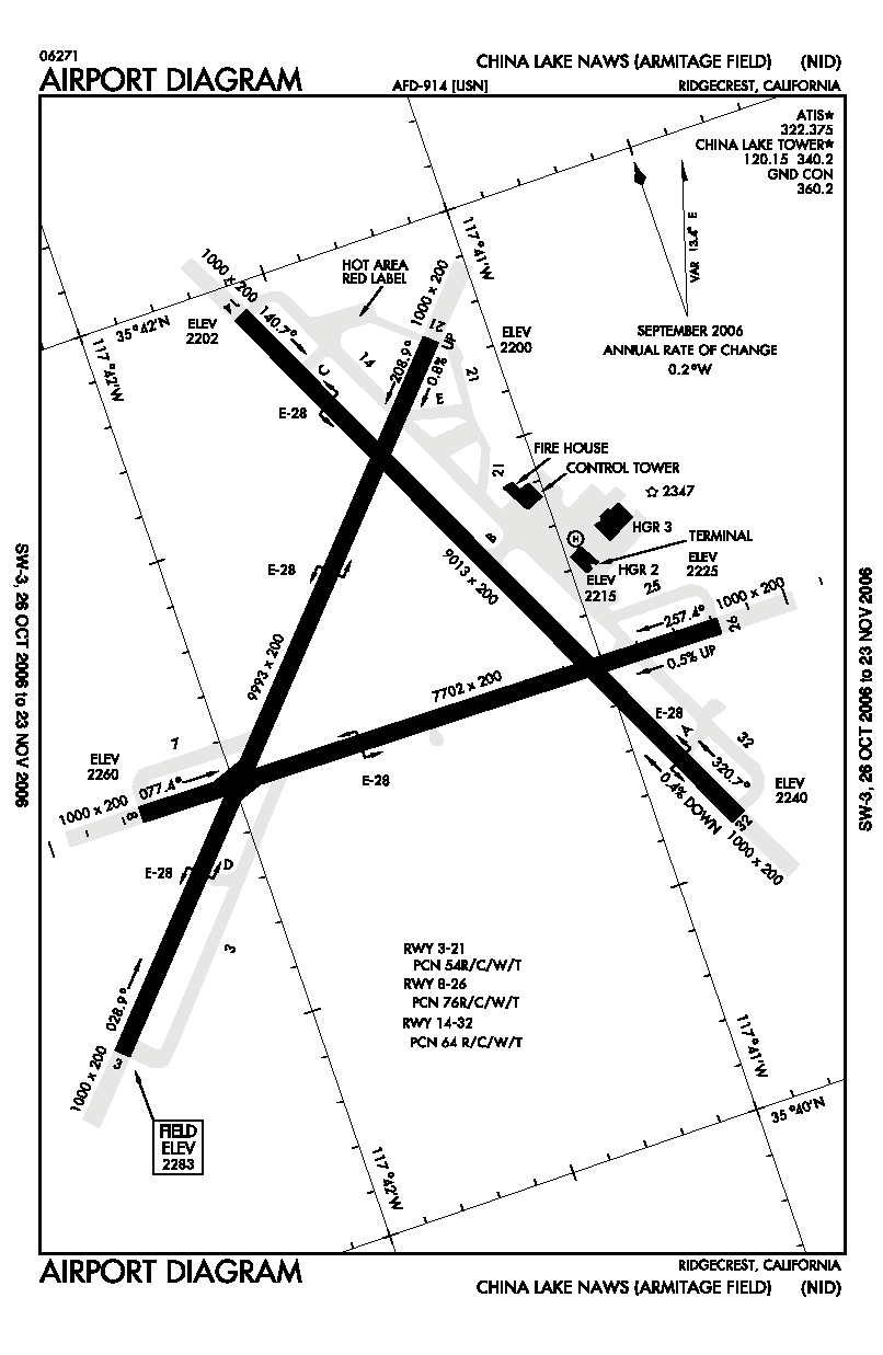
Runway InformationRunway 03/21
Runway 08/26
Runway 14/32
Radio Navigation Aids
Remarks
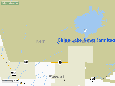
China Lake Naws (armitage Fld) Airport Address: Kern County, CA Tel: Images
and information placed above are from We thank them for the data!
|
|||||||||||||||||||||||||||||||||||||||||||||||||||||||||||||||||||||||||||||||||||||||||||||||||||||||||||||||||||||||||||||||||||||||||||||||||||||||||||||||||||||||||||||||||||||||||||||||||||||||||||||||||||||||||||||||||||||||||||||||||||||||||||||||||||||||||

 |
|
Copyright 2004-2024 © by Airports-Worldwide.com, Vyshenskoho st. 36, Lviv 79010, Ukraine Legal Disclaimer |