|
|
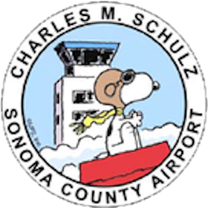
Charles M. Schulz - Sonoma County Airport |
| Charles M. Schulz-Sonoma County Airport
|
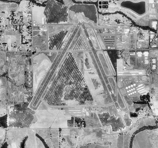 |
| 1993 USGS Photo |
| IATA: STS – ICAO: KSTS – FAA LID: STS |
| Summary |
| Airport type |
Public |
| Owner/Operator |
Sonoma County DOT |
| Location |
Sonoma County, near Santa Rosa, California |
| Elevation AMSL |
125 ft / 38 m |
| Coordinates |
38°30′32″N 122°48′46″W / 38.50889°N 122.81278°W / 38.50889; -122.81278 |
| Website |
SonomaCountyAirport.org |
| Runways |
| Direction |
Length |
Surface |
| ft |
m |
| 1/19 |
5,002 |
1,525 |
Asphalt |
| 14/32 |
5,115 |
1,559 |
Asphalt |
| Statistics (2007) |
| Aircraft operations |
128,875 |
| Based aircraft |
350 |
| Source: Federal Aviation Administration |
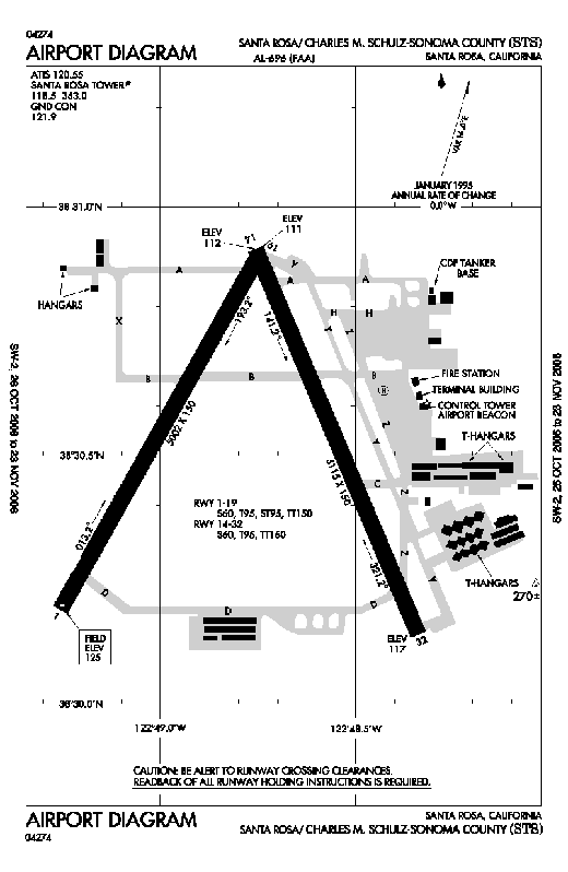 | |
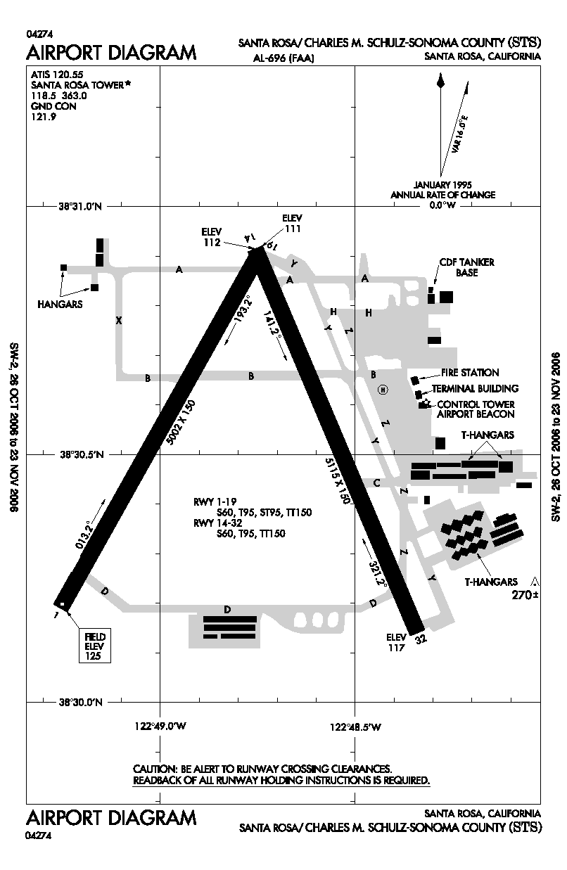
FAA airport diagram |
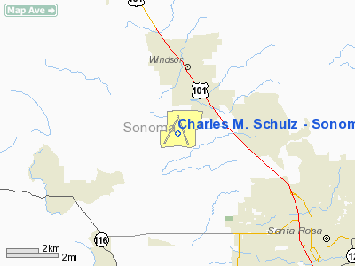
Charles M. Schulz – Sonoma County Airport (IATA: STS, ICAO: KSTS, FAA LID: STS) is a county-owned public-use airport located 6 nautical miles (0 km) northwest of downtown Santa Rosa, a city in Sonoma County, California, United States. It serves the county and surrounding areas of Wine Country in California.
The airport is named after Charles M. Schulz, the famed cartoonist of the Peanuts comic strip, who lived and worked in Santa Rosa for more than 30 years. The airport's logo features Snoopy in his "World War I Flying Ace" attire, taking to the skies on top of his "Sopwith Camel" (i.e. his doghouse). History
From 2001-2007, the airport was exclusively used for general aviation. Prior to that, commercial airline service was by United Express, which was stopped because their flights (to San Francisco and Los Angeles) were not profitable.
In March 2007, Horizon Air returned commercial aviation service to Santa Rosa with flights to Seattle/Tacoma and Los Angeles. Horizon added service to Portland, Oregon in the fall of 2007, and to Las Vegas in spring 2008. The additional routes brought new hope that other airlines will start flying into Sonoma County.
Facilities and aircraft
Charles M. Schulz – Sonoma County Airport covers an area of 1,014 acres (410 ha) at an elevation of 125 feet (38 m) above mean sea level. It has two asphalt paved runways: 1/19 is 5,002 by 100 feet (1,525 x 30 m) and 14/32 measures 5,115 by 150 feet (1,559 x 46 m).
For the 12-month period ending December 31, 2007, the airport had 128,875 aircraft operations, an average of 353 per day: 95% general aviation, 4% air taxi, 1% scheduled commercial and <1% military. At that time there were 350 aircraft based at this airport: 86% single-engine, 11% multi-engine, 2% jet, 1% glider and <1% helicopter.
CAL FIRE Sonoma Air Attack base
The Sonoma Air Attack Base was established in 1964 and is located at the northeast corner of the Sonoma County Airport. Sonoma responds to an average of 300 calls per year. Staff at the base consists of one battalion chief and one fire captain (Air Tactics Group Supervisors), one fire apparatus engineer (Base Manager), and six firefighters. The complement of aircraft located at Sonoma includes one OV-10 Bronco (Air Attack 140) and two Grumman S-2 Tracker air tankers (classified as S-2T's, Tankers 85 and 86.)
On average, the base pumps about 300,000 US gallons (1,000 m) of retardant a year. With the base’s pumps, four loading pits and equipment, Sonoma has a possible peak output of 120,000 US gallons (450 m) of retardant each day. The base’s immediate response area covers 4,000 square miles (10,000 km) and includes Marin County and portions of the CDF Sonoma-Lake-Napa, Santa Clara, San Mateo-Santa Cruz, and Mendocino Units.
Airlines and destinations
| Airlines |
Destinations |
| Horizon Air |
Las Vegas, Los Angeles, Portland (OR), Seattle/Tacoma |
Future expansion
Airport officials are expanding the current terminal from 9,000 square feet (840 m) to 14,000 square feet (1,300 m). They hope to complete the project by August 2010.
The airport is actively engaged in securing additional commercial air service, with goals of both increasing the number of flights to their current destinations and adding new destinations. These hoped-for destinations include:
- Denver, which would be operated by Frontier or its affiliate.
- Salt Lake City, which would be flown by Delta Connection (possibly subsidized by a joint incentive package by both airport authorities).
- San Diego, currently being evaluated. Will be used with Horizon Air's Dash 8-Q400.
World War II
Opened in June 1942 and known as Santa Rosa Army Airfield, the airfield was assigned to Fourth Air Force as a group and replacement training airfield. Known units assigned to Santa Rosa were:
- 354th Fighter Group, March-June 1943
- 357th Fighter Group, June-August 1943
- 363d Fighter Group, August-October 1943
- 367th Fighter Group, October-December 1943
The 478th Fighter Group was permanently assigned to Santa Rosa in December 1943 and began training replacement pilots, who were sent to combat units overseas after graduation.
The airfield was inactivated on 31 January 1946 and turned over to the War Assets Administration for eventual conversion to a civil airport.
The above content comes from Wikipedia and is published under free licenses – click here to read more.
|
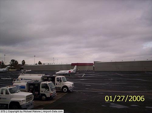 |
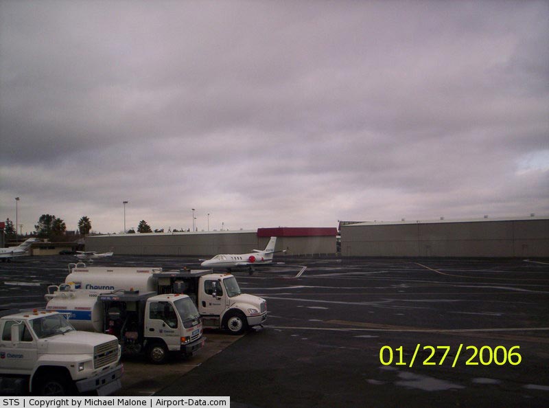
(Click on the photo to enlarge) |
|
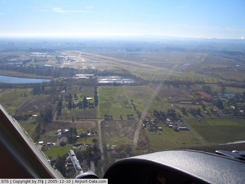
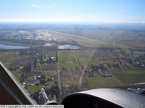 |
(Click on the photo to enlarge) |
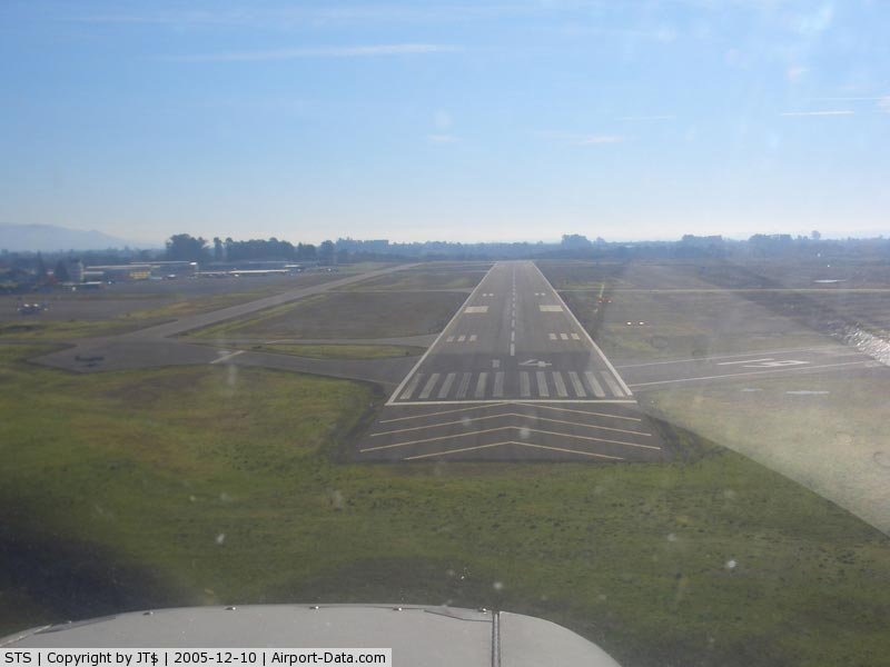
|
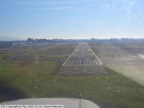 |
(Click on the photo to enlarge) |
Location
& QuickFacts
|
FAA
Information Effective: |
2006-06-08 |
|
Airport
Identifier: |
STS |
|
Longitude/Latitude: |
122-48-46.3690W/38-30-32.3170N
-122.812880/38.508977 (Estimated) |
|
Elevation: |
125 ft / 38.10 m (Surveyed) |
|
Land: |
970 acres |
|
From
nearest city: |
6 nautical miles NW of Santa Rosa, CA |
|
Location: |
Sonoma County, CA |
|
Magnetic Variation: |
16E (1985) |
Owner
& Manager
|
Ownership: |
Publicly owned |
|
Owner: |
Sonoma County |
|
Address: |
2200 Airport Blvd
Santa Rosa, CA 95403 |
|
Phone
number: |
707-565-7240 |
|
Manager: |
Jon G Stout |
|
Address: |
2200 Airport Blvd
Santa Rosa, CA 95403 |
|
Phone number: |
707-565-7243 |
Airport
Operations and Facilities
|
Airport
Use: |
Open to public |
|
Wind
indicator: |
Yes |
|
Segmented
Circle: |
Yes |
|
Control
Tower: |
Yes |
|
Attendance
Schedule: |
ALL/ALL/0600-2200 |
|
Lighting
Schedule: |
DUSK-DAWN
WHEN ATCT CLSD ACTVT HIRL RY 14/32, TWY LGTS, MALSR RY 32,
VASI RY 14 - CTAF. WHEN ATCT CLSD ACTVT REIL RY 14 ONLY
WHEN RY LGTS ON HIGHEST INTST - CTAF. |
|
Beacon
Color: |
Clear-Green (lighted land airport) |
|
Landing
fee charge: |
Yes |
|
Sectional
chart: |
San Francisco |
|
Region: |
AWP - Western-Pacific |
|
Traffic
Pattern Alt: |
800 ft |
|
Boundary
ARTCC: |
ZOA - Oakland |
|
Tie-in
FSS: |
OAK - Oakland |
|
FSS
on Airport: |
No |
|
FSS
Phone: |
510-273-6111 |
|
FSS
Toll Free: |
1-800-WX-BRIEF |
|
NOTAMs
Facility: |
STS (NOTAM-d service avaliable) |
|
Certification type/date: |
I AU 5/1973 |
|
Federal Agreements: |
NGPRY |
Airport
Communications
|
CTAF: |
118.500 |
|
Unicom: |
122.950 |
Airport
Services
|
Fuel
available: |
100LLA
100LL AVBL 24 HRS WITH CREDIT CARD. JET A AVBL DURG ATTENDANCE
HRS. |
|
Airframe
Repair: |
MAJOR |
|
Power
Plant Repair: |
MAJOR |
|
Bottled
Oxygen: |
LOW |
|
Bulk
Oxygen: |
LOW |
|
Runway Information
Runway 01/19
|
Dimension: |
5002 x 100 ft / 1524.6 x 30.5 m |
|
Surface: |
ASPH, Fair Condition |
|
Weight
Limit: |
Single wheel: 60000 lbs.
Dual wheel: 95000 lbs.
Dual
tandem wheel: 150000 lbs. |
|
|
Runway 01 |
Runway 19 |
|
Longitude: |
122-49-15.4400W |
122-48-44.7790W |
|
Latitude: |
38-30-11.3720N |
38-30-54.5550N |
|
Elevation: |
125.00 ft |
111.00 ft |
|
Alignment: |
29 |
127 |
|
Traffic
Pattern: |
Left |
Left |
|
Markings: |
Basic, Good Condition |
Basic, Good Condition |
|
Runway
End Identifier: |
No |
No |
|
Centerline
Lights: |
No |
No |
|
Touchdown
Lights: |
No |
No |
|
Obstruction: |
131 ft trees, 2900.0 ft from runway, 20:1 slope
to clear |
33 ft trees, 1200.0 ft from runway, 200 ft
right of centerline, 30:1 slope to clear |
|
Runway 14/32
|
Dimension: |
5115 x 150 ft / 1559.1 x 45.7 m |
|
Surface: |
ASPH, Good Condition |
|
Surface
Treatment: |
Saw-cut or plastic Grooved |
|
Weight
Limit: |
Single wheel: 60000 lbs.
Dual wheel: 95000 lbs.
Dual
tandem wheel: 150000 lbs. |
|
Edge
Lights: |
High |
|
|
Runway 14 |
Runway 32 |
|
Longitude: |
122-48-45.4010W |
122-48-20.4590W |
|
Latitude: |
38-30-54.9850N |
38-30-08.3810N |
|
Elevation: |
112.00 ft |
117.00 ft |
|
Alignment: |
127 |
127 |
|
ILS
Type: |
|
ILS |
|
Traffic
Pattern: |
Left |
Left |
|
Markings: |
Precision instrument, Good Condition |
Precision instrument, Good Condition |
|
Crossing
Height: |
50.00 ft |
0.00 ft |
|
VASI: |
4-box on right side |
|
|
Visual
Glide Angle: |
3.00� |
0.00� |
|
RVR
Equipment: |
|
touchdown |
|
Approach
lights: |
|
MALSR |
|
Runway
End Identifier: |
Yes |
No |
|
Centerline
Lights: |
No |
No |
|
Touchdown
Lights: |
No |
No |
|
Obstruction: |
17 ft trees, 800.0 ft from runway, 250 ft left
of centerline, 35:1 slope to clear |
135 ft trees, 6400.0 ft from runway, 45:1 slope
to clear |
|
Radio Navigation
Aids
|
ID |
Type |
Name |
Ch |
Freq |
Var |
Dist |
|
LOP |
NDB |
Lampson |
|
217.00 |
16E |
29.4 nm |
|
SUU |
TACAN |
Travis |
113X |
|
17E |
43.9 nm |
|
TZZ |
VOR |
Travis |
|
116.40 |
17E |
48.2 nm |
|
STS |
VOR/DME |
Santa Rosa |
077X |
113.00 |
16E |
0.1 nm |
|
CCR |
VOR/DME |
Concord |
117X |
117.00 |
17E |
45.7 nm |
|
PYE |
VORTAC |
Point Reyes |
084X |
113.70 |
17E |
25.9 nm |
|
SGD |
VORTAC |
Scaggs Island |
058X |
112.10 |
17E |
28.7 nm |
|
ENI |
VORTAC |
Mendocino |
070X |
112.30 |
16E |
39.2 nm |
|
SAU |
VORTAC |
Sausalito |
109X |
116.20 |
17E |
41.6 nm |
|
ILA |
VORTAC |
Williams |
091X |
114.40 |
18E |
50.0 nm |
Remarks
- ARPT
HAS NOISE ABATEMENT PROCEDURES CTC AMGR 707-565-7243.
- ACFT
OVER 95000 LBS PPR; CTC AMGR 707-565-7243.
- TWY
B BTWN RWY 1-19 & 14-32 LMTD S-12, D-25.
- TWY
Z BETWEEN TWY H & TWY B LTD TO ACFT LESS THAN 30000 GWT.
- PPR
24 HRS ACR OPNS WITH MORE THAN 30 PSGR SEATS CTC AMGR 707-565-7243.
- TWY
Z BTN RY 14/32 & TWY Y LTD TO S-20, D-40.
- EXISTED
PRIOR TO 5/15/59.
Based Aircraft
|
Aircraft
based on field: |
380 |
|
Single
Engine Airplanes: |
325 |
|
Multi
Engine Airplanes: |
49 |
|
Jet Engine
Airplanes: |
2 |
|
Helicopters: |
3 |
|
Gliders: |
1 |
Operational Statistics
|
Aircraft
Operations: |
313/Day |
|
Air Taxi: |
5.2% |
|
General
Aviation Local: |
32.6% |
|
General
Aviation Itinerant: |
62.2% |
|
Military: |
0.0% |
Charles M. Schulz - Sonoma County Airport
Address:
Sonoma County, CA
Tel:
707-565-7240,
707-565-7243
Images
and information placed above are from
http://www.airport-data.com/airport/STS/
We
thank them for the data!
| General
Info |
| Country |
United
States |
| State |
CALIFORNIA
|
| FAA ID |
STS
|
| Time |
UTC-8(-7DT)
|
| Latitude |
38.508978
38� 30' 32.32" N |
| Longitude |
-122.812880
122� 48' 46.37" W |
| Elevation |
125 feet
38 meters |
| Type |
Civil
|
| Magnetic
Variation |
015� E
(01/06) |
| Beacon |
Yes
|
| Operating
Agency |
U.S.CIVIL
AIRPORT WHEREIN PERMIT COVERS USE BY TRANSIT MILITARY AIRCRAFT
|
| Near City |
Santa
Rosa |
| Operating
Hours |
SEE REMARKS
FOR OPERATING HOURS OR COMMUNICATIONS FOR POSSIBLE HOURS |
| Daylight
Savings Time |
First
Sunday in April at 0200 to last Sunday in October at 0200 local time
(Exception Arizona and that portion of Indiana in the Eastern Time
Zone) |
We don't guarantee the information is fresh and accurate. The data may
be wrong or outdated.
For more up-to-date information please refer to other sources.
|
|