|
 |
|
||||
|
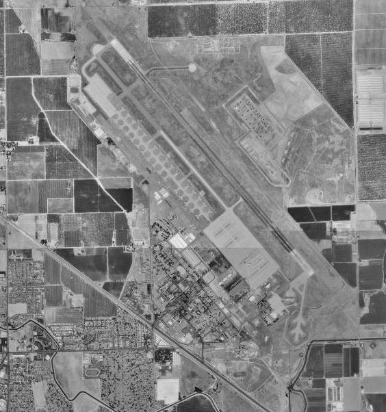
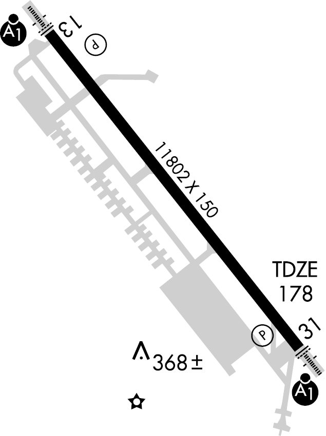
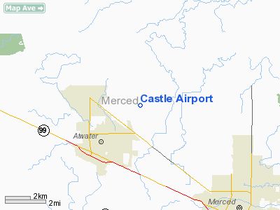
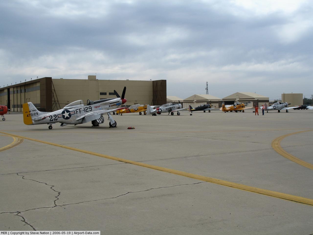
Castle Airport (IATA: MER, ICAO: KMER, FAA LID: MER) is a public use airport located seven nautical miles (13 km) northwest of the central business district of Merced, a city in Merced County, California, United States. It is operated by the Merced County Department of Commerce, Aviation, and Economic Development. The airport is located at the former Castle Air Force Base which closed in 1995. This land is owned jointly by the city of Merced, city of Atwater and the county of Merced. Until 2007 this land was administered by the JPA or Joint Powers Administration. It has served two large flight schools, American School of Aviation (ASA) and Sierra Academy of Aeronautics, both of which specialize in training foreign pilots, from India and China respectively. Activity related to these two schools makes up the majority of the air traffic at Castle. In early 2007, the control tower was reopened to handle increased training traffic. Castle Air Museum is 500 yards (500 m) away, displaying 50 restored World War II, Korean War, and Cold War era aircraft. Among the exhibit highlights are a Lockheed SR-71 Blackbird, one of only 19 surviving, a Boeing B-52D Stratofortress, and the massive Convair RB-36 Peacemaker, the only surviving reconnaissance variant of the Air Force's largest bomber. Facilities and aircraftCastle Airport covers an area of 1,580 acres (639 ha) which contains one runway (13/31) with an 11,802 x 150 ft (3,597 x 46 m) asphalt and concrete pavement. For the 12-month period ending December 31, 2008, the airport had 125,842 aircraft operations, an average of 345 per day: 99.2% general aviation and 0.7% military. At that time there were 85 aircraft based at this airport: 78% single-engine, 13% multi-engine and 9% jet. PollutionSince the mid-1940s, aircraft maintenance, fuel management, and fire training activities on the base have generated wastes that consist primarily of waste fuels, oils, solvents, and cleaners. Base activities also have generated lesser amounts of paints and plating wastes. The EPA currently has this base listed on their database due to the bulk wastes such as solvents, oils, fuels, and sludges which were disposed in pits at landfills around the base until 1977. Fuel and waste oils were incinerated by the Air Force during fire training exercises. The Air Force ceased disposal of hazardous waste on site in 1977, and the base was officially closed in 1995. During the following cleanup efforts, all hazardous and toxic materials that the Air Force was unwilling or unable to transport offsite were sealed into four onsite landfills. EPA investigations have been completed at multiple areas of contamination including landfills, discharge areas, chemical disposal areas, fire training areas, fuel spill areas, and polychlorinated biphenyl (PCB) spill areas. Through the fiscal year 2006, $164.27 million was spent on cleanup activities at Castle. The USAF expects to spend an additional $70.98 million through fiscal year 2044. Approximately 6000 people obtain their drinking water from both municipal and private wells located near the site. The principal pollutant at the base, TCE Trichloroethylene, was found in a plume. Merced Irrigation purified the water at the edge of the plume and released the purified water outside the plume. Working their way inward, they managed to clean the contaminated water. The methods used to purify the groundwater included passing the water through carbon filters and then aerating it. The pollutant remaining after purification was packaged in a barrel and removed from the site. In 1991, a Base Realignment and Closure (BRAC) Cleanup Team (BCT) was created to review and offer comments/recommendations on the progress of the cleanup effort at Castle. BCT membership included representatives from the Air Force, federal and state regulatory agencies, and appointed representatives from the governing bodies of surrounding communities. The Castle RAB, or Restoration Advisory Board, which was established in 1994 on behalf of the former Castle Air Force Base, was responsible for reviewing Federal cleanup methods and efforts, and was officially adjourned on January 16, 2007. Air National GuardIn 2004, recommendations were made to relocate the 129th Rescue Wing (129 RQW) of the California Air National Guard and its associated HC-130, MC-130 and HH-60 aircraft from Moffett Federal Airfield (formerly Naval Air Station Moffett Field) to the former Castle Air Force Base, now Castle Airport. Rationale for this move was the high cost of living in the Sunnyvale/Mountain View/San Francisco Bay Area for full-time Active Guard and Reserve (AGR) and Air Reserve Technician (ART) personnel assigned to the unit, and the travel time and non-reimbursed expenses cost for "traditional" part-time air national guardsmen serving in the unit, most of whom reside in the San Joaquin Valley region due to lower cost of living. It was estimated that the cost to relocate the 129 RQW to Castle, to include associated military construction (MILCON) costs, could be recouped in seven (7) years. This would result in the reestablishment of an Air Force cantonment area at Castle that would be renamed either Castle Air National Guard Base or Castle Air National Guard Station. However, likely due to organizational restructuring currently occurring in the Air National Guard nation-wide and higher priority defense spending requirements for the U.S. Air Force, the National Guard Bureau and the Air National Guard since September 2001, this initiative has been placed on indefinite hold and the 129 RQW remains at Moffett. California High-Speed RailWith its central location in the San Joaquin Valley, on the route of the proposed California High-Speed Rail system, and with a large, underdeveloped site, Castle Airport has been submitted as a possible location for the central maintenance facility for the system. The above content comes from Wikipedia and is published under free licenses – click here to read more.
Runway InformationRunway 13/31
Radio Navigation Aids
Remarks
Based Aircraft
Operational Statistics
Castle Airport Address: Merced County, CA Tel: 209-385-7868, 209-385-7686 Images
and information placed above are from We thank them for the data!
|
||||||||||||||||||||||||||||||||||||||||||||||||||||||||||||||||||||||||||||||||||||||||||||||||||||||||||||||||||||||||||||||||||||||||||||||||||||||||||||||||||||||||||||||||||||||||||||||||||||||||||||||||||||||||||||||||||||||||||||||||||||||||||||||||||||||||||||||||||||||||||||||||||||||||||||||||||||||||||||||||||||||||||||||||||||

 |
|
Copyright 2004-2024 © by Airports-Worldwide.com, Vyshenskoho st. 36, Lviv 79010, Ukraine Legal Disclaimer |