 |
|
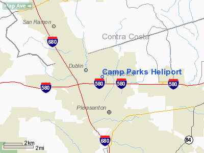
Location
& QuickFacts
|
FAA
Information Effective: |
2006-06-08 |
|
Airport
Identifier: |
4CA3 |
|
Longitude/Latitude: |
121-53-33.8470W/37-42-29.7460N
-121.892735/37.708263 (Estimated) |
|
Elevation: |
361 ft / 110.03 m (Estimated) |
|
Land: |
0 acres |
|
From
nearest city: |
1 nautical miles N of Pleasanton, CA |
|
Location: |
Alameda County, CA |
|
Magnetic Variation: |
16E (1985) |
Owner
& Manager
|
Ownership: |
Army owned |
|
Owner: |
U S Army |
|
Address: |
U S Army Garrison/camp Parks
Pleasanton, CA 94566 |
|
Address: |
|
Airport
Operations and Facilities
|
Airport
Use: |
Private |
|
Segmented
Circle: |
No |
|
Control
Tower: |
No |
|
Attendance
Schedule: |
UNATNDD
PPR BASE OPS 925-803-5257/5628/5617. |
|
Sectional
chart: |
San Francisco |
|
Region: |
AWP - Western-Pacific |
|
Boundary
ARTCC: |
ZOA - Oakland |
|
Tie-in
FSS: |
OAK - Oakland |
|
FSS
on Airport: |
No |
|
FSS
Phone: |
510-273-6111 |
|
FSS
Toll Free: |
1-800-WX-BRIEF |
|
Runway Information
Helipad H1
|
Dimension: |
2200 x 400 ft / 670.6 x 121.9 m |
|
Surface: |
ASPH, |
|
|
Runway H1 |
Runway |
|
Traffic
Pattern: |
Left |
Left |
|
Radio Navigation
Aids
|
ID |
Type |
Name |
Ch |
Freq |
Var |
Dist |
|
LV |
NDB |
Reiga |
|
374.00 |
16E |
10.0 nm |
|
TCY |
NDB |
Tracy |
|
203.00 |
15E |
21.3 nm |
|
PDG |
NDB |
Pajar |
|
327.00 |
17E |
47.9 nm |
|
NUQ |
TACAN |
Moffett |
123X |
|
17E |
18.3 nm |
|
SUU |
TACAN |
Travis |
113X |
|
17E |
32.4 nm |
|
TZZ |
VOR |
Travis |
|
116.40 |
17E |
38.4 nm |
|
SJC |
VOR/DME |
San Jose |
088X |
114.10 |
16E |
20.2 nm |
|
CCR |
VOR/DME |
Concord |
117X |
117.00 |
17E |
21.5 nm |
|
SFO |
VOR/DME |
San Francisco |
105X |
115.80 |
17E |
23.5 nm |
|
MOD |
VOR/DME |
Modesto |
093X |
114.60 |
17E |
44.7 nm |
|
OAK |
VORTAC |
Oakland |
115X |
116.80 |
17E |
15.8 nm |
|
OSI |
VORTAC |
Woodside |
086X |
113.90 |
17E |
26.5 nm |
|
SAU |
VORTAC |
Sausalito |
109X |
116.20 |
17E |
31.2 nm |
|
ECA |
VORTAC |
Manteca |
107X |
116.00 |
17E |
35.1 nm |
|
SGD |
VORTAC |
Scaggs Island |
058X |
112.10 |
17E |
36.3 nm |
|
SAC |
VORTAC |
Sacramento |
099X |
115.20 |
17E |
47.1 nm |
|
LIN |
VORTAC |
Linden |
095X |
114.80 |
17E |
47.6 nm |
|
SFO |
VOT |
San Francisco Intl |
|
111.00 |
|
23.6 nm |
Remarks
- (E137-1)
APCH/DEP NORTH THRU EAST. MAINT HIGHEST PRACTICAL ALT DURING APCH FOR
NOISE ABATEMENT. MAKE TFC PAT OVER CAMP PARKS. AVOID DUBLIN/SAN RAMON.
- (E137-2)
CTC FIRE DEPT 15 NM OUT ON 41.50 FM. CAUTION-SMALL ARMS RANGE 1 NM NORTH
OF LNDG AREA.
Camp Parks Heliport
Address:
Alameda County, CA
Tel:
Images
and information placed above are from
http://www.airport-data.com/airport/4CA3/
We
thank them for the data!
| General
Info |
| Country |
United
States |
| State |
CALIFORNIA
|
| FAA ID |
4CA3
|
| Latitude |
37-42-29.746N
|
| Longitude |
121-53-33.847W
|
| Elevation |
361 feet
|
| Near City |
PLEASANTON
|
We don't guarantee the information is fresh and accurate. The data may
be wrong or outdated.
For more up-to-date information please refer to other sources.
|
|


