 |
|
Location
& QuickFacts
|
FAA
Information Effective: |
2006-06-08 |
|
Airport
Identifier: |
CL29 |
|
Longitude/Latitude: |
114-57-25.9010W/34-50-06.0020N
-114.957195/34.835001 (Estimated) |
|
Elevation: |
2079 ft / 633.68 m (Surveyed) |
|
Land: |
0 acres |
|
From
nearest city: |
7 nautical miles SE of Goffs, CA |
|
Location: |
San Bernardino County, CA |
|
Magnetic Variation: |
14E (1985) |
Owner
& Manager
|
Ownership: |
Privately owned |
|
Owner: |
The Metro Water Dist Of S Ca |
|
Address: |
1111 Sunset Blvd
Los Angeles, CA 90012 |
|
Phone
number: |
213-250-6000 |
|
Manager: |
M. B. Dailey |
|
Address: |
Po Box 38
Parker Dam, CA 92267 |
|
Phone number: |
619-663-3715 |
Airport
Operations and Facilities
|
Airport
Use: |
Private |
|
Wind
indicator: |
Yes |
|
Segmented
Circle: |
No |
|
Control
Tower: |
No |
|
Attendance
Schedule: |
UNATNDD |
|
Landing
fee charge: |
No |
|
Sectional
chart: |
Los Angeles |
|
Region: |
AWP - Western-Pacific |
|
Boundary
ARTCC: |
ZLA - Los Angeles |
|
Tie-in
FSS: |
RAL - Riverside |
|
FSS
on Airport: |
No |
|
FSS
Phone: |
951-351-3020 |
|
FSS
Toll Free: |
1-800-WX-BRIEF |
|
Runway Information
Runway 12/30
|
Dimension: |
3000 x 30 ft / 914.4 x 9.1 m |
|
Surface: |
DIRT, |
|
|
Runway 12 |
Runway 30 |
|
Traffic
Pattern: |
Left |
Left |
|
Radio Navigation
Aids
|
ID |
Type |
Name |
Ch |
Freq |
Var |
Dist |
|
GFS |
VORTAC |
Goffs |
091X |
114.40 |
15E |
20.8 nm |
|
EED |
VORTAC |
Needles |
099X |
115.20 |
15E |
24.2 nm |
|
PKE |
VORTAC |
Parker |
126X |
117.90 |
15E |
46.1 nm |
Remarks
- OPERATION
DURING VFR CONDITIONS ONLY.
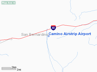
Camino Airstrip Airport
Address:
San Bernardino County, CA
Tel:
213-250-6000,
619-663-3715
Images
and information placed above are from
http://www.airport-data.com/airport/CL29/
We
thank them for the data!
| General
Info |
| Country |
United
States |
| State |
CALIFORNIA
|
| FAA ID |
CL29
|
| Latitude |
34-50-06.002N
|
| Longitude |
114-57-25.901W
|
| Elevation |
2079 feet
|
| Near City |
GOFFS
|
We don't guarantee the information is fresh and accurate. The data may
be wrong or outdated.
For more up-to-date information please refer to other sources.
|
|


