 |
|
| Cable Airport |
| IATA: CCB – ICAO: KCCB – FAA LID: CCB |
| Summary |
| Airport type |
Public |
| Owner |
Cable Land Co. |
| Location |
Upland, California |
| Elevation AMSL |
1,444 ft / 440 m |
| Coordinates |
34°06′42″N 117°41′15″W / 34.11167°N 117.6875°W / 34.11167; -117.6875 |
| Website |
www.CableAirport.com |
| Runways |
| Direction |
Length |
Surface |
| ft |
m |
| 6/24 |
3,864 |
1,178 |
Asphalt |
| Helipads |
| Number |
Length |
Surface |
| ft |
m |
| H1 |
65 |
20 |
Asphalt |
| H2 |
65 |
20 |
Asphalt/Concrete |
| Statistics (2007) |
| Aircraft operations |
92,189 |
| Based aircraft |
365 |
| Source: Federal Aviation Administration |
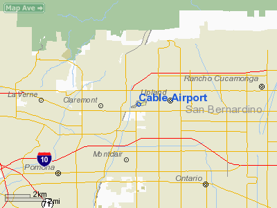
Cable Airport (IATA: CCB, ICAO: KCCB, FAA LID: CCB) is a non-towered public-use airport located two miles (3 km) northwest of the central business district of Upland, a city in San Bernardino County, California, United States. It is privately-owned by the Cable Land Company. History
Cable-Claremont Airport (as it was known until 1961) was founded in 1945 by Maude and Dewey Cable, who bought the land for $8,500. The Cables divided the land, selling the northern portion for what the entire parcel had cost the Cables. That parcel was developed into a quarry by Holliday Rock, which recently erected its national headquarters near the approach end of Runway 24. The first runway, 1-19, built by Dewey Cable himself, was 1,500 feet (460 m) long. It ran north-south, perpendicular to the prevailing winds, and had a steep gradient. The main runway, 6-24, was completed six months later. Unlike the first runway, it ran east-west (parallel to the wind, which is ideal), had a hard, flat surface, and by 1947 was 2,350 feet (720 m) long and 150 feet (46 m) wide.
Today
KCCB is a Class G (untowered) airport. Runway 1-19 is no longer in existence. In its place are some hangars, a fuel island, and a covered, lighted wash rack. Runway 6-24, now lengthened to 3,865 feet (1,178 m), was recently resurfaced and is mostly flat, with some undulations on the east half. There is a terminal building with an FBO (flight school & rentals), aircraft repair shop, Maniac Mike's restaurant, and a control tower which is used to marshal aircraft during the annual Cable Air Show in January. (The tower is not normally used at any other time, as Cable is an uncontrolled airport.) This airport is also home to the Civil Air Patrol Squadron 25. The Cable family was nice enough to loan Civil Air Patrol their airport every Tuesday night from 6:30-9:00. Cable Airport is still owned by the Cable family. Based on number of aircraft based at the field (450), it ranks as the largest privately-owned airport in the world.
Facilities and aircraft
Cable Airport covers an area of 95 acres (38 ha) which contains one runway (6/24) measuring 3,864 x 75 ft (1,178 x 23 m) and two helipads, each measuring 65 x 65 ft (20 x 20 m).
For the 12-month period ending August 30, 2007, the airport had 92,189 general aviation aircraft operations, an average of 252 per day. There are 365 aircraft based at this airport: 90% single-engine, 8% multi-engine, 1% helicopter, 1% glider and <1% ultralight.
The above content comes from Wikipedia and is published under free licenses – click here to read more.
Location
& QuickFacts
|
FAA
Information Effective: |
2006-06-08 |
|
Airport
Identifier: |
CCB |
|
Longitude/Latitude: |
117-41-14.6000W/34-06-41.8000N
-117.687389/34.111611 (Estimated) |
|
Elevation: |
1444 ft / 440.13 m (Surveyed) |
|
Land: |
95 acres |
|
From
nearest city: |
2 nautical miles NW of Upland, CA |
|
Location: |
San Bernardino County, CA |
|
Magnetic Variation: |
14E (2000) |
Owner
& Manager
|
Ownership: |
Privately owned |
|
Owner: |
Cable Land Co - A Partnership |
|
Address: |
1749 West 13th Street
Upland, CA 91786-2199 |
|
Phone
number: |
909-982-6021 |
|
Manager: |
Charles R Barnett |
|
Address: |
1749 West 13th Street
Upland, CA 91786-2199 |
|
Phone number: |
909-982-6021 |
Airport
Operations and Facilities
|
Airport
Use: |
Open to public |
|
Wind
indicator: |
Yes |
|
Segmented
Circle: |
No |
|
Control
Tower: |
No |
|
Attendance
Schedule: |
ALL/ALL/DALGT |
|
Lighting
Schedule: |
DUSK-DAWN
MIRL RY 06/24 PRESET ON LOW INTST DUSK TILL 2200; AFTER
2200 ACTVT - CTAF. |
|
Beacon
Color: |
Clear-Green (lighted land airport) |
|
Landing
fee charge: |
No |
|
Sectional
chart: |
Los Angeles |
|
Region: |
AWP - Western-Pacific |
|
Traffic
Pattern Alt: |
800 ft |
|
Boundary
ARTCC: |
ZLA - Los Angeles |
|
Tie-in
FSS: |
RAL - Riverside |
|
FSS
on Airport: |
No |
|
FSS
Phone: |
951-351-3020 |
|
FSS
Toll Free: |
1-800-WX-BRIEF |
|
NOTAMs
Facility: |
RAL (NOTAM-d service avaliable) |
|
Federal Agreements: |
NMY |
Airport
Communications
|
CTAF: |
123.000 |
|
Unicom: |
123.000 |
Airport
Services
|
Fuel
available: |
100LLA
SELF SERVICE 24 HOUR |
|
Airframe
Repair: |
MAJOR |
|
Power
Plant Repair: |
MAJOR |
|
Bottled
Oxygen: |
HIGH/LOW |
|
Bulk
Oxygen: |
HIGH/LOW |
|
Runway Information
Runway 06/24
|
Dimension: |
3864 x 75 ft / 1177.7 x 22.9 m |
|
Surface: |
ASPH, Good Condition |
|
Weight
Limit: |
Single wheel: 20000 lbs.
GROSS PAVEMENT STRENGTH PRVDD BY ARPT OPERATOR 12500 LBS. |
|
Edge
Lights: |
Medium |
|
|
Runway 06 |
Runway 24 |
|
Longitude: |
117-41-36.0417W |
117-40-53.1087W |
|
Latitude: |
34-06-34.9753N |
34-06-48.5894N |
|
Elevation: |
1393.00 ft |
1444.00 ft |
|
Alignment: |
69 |
127 |
|
Traffic
Pattern: |
Left |
Left |
|
Markings: |
Non-precision instrument, Good Condition |
Basic, Good Condition |
|
Crossing
Height: |
26.00 ft |
28.00 ft |
|
Displaced
threshold: |
106.00 ft |
158.00 ft |
|
VASI: |
2-box on left side |
2-box on right side |
|
Visual
Glide Angle: |
4.00� |
4.00� |
|
Runway
End Identifier: |
No |
No |
|
Centerline
Lights: |
No |
No |
|
Touchdown
Lights: |
No |
No |
|
Obstruction: |
, 50:1 slope to clear |
9 ft road, 200.0 ft from runway
APCH RATIO TO DSPLCD THR OVER +9 FT ROAD 220 FT FM DSPLCD
THR; 147 FT LEFT; 24:1.
+6 FT FENCE WITH RED LGTS 50 FT FM THLD 125 FT LEFT. |
|
Radio Navigation
Aids
|
ID |
Type |
Name |
Ch |
Freq |
Var |
Dist |
|
SB |
NDB |
Petis |
|
397.00 |
14E |
16.3 nm |
|
EMT |
NDB |
El Monte |
|
359.00 |
15E |
17.2 nm |
|
CPM |
NDB |
Compton |
|
378.00 |
15E |
30.9 nm |
|
PAI |
NDB |
Pacoima |
|
370.00 |
15E |
37.2 nm |
|
SJY |
NDB |
San Jacinto |
|
227.00 |
14E |
39.2 nm |
|
GWF |
NDB |
Gen William J Fox |
|
282.00 |
15E |
45.9 nm |
|
RIV |
TACAN |
March |
077X |
|
14E |
24.0 nm |
|
RAL |
VOR |
Riverside |
|
112.40 |
15E |
15.3 nm |
|
HDF |
VOR |
Homeland |
|
113.40 |
14E |
32.1 nm |
|
ELB |
VOR/DME |
El Toro |
119X |
117.20 |
14E |
26.3 nm |
|
VCV |
VOR/DME |
Victorville |
031X |
109.40 |
14E |
32.5 nm |
|
SMO |
VOR/DME |
Santa Monica |
045X |
110.80 |
15E |
38.8 nm |
|
VNY |
VOR/DME |
Van Nuys |
078X |
113.10 |
15E |
40.6 nm |
|
POM |
VORTAC |
Pomona |
041X |
110.40 |
15E |
5.3 nm |
|
PDZ |
VORTAC |
Paradise |
059X |
112.20 |
15E |
14.0 nm |
|
SLI |
VORTAC |
Seal Beach |
104X |
115.70 |
15E |
26.9 nm |
|
PMD |
VORTAC |
Palmdale |
092X |
114.50 |
15E |
36.4 nm |
|
LAX |
VORTAC |
Los Angeles |
083X |
113.60 |
15E |
38.6 nm |
|
SNA |
VOT |
Santa Ana |
|
110.00 |
|
27.7 nm |
|
LAX |
VOT |
San Pedro Hill |
|
113.90 |
|
39.1 nm |
Based Aircraft
|
Aircraft
based on field: |
362 |
|
Single
Engine Airplanes: |
328 |
|
Multi
Engine Airplanes: |
28 |
|
Helicopters: |
4 |
|
Gliders: |
2 |
Operational Statistics
|
Aircraft
Operations: |
253/Day |
|
General
Aviation Local: |
80.0% |
|
General
Aviation Itinerant: |
20.0% |
Cable Airport
Address:
San Bernardino County, CA
Tel:
909-982-6021
Images
and information placed above are from
http://www.airport-data.com/airport/CCB/
We
thank them for the data!
| General
Info |
| Country |
United
States |
| State |
CALIFORNIA
|
| FAA ID |
CCB
|
| Latitude |
34-06-41.546N
|
| Longitude |
117-41-15.323W
|
| Elevation |
1439 feet
|
| Near City |
UPLAND
|
We don't guarantee the information is fresh and accurate. The data may
be wrong or outdated.
For more up-to-date information please refer to other sources.
|
|


