 |
|
Coordinates: 41°53′14″N 121°58′32″W / 41.88722°N 121.97556°W / 41.88722; -121.97556
| Butte Valley Airport |
| IATA: none – ICAO: none – FAA LID: A32 |
| Summary |
| Airport type |
Public |
| Owner |
County of Siskiyou |
| Serves |
Dorris, California |
| Elevation AMSL |
4,243 ft / 1,293 m |
| Runways |
| Direction |
Length |
Surface |
| ft |
m |
| 16/34 |
4,300 |
1,311 |
Asphalt |
| Statistics (2005) |
| Aircraft operations |
2,000 |
| Source: Federal Aviation Administration |
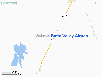
Butte Valley Airport (FAA LID: A32, formerly CA03) is a county-owned public-use airport located five miles (8 km) southwest of the central business district of Dorris, in Siskiyou County, California, United States.
Facilities and aircraft
Butte Valley Airport covers an area of 234 acres (95 ha) which contains one asphalt paved runway (16/34) measuring 4,300 x 60 ft (1,311 x 18 m). For the 12-month period ending December 31, 2005, the airport had 2,000 general aviation aircraft operations, an average of 5 per day.
The above content comes from Wikipedia and is published under free licenses – click here to read more.
Location
& QuickFacts
|
FAA
Information Effective: |
2006-06-08 |
|
Airport
Identifier: |
A32 |
|
Longitude/Latitude: |
121-58-32.1400W/41-53-14.0500N
-121.975594/41.887236 (Estimated) |
|
Elevation: |
4243 ft / 1293.27 m (Estimated) |
|
Land: |
234 acres |
|
From
nearest city: |
5 nautical miles SW of Dorris, CA |
|
Location: |
Siskiyou County, CA |
|
Magnetic Variation: |
18E (1985) |
Owner
& Manager
|
Ownership: |
Publicly owned |
|
Owner: |
County Of Siskiyou |
|
Address: |
305 Butte St
Yreka, CA 96097 |
|
Phone
number: |
530-842-8295 |
|
Manager: |
Thomas L. Anderson
DIR OF ARPTS. |
|
Address: |
305 Butte St
Yreka, CA 96097 |
|
Phone
number: |
530-842-8295
PHONE RINGS AT MGRS YREKA OFFICE. |
Airport
Operations and Facilities
|
Airport
Use: |
Open to public |
|
Wind
indicator: |
Yes |
|
Segmented
Circle: |
Yes |
|
Control
Tower: |
No |
|
Attendance
Schedule: |
UNATNDD |
|
Lighting
Schedule: |
DUSK-DAWN
ACTVT MIRL RY 16/34 KEY 122.9; 5 TIMES. |
|
Beacon
Color: |
Clear-Green (lighted land airport) |
|
Landing
fee charge: |
No |
|
Sectional
chart: |
Klamath Falls |
|
Region: |
AWP - Western-Pacific |
|
Traffic
Pattern Alt: |
800 ft |
|
Boundary
ARTCC: |
ZSE - Seattle |
|
Tie-in
FSS: |
RIU - Rancho Murieta |
|
FSS
on Airport: |
No |
|
FSS
Phone: |
916-354-0161 |
|
FSS
Toll Free: |
1-800-WX-BRIEF |
|
NOTAMs
Facility: |
RIU (NOTAM-d service avaliable) |
|
Federal Agreements: |
NS1 |
Airport
Communications
Airport
Services
|
Airframe
Repair: |
NONE |
|
Power
Plant Repair: |
NONE |
|
Bottled
Oxygen: |
NONE |
|
Bulk
Oxygen: |
NONE |
|
Runway Information
Runway 16/34
|
Dimension: |
4300 x 60 ft / 1310.6 x 18.3 m |
|
Surface: |
ASPH, Good Condition
RWY 16/34 - NUMEROUS CRACKS AND SEVERE SPALLING ON PAVEMENT |
|
Weight
Limit: |
Single wheel: 30000 lbs. |
|
Edge
Lights: |
Medium |
|
|
Runway 16 |
Runway 34 |
|
Longitude: |
121-58-32.1900W |
121-58-32.1000W |
|
Latitude: |
41-53-35.3000N |
41-52-52.8100N |
|
Elevation: |
4243.00 ft |
4243.00 ft |
|
Alignment: |
127 |
127 |
|
Traffic
Pattern: |
Left |
Left |
|
Markings: |
Basic, Good Condition |
Basic, Good Condition |
|
Runway
End Identifier: |
No |
No |
|
Centerline
Lights: |
No |
No |
|
Touchdown
Lights: |
No |
No |
|
Obstruction: |
15 ft road, 520.0 ft from runway, 21:1 slope
to clear |
5 ft fence, 350.0 ft from runway, 28:1 slope
to clear |
|
Radio Navigation
Aids
|
ID |
Type |
Name |
Ch |
Freq |
Var |
Dist |
|
LFA |
NDB |
Merrill |
|
347.00 |
17E |
16.0 nm |
|
MOG |
NDB |
Montague |
|
404.00 |
19E |
24.6 nm |
|
FJS |
VOR/DME |
Fort Jones |
033X |
109.60 |
19E |
45.6 nm |
|
LMT |
VORTAC |
Klamath Falls |
106X |
115.90 |
17E |
19.4 nm |
|
MFR |
VOT |
Medford-jackson County |
|
117.20 |
|
48.8 nm |
Remarks
Operational Statistics
|
Aircraft
Operations: |
39/Week |
|
General
Aviation Local: |
25.0% |
|
General
Aviation Itinerant: |
75.0% |
Butte Valley Airport
Address:
Siskiyou County, CA
Tel:
530-842-8295
Images
and information placed above are from
http://www.airport-data.com/airport/A32/
We
thank them for the data!
| General
Info |
| Country |
United
States |
| State |
CALIFORNIA
|
| FAA ID |
A32
|
| Latitude |
41-53-13.532N
|
| Longitude |
121-58-32.021W
|
| Elevation |
4239 feet
|
| Near City |
DORRIS
|
We don't guarantee the information is fresh and accurate. The data may
be wrong or outdated.
For more up-to-date information please refer to other sources.
|
|


