|
|
| Brownsville/South Padre Island International Airport |
 |
 |
| IATA: BRO – ICAO: KBRO – FAA LID: BRO |
| Summary |
| Airport type |
Public |
| Owner |
City of Brownsville |
| Serves |
Brownsville / South Padre Island, Texas |
| Location |
Brownsville, Texas |
| Elevation AMSL |
22 ft / 7 m |
| Coordinates |
25°54′25″N 097°25′33″W / 25.90694°N 97.42583°W / 25.90694; -97.42583 |
| Runways |
| Direction |
Length |
Surface |
| ft |
m |
| 13L/31R |
3,000 |
914 |
Asphalt |
| 13R/31L |
7,400 |
2,256 |
Asphalt |
| 17/35 |
6,000 |
1,829 |
Asphalt |
| Statistics (2007) |
| Aircraft operations |
43,105 |
| Based aircraft |
56 |
| Source: Federal Aviation Administration |
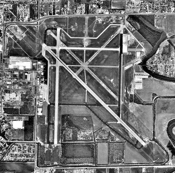
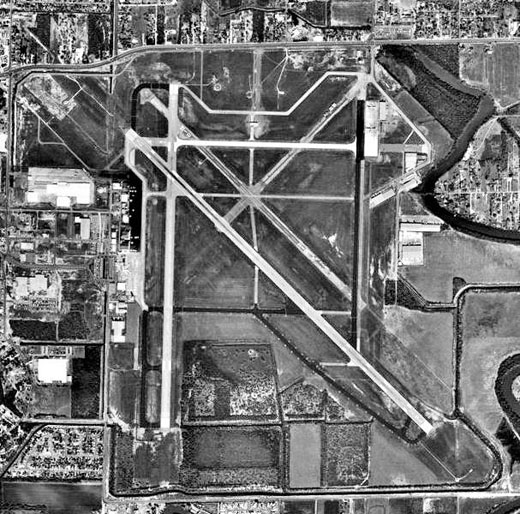
FAA airport diagram Brownsville/South Padre Island International Airport (IATA: BRO, ICAO: KBRO, FAA LID: BRO) is a city-owned public-use airport located four nautical miles (7 km) east of the central business district of Brownsville, a city in Cameron County, Texas, United States.
The airport is mostly used for general aviation, but it is also served by commercial airlines. It is a convenient airport for flying into the Rio Grande Valley and Northern Mexico. Most cities in the Rio Grande Valley are accessible from BRO by automobile within 30-60 minutes. It is also the closest commercial airport to South Padre Island.
The National Weather Service forecast office for Deep South Texas is located on the airport grounds.
History
- On March 9, 1929, Charles Lindbergh landed at BRO after a five hour, 38 minute historic flight from Mexico City to the United States. This established the first leg of Airmail Service to Mexico.
- An event was held on site in Lindbergh's honor, with a crowd of over 20,000 greeting him upon his arrival. Among the attendees was Amelia Earhart. This event has been described as an international event of great significance.
- Pan-American Airways started service at the airport on June 4th, 1929, the beginning of a 30-year relationship between BRO and PanAm.
- During World War II the airport was used by the United States Army Air Forces.
- The first American jet engine flight was tested at Brownsville Army Air Field.
- B-29 bombers were renovated on the site.
- The airport had one of the largest overhaul facilities in the country. By the end of the war Pan American had overhauled nearly 6,000 engines.
- Civilian Pilot Training program initiated to train military and commercial pilots.
- Only Mexican military unit to engage in combat during World War II, the 201st Fighter Squadron, trained at the Brownsville Army Air Field.
- In the 1960s, the 16th weather radar system in the nation was installed at BRO.
- In 1983, the airport was officially renamed the Brownsville-South Padre Island International Airport.
Facilities and aircraft
Brownsville/South Padre Island International Airport covers an area of 1,700 acres (688 ha) at an elevation of 22 feet (7 m) above mean sea level. It has three asphalt paved runways: 13L/31R measuring 3,000 x 75 ft (914 x 23 m), 13R/31L measuring 7,400 x 150 ft (2,256 x 46 m) and 17/35 measuring 6,000 x 150 ft (1,829 x 46 m).
For the 12-month period ending December 31, 2007, the airport had 43,105 aircraft operations, an average of 118 per day: 52% general aviation, 35% military, 13% air taxi and <1% scheduled commercial. At that time there were 56 aircraft based at this airport: 91% single-engine and 9% multi-engine.
Various aircraft types, including Embraer ERJ 140 and Embraer ERJ 145, are used by Continental Express and American Eagle in Brownsville. Previous aircraft used include ATR-42 and Embraer ERJ 135 aircraft (ExpressJet Airlines), Bombardier CRJ-200 aircraft (Chautauqua Airlines), as well as Boeing 737-200, 737-300 and 737-500 aircraft (Continental Airlines).
On June 21, 2010 Pan American Airways, Inc. was incorporated in Delaware. Pan American Airways, located in the 1931 Pan American Airways Building at the Brownsville South Padre Island International Airport is in the process of renovating the 1931 Pan American Airways Building with the intent of re-opening the "Gateway to Latin America" in 2011 with up to 70 monthly flights to Latin American cities. Plans are to renovate the entire 1931 building and start flights under Pan American Airways. For information go to panamericanairways.net.
Airlines and destinations
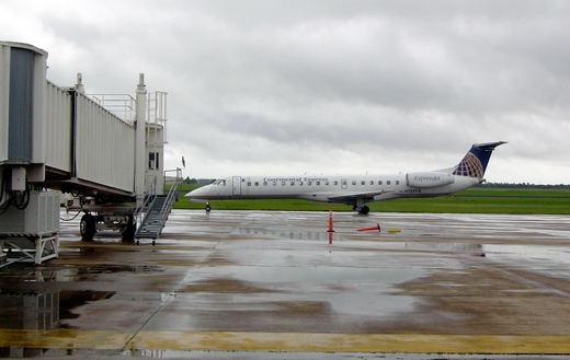 | |
An ExpressJet Airlines ERJ 145 arriving at the Gate 2 jetway. |
| Airlines |
Destinations |
| American Eagle |
Dallas/Fort Worth |
| Continental Express operated by ExpressJet Airlines |
Houston-Intercontinental |
Cargo
The airport is the largest air cargo handling airport in the Rio Grande Valley.
Pan American Airways and World-Wide Consolidated Logistics, Inc. will open cargo service to Latin America in 2011. A TSA Certified Cargo Screening Facility is being established by World-Wide Consolidated Logistics, Inc. to facility the screening of domestic and international cargo to and from the United States with the Brownsville South Padre Island International Airport being the "Gateway to Latin America" in 2011 and the "Gateway to Africa" (via the Southern Route) in 2012.
Website
The Brownsville/South Padre Island International Airport is the first airport in Texas to offer flight status notification via text-messaging through its website. When the system was launched, it was one of only three airports in the nation between Michigan and Alabama to offer such a service.
In addition to flight status text-messaging notification, the site also features current fares to popular routes, including Houston, Atlanta, Toronto, Minneapolis/St. Paul, and Querétaro.
The above content comes from Wikipedia and is published under free licenses – click here to read more.
Location
& QuickFacts
|
FAA
Information Effective: |
2006-06-08 |
|
Airport
Identifier: |
F25 |
|
Longitude/Latitude: |
121-17-29.9000W/39-27-18.8000N
-121.291639/39.455222 (Estimated) |
|
Elevation: |
2120 ft / 646.18 m (Estimated) |
|
Land: |
26 acres |
|
From
nearest city: |
2 nautical miles SW of Brownsville, CA |
|
Location: |
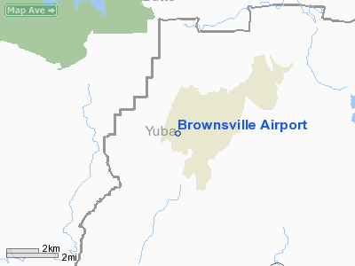
Yuba County, CA |
|
Magnetic Variation: |
16E (1985) |
Owner
& Manager
|
Ownership: |
Privately owned |
|
Owner: |
Second Golden Feather Nest Lp
OWNER - CHERYL WHITE (800) 984-6789 HOME: (619) 453-1109 |
|
Address: |
3368 Govenor Drive 178f
San Diego, CA 92122-2937 |
|
Phone number: |
619-452-9677 |
|
Manager: |
Hal Houston |
|
Address: |
Box 779
Brownsville, CA 95919 |
|
Phone number: |
530-675-2795 |
Airport
Operations and Facilities
|
Airport
Use: |
Open to public |
|
Wind
indicator: |
Yes |
|
Segmented
Circle: |
Yes |
|
Control
Tower: |
No |
|
Attendance
Schedule: |
UNATNDD |
|
Landing
fee charge: |
No |
|
Sectional
chart: |
San Francisco |
|
Region: |
AWP - Western-Pacific |
|
Traffic
Pattern Alt: |
800 ft |
|
Boundary
ARTCC: |
ZOA - Oakland |
|
Tie-in
FSS: |
RIU - Rancho Murieta |
|
FSS
on Airport: |
No |
|
FSS
Phone: |
916-354-0161 |
|
FSS
Toll Free: |
1-800-WX-BRIEF |
|
NOTAMs
Facility: |
RIU (NOTAM-d service avaliable) |
|
Federal Agreements: |
N |
Airport
Communications
Airport
Services
|
Bottled
Oxygen: |
NONE |
|
Bulk
Oxygen: |
NONE |
|
Runway Information
Runway 06/24
|
Dimension: |
2326 x 20 ft / 709.0 x 6.1 m |
|
Surface: |
GRVL-TRTD, Fair Condition |
|
|
Runway 06 |
Runway 24 |
|
Longitude: |
121-17-44.4269W |
121-17-15.3230W |
|
Latitude: |
39-27-16.5535N |
39-27-20.9491N |
|
Elevation: |
2092.00 ft |
2108.00 ft |
|
Traffic
Pattern: |
Right |
Left |
|
Markings: |
None, |
None, |
|
Runway
End Identifier: |
No |
No |
|
Centerline
Lights: |
No |
No |
|
Touchdown
Lights: |
No |
No |
|
Obstruction: |
35 ft tree, 200.0 ft from runway, 135 ft right
of centerline, 5:1 slope to clear |
15 ft pole, 110.0 ft from runway, 78 ft left
of centerline, 7:1 slope to clear |
|
Radio Navigation
Aids
|
ID |
Type |
Name |
Ch |
Freq |
Var |
Dist |
|
OVE |
NDB |
Oroville |
|
212.00 |
16E |
15.5 nm |
|
MY |
NDB |
Halow |
|
222.00 |
16E |
22.7 nm |
|
BAB |
TACAN |
Beale |
023X |
|
16E |
20.5 nm |
|
MYV |
VOR/DME |
Marysville |
045X |
110.80 |
16E |
25.1 nm |
|
CIC |
VOR/DME |
Chico |
035X |
109.80 |
16E |
32.7 nm |
|
MCC |
VOR/DME |
Mc Clellan |
029X |
109.20 |
17E |
47.6 nm |
|
ILA |
VORTAC |
Williams |
091X |
114.40 |
18E |
41.3 nm |
|
MXW |
VORTAC |
Maxwell |
037X |
110.00 |
18E |
44.0 nm |
|
SMF |
VOT |
Sacramento Metropolitan |
|
111.40 |
|
48.0 nm |
Remarks
- TREES
SURROUND ARPT ON NORTH, SOUTH, AND EAST. STEEP DROP-OFF TO WEST.
- TERRAIN
RISES 850' ABV RY ELEV 4000' EAST OF RY END.
- RY
06 +10 FT BRUSH 75 FT LEFT 200 FT FM EOR; +10 FT TREES 50 FT RIGHT 200
FT FM EOR.
- ESTABD
PRIOR TO 15 SEP 49.
Based Aircraft
|
Aircraft
based on field: |
12 |
|
Single
Engine Airplanes: |
12 |
Operational Statistics
|
Aircraft
Operations: |
39/Week |
|
General
Aviation Local: |
75.0% |
|
General
Aviation Itinerant: |
25.0% |
Brownsville Airport
Address:
Yuba County, CA
Tel:
619-452-9677, 530-675-2795
Images
and information placed above are from
http://www.airport-data.com/airport/F25/
We thank them for the
data!
We don't guarantee the information is fresh and accurate. The data may
be wrong or outdated.
For more up-to-date information please refer to other sources.
|
|