 |
|
|
|
|
|
Location
& QuickFacts
|
FAA
Information Effective: |
2006-06-08 |
|
Airport
Identifier: |
57CL |
|
Longitude/Latitude: |
117-36-25.2110W/35-00-12.9120N
-117.607003/35.003587 (Estimated) |
|
Elevation: |
2499 ft / 761.70 m (Estimated) |
|
Land: |
100 acres |
|
From
nearest city: |
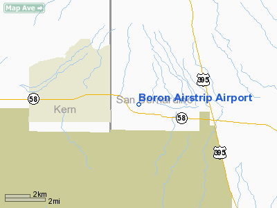
2 nautical miles E of Boron, CA |
|
Location: |
San Bernardino County, CA |
|
Magnetic Variation: |
14E (1985) |
Owner
& Manager
|
Ownership: |
Privately owned |
|
Owner: |
Oreda Wharton |
|
Address: |
Box 719
Boron, CA 93516 |
|
Phone number: |
619-762-6731 |
|
Manager: |
Oreda Wharton |
|
Address: |
Box 719
Boron, CA 93516 |
|
Phone number: |
619-762-6731 |
Airport
Operations and Facilities
|
Airport
Use: |
Private |
|
Wind
indicator: |
Yes |
|
Segmented
Circle: |
Yes
NON-STD - 20' DIAM. TIRES. |
|
Control
Tower: |
No |
|
Attendance
Schedule: |
UNATNDD |
|
Lighting
Schedule: |
PHONE REQ
< CALL LGTS
RWY> |
|
Landing fee charge: |
No |
|
Sectional chart: |
Los Angeles |
|
Region: |
AWP - Western-Pacific |
|
Traffic Pattern Alt: |
1000 ft |
|
Boundary ARTCC: |
ZLA - Los Angeles |
|
Tie-in FSS: |
RAL - Riverside |
|
FSS on Airport: |
No |
|
FSS Phone: |
951-351-3020 |
|
FSS Toll Free: |
1-800-WX-BRIEF |
Airport
Services
|
Airframe
Repair: |
NONE |
|
Power
Plant Repair: |
NONE |
|
Bottled
Oxygen: |
NONE |
|
Bulk
Oxygen: |
NONE |
|
Runway Information
Runway 07/25
|
Dimension: |
2290 x 50 ft / 698.0 x 15.2 m |
|
Surface: |
DIRT, Fair Condition |
|
Edge
Lights: |
Low
NON STD END LGTS & EDGE LGTS ARE 500' APART. |
|
|
Runway 07 |
Runway 25 |
|
Traffic
Pattern: |
Left |
Left |
|
Runway
End Identifier: |
No |
No |
|
Centerline
Lights: |
No |
No |
|
Touchdown
Lights: |
No |
No |
|
Obstruction: |
20 ft , 500.0 ft from runway, 25:1 slope to
clear |
, 50:1 slope to clear |
|
Runway 14/32
|
Dimension: |
1900 x 45 ft / 579.1 x 13.7 m |
|
Surface: |
DIRT, Fair Condition |
|
|
Runway 14 |
Runway 32 |
|
Elevation: |
2450.00 ft |
0.00 ft |
|
Traffic
Pattern: |
Left |
Left |
|
Runway
End Identifier: |
No |
No |
|
Centerline
Lights: |
No |
No |
|
Touchdown
Lights: |
No |
No |
|
Obstruction: |
, 50:1 slope to clear |
45 ft ant, 450.0 ft from runway, 275 ft left
of centerline, 10:1 slope to clear |
|
Runway 17/35
|
Dimension: |
2400 x 40 ft / 731.5 x 12.2 m |
|
Surface: |
DIRT, Fair Condition |
|
|
Runway 17 |
Runway 35 |
|
Traffic
Pattern: |
Left |
Left |
|
Runway
End Identifier: |
No |
No |
|
Centerline
Lights: |
No |
No |
|
Touchdown
Lights: |
No |
No |
|
Obstruction: |
, 50:1 slope to clear |
45 ft ant, 450.0 ft from runway, 275 ft right
of centerline, 10:1 slope to clear |
|
Radio Navigation
Aids
|
ID |
Type |
Name |
Ch |
Freq |
Var |
Dist |
|
GWF |
NDB |
Gen William J Fox |
|
282.00 |
15E |
34.0 nm |
|
NID |
TACAN |
China Lake |
053X |
|
16E |
41.3 nm |
|
VCV |
VOR/DME |
Victorville |
031X |
109.40 |
14E |
26.8 nm |
|
EDW |
VORTAC |
Edwards |
111X |
116.40 |
15E |
6.3 nm |
|
PMD |
VORTAC |
Palmdale |
092X |
114.50 |
15E |
31.8 nm |
Based Aircraft
|
Aircraft
based on field: |
1 |
|
Single
Engine Airplanes: |
1 |
Operational Statistics
|
Aircraft
Operations: |
14/Week |
|
General
Aviation Local: |
21.4% |
|
General
Aviation Itinerant: |
78.6% |
Boron Airstrip Airport
Address:
San Bernardino County, CA
Tel:
619-762-6731
Images
and information placed above are from
http://www.airport-data.com/airport/57CL/
We
thank them for the data!
| General
Info |
| Country |
United
States |
| State |
CALIFORNIA
|
| FAA ID |
57CL
|
| Latitude |
35-00-12.912N
|
| Longitude |
117-36-25.211W
|
| Elevation |
2499 feet
|
| Near City |
BORON
|
We don't guarantee the information is fresh and accurate. The data may
be wrong or outdated.
For more up-to-date information please refer to other sources.
|
|


