 |
|
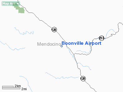
| Boonville Airport |
| IATA: none – ICAO: none – FAA LID: D83 |
| Summary |
| Airport type |
Anderson Valley Community Services District |
| Operator |
Boonville, California |
| Location |
371 |
| Elevation AMSL |
113.1 ft / m |
| Coordinates |
39°00′46″N 123°22′58″W / 39.01278°N 123.38278°W / 39.01278; -123.38278Coordinates: 39°00′46″N 123°22′58″W / 39.01278°N 123.38278°W / 39.01278; -123.38278 |
| Runways |
| Direction |
Length |
Surface |
| ft |
m |
| 13/31 |
3,240 |
988 |
Asphalt |
Boonville Airport (FAA LID: D83), formerly Q17, is a public airport located one mile (1.6 km) northwest of the central business district (CBD) of Boonville, a town in Anderson Valley in Mendocino County, California, USA. The airport is mostly used for general aviation.
Facilities
Boonville Airport covers 35 acres (140,000 m) and has one runway:
- Runway 13/31: 3,240 x 50 ft (988 x 15 m), Surface: Asphalt
The above content comes from Wikipedia and is published under free licenses – click here to read more.
Location
& QuickFacts
|
FAA
Information Effective: |
2006-06-08 |
|
Airport
Identifier: |
D83 |
|
Longitude/Latitude: |
123-22-58.0310W/39-00-45.6390N
-123.382786/39.012677 (Estimated) |
|
Elevation: |
371 ft / 113.08 m (Estimated) |
|
Land: |
35 acres |
|
From
nearest city: |
1 nautical miles NW of Boonville, CA |
|
Location: |
Mendocino County, CA |
|
Magnetic Variation: |
17E (1985) |
Owner
& Manager
|
Ownership: |
Publicly owned |
|
Owner: |
Anderson Valley Comm.svc Dst. |
|
Address: |
P.o. Box 398
Boonville, CA 95415 |
|
Phone number: |
707-895-2075 |
|
Manager: |
Kirk Wilder |
|
Address: |
13461 Airport Road
Boonville, CA 95415 |
|
Phone number: |
707-895-2949 |
Airport
Operations and Facilities
|
Airport
Use: |
Open to public |
|
Wind
indicator: |
Yes |
|
Segmented
Circle: |
Yes |
|
Control
Tower: |
No |
|
Attendance
Schedule: |
UNATNDD |
|
Landing
fee charge: |
No |
|
Sectional
chart: |
San Francisco |
|
Region: |
AWP - Western-Pacific |
|
Traffic
Pattern Alt: |
800 ft |
|
Boundary
ARTCC: |
ZOA - Oakland |
|
Tie-in
FSS: |
OAK - Oakland |
|
FSS
on Airport: |
No |
|
FSS
Phone: |
510-273-6111 |
|
FSS
Toll Free: |
1-800-WX-BRIEF |
|
NOTAMs
Facility: |
OAK (NOTAM-d service avaliable) |
|
Federal Agreements: |
N |
Airport
Communications
|
CTAF: |
122.700 |
|
Unicom: |
122.700 |
Airport
Services
|
Airframe
Repair: |
NONE |
|
Power
Plant Repair: |
NONE |
|
Bottled
Oxygen: |
NONE |
|
Bulk
Oxygen: |
NONE |
|
Runway Information
Runway 13/31
|
Dimension: |
3240 x 50 ft / 987.6 x 15.2 m |
|
Surface: |
ASPH, Good Condition |
|
Weight
Limit: |
Single wheel: 30000 lbs.
PAVEMENT GROSS WEIGHT STRENGTH ESTIMATED BY ARPT MGR 12,500 LBS. |
|
|
Runway 13 |
Runway 31 |
|
Elevation: |
350.00 ft |
371.00 ft |
|
Traffic
Pattern: |
Left |
Right |
|
Markings: |
Basic, Good Condition |
Basic, Good Condition |
|
Displaced
threshold: |
460.00 ft |
256.00 ft |
|
Runway
End Identifier: |
No |
No |
|
Centerline
Lights: |
No |
No |
|
Touchdown
Lights: |
No |
No |
|
Obstruction: |
35 ft trees, 400.0 ft from runway, 20 ft left
of centerline, 5:1 slope to clear
APCH RATIO 24:1 TO DSPLCD THLD; APCH RATIO TO DSPLD THLD OVER
92 FT TREES AT 1200 FT, 175 FT R FM EOR 18:1.
5'
FENCE 37' FROM END OF RWY. |
185 ft hill, 3900.0 ft from runway, 500 ft
left of centerline, 20:1 slope to clear
APCH RATIO 22:1 TO DSPLCD THR; APCH RATIO TO DSPLCD THR OVER
+15 FT ROAD 311 FT FM DSPLCD THR 125 FT LEFT 20:1.
PUBLIC ROAD 55' FM RWY END. |
|
Radio Navigation
Aids
|
ID |
Type |
Name |
Ch |
Freq |
Var |
Dist |
|
LOP |
NDB |
Lampson |
|
217.00 |
16E |
23.3 nm |
|
STS |
VOR/DME |
Santa Rosa |
077X |
113.00 |
16E |
40.5 nm |
|
ENI |
VORTAC |
Mendocino |
070X |
112.30 |
16E |
5.6 nm |
Remarks
- DITCH
SW SIDE OF RY 13/31.
- BACK
TAXI ON RY, DO NOT MISTAKE COUNTY ROAD FOR TWY.
- NON
COMPLIANCE FAR 157.
Based Aircraft
|
Aircraft
based on field: |
14 |
|
Single
Engine Airplanes: |
14 |
Operational Statistics
|
Aircraft
Operations: |
97/Week |
|
General
Aviation Local: |
40.0% |
|
General
Aviation Itinerant: |
60.0% |
Boonville Airport
Address:
Mendocino County, CA
Tel:
707-895-2075, 707-895-2949
Images
and information placed above are from
http://www.airport-data.com/airport/D83/
We
thank them for the data!
| General
Info |
| Country |
United
States |
| State |
CALIFORNIA
|
| FAA ID |
D83
|
| Latitude |
39.012678
39� 00' 45.64" N |
| Longitude |
-123.382786
123� 22' 58.03" W |
| Elevation |
371 feet
113 meters |
| Magnetic
Variation |
015� E
(01/06) |
| Operating
Agency |
U.S.CIVIL
AIRPORT WHEREIN PERMIT COVERS USE BY TRANSIT MILITARY AIRCRAFT
|
| Daylight
Savings Time |
First
Sunday in April at 0200 to last Sunday in October at 0200 local time
(Exception Arizona and that portion of Indiana in the Eastern Time
Zone) |
We don't guarantee the information is fresh and accurate. The data may
be wrong or outdated.
For more up-to-date information please refer to other sources.
|
|


