 |
|
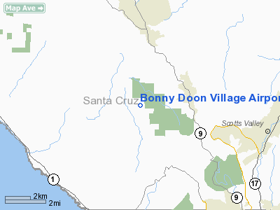
Bonny Doon Village Airport |
Location
& QuickFacts
|
FAA
Information Effective: |
2006-06-08 |
|
Airport
Identifier: |
CL77 |
|
Longitude/Latitude: |
122-07-38.8760W/37-04-13.8130N
-122.127466/37.070504 (Estimated) |
|
Elevation: |
2020 ft / 615.70 m (Estimated) |
|
Land: |
0 acres |
|
From
nearest city: |
8 nautical miles NW of Santa Cruz, CA |
|
Location: |
Santa Cruz County, CA |
|
Magnetic Variation: |
16E (1980) |
Owner
& Manager
|
Ownership: |
Privately owned |
|
Owner: |
Rich & Elvon Hoogner |
|
Address: |
8647 Empire Grade
Santa Cruz, CA 95060 |
|
Phone
number: |
831-459-8577 |
|
Manager: |
Rich Hoogner |
|
Address: |
8647 Empire Grade
Santa Cruz, CA 95060 |
|
Phone number: |
831-459-8577 |
Airport
Operations and Facilities
|
Airport
Use: |
Private |
|
Wind
indicator: |
Yes |
|
Segmented
Circle: |
Yes |
|
Control
Tower: |
No |
|
Attendance
Schedule: |
ALL/ALL/ALL |
|
Sectional
chart: |
San Francisco |
|
Region: |
AWP - Western-Pacific |
|
Boundary
ARTCC: |
ZOA - Oakland |
|
Tie-in
FSS: |
OAK - Oakland |
|
FSS
Phone: |
510-273-6111 |
|
FSS
Toll Free: |
1-800-WX-BRIEF |
|
Runway Information
Runway 12/30
|
Dimension: |
2200 x 50 ft / 670.6 x 15.2 m |
|
Surface: |
ASPH, |
|
|
Runway 12 |
Runway 30 |
|
Traffic
Pattern: |
Left |
Left |
|
Radio Navigation
Aids
|
ID |
Type |
Name |
Ch |
Freq |
Var |
Dist |
|
PDG |
NDB |
Pajar |
|
327.00 |
17E |
18.0 nm |
|
LV |
NDB |
Reiga |
|
374.00 |
16E |
43.0 nm |
|
UAD |
NDB |
Chualar |
|
263.00 |
16E |
46.9 nm |
|
TCY |
NDB |
Tracy |
|
203.00 |
15E |
49.6 nm |
|
NUQ |
TACAN |
Moffett |
123X |
|
17E |
22.0 nm |
|
SJC |
VOR/DME |
San Jose |
088X |
114.10 |
16E |
20.3 nm |
|
SFO |
VOR/DME |
San Francisco |
105X |
115.80 |
17E |
35.0 nm |
|
OSI |
VORTAC |
Woodside |
086X |
113.90 |
17E |
20.7 nm |
|
SNS |
VORTAC |
Salinas |
120X |
117.30 |
17E |
35.1 nm |
|
OAK |
VORTAC |
Oakland |
115X |
116.80 |
17E |
39.7 nm |
|
SFO |
VOT |
San Francisco Intl |
|
111.00 |
|
35.1 nm |
Remarks
- TREES
SURROUNDING ARPT; HIGH TRRN NORTH; USE RWY 30 FOR LANDING; RWY 12 FOR
TKOF.
- VFR,
PRIVATE USE ONLY.
Based Aircraft
|
Aircraft
based on field: |
2 |
|
Single
Engine Airplanes: |
2 |
Bonny Doon Village Airport
Address:
Santa Cruz County, CA
Tel:
831-459-8577
Images
and information placed above are from
http://www.airport-data.com/airport/CL77/
We
thank them for the data!
| General
Info |
| Country |
United
States |
| State |
CALIFORNIA
|
| FAA ID |
CL77
|
| Latitude |
37-04-13.813N
|
| Longitude |
122-07-38.876W
|
| Elevation |
2020 feet
|
| Near City |
SANTA
CRUZ |
We don't guarantee the information is fresh and accurate. The data may
be wrong or outdated.
For more up-to-date information please refer to other sources.
|
|


