 |
|
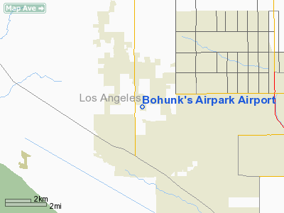
Location
& QuickFacts
|
FAA
Information Effective: |
2006-06-08 |
|
Airport
Identifier: |
0CL6 |
|
Longitude/Latitude: |
118-16-59.2750W/34-41-40.9440N
-118.283132/34.694707 (Estimated) |
|
Elevation: |
2410 ft / 734.57 m (Estimated) |
|
Land: |
10 acres |
|
From
nearest city: |
7 nautical miles W of Lancaster, CA |
|
Location: |
Los Angeles County, CA |
|
Magnetic Variation: |
14E (1985) |
Owner
& Manager
|
Ownership: |
Privately owned |
|
Owner: |
William C. Safranek |
|
Address: |
44822 N. 15th St. W.
Lancaster, CA 93534 |
|
Phone number: |
805-942-7080 |
|
Address: |
|
Airport
Operations and Facilities
|
Airport
Use: |
Private |
|
Wind
indicator: |
Yes |
|
Segmented
Circle: |
No |
|
Control
Tower: |
No |
|
Attendance
Schedule: |
ALL/MON-SAT/1000-1400 |
|
Sectional
chart: |
Los Angeles |
|
Region: |
AWP - Western-Pacific |
|
Boundary
ARTCC: |
ZLA - Los Angeles |
|
Tie-in
FSS: |
RAL - Riverside |
|
FSS
Phone: |
951-351-3020 |
|
FSS
Toll Free: |
1-800-WX-BRIEF |
|
Runway Information
Runway 09/27
|
Dimension: |
1900 x 70 ft / 579.1 x 21.3 m |
|
Surface: |
DIRT, |
|
|
Runway 09 |
Runway 27 |
|
Traffic
Pattern: |
Left |
Right |
|
Displaced
threshold: |
200.00 ft |
0.00 ft |
|
Radio Navigation
Aids
|
ID |
Type |
Name |
Ch |
Freq |
Var |
Dist |
|
GWF |
NDB |
Gen William J Fox |
|
282.00 |
15E |
4.2 nm |
|
PAI |
NDB |
Pacoima |
|
370.00 |
15E |
26.9 nm |
|
EMT |
NDB |
El Monte |
|
359.00 |
15E |
38.5 nm |
|
CPM |
NDB |
Compton |
|
378.00 |
15E |
48.5 nm |
|
VNY |
VOR/DME |
Van Nuys |
078X |
113.10 |
15E |
30.2 nm |
|
SMO |
VOR/DME |
Santa Monica |
045X |
110.80 |
15E |
42.0 nm |
|
VCV |
VOR/DME |
Victorville |
031X |
109.40 |
14E |
44.6 nm |
|
CMA |
VOR/DME |
Camarillo |
105X |
115.80 |
15E |
49.6 nm |
|
PMD |
VORTAC |
Palmdale |
092X |
114.50 |
15E |
11.5 nm |
|
LHS |
VORTAC |
Lake Hughes |
021X |
108.40 |
15E |
14.5 nm |
|
GMN |
VORTAC |
Gorman |
108X |
116.10 |
16E |
29.3 nm |
|
EDW |
VORTAC |
Edwards |
111X |
116.40 |
15E |
32.2 nm |
|
FIM |
VORTAC |
Fillmore |
072X |
112.50 |
15E |
35.9 nm |
|
POM |
VORTAC |
Pomona |
041X |
110.40 |
15E |
44.5 nm |
|
LAX |
VORTAC |
Los Angeles |
083X |
113.60 |
15E |
46.4 nm |
Remarks
- LAND
AT OWN RISK
- PRVDD
PILOTS OPERATING IN/OUT OF ARPT ARE KNOWLEDGEABLE OF PROCEDURES FOR
OPERATING WITHIN THE WM. J. FOX AIRFIELD CONTROL ZONE DURING LESS THAN
VFR WEATHER CONDITIONS.
Bohunk's Airpark Airport
Address:
Los Angeles County, CA
Tel:
805-942-7080
Images
and information placed above are from
http://www.airport-data.com/airport/0CL6/
We
thank them for the data!
| General
Info |
| Country |
United
States |
| State |
CALIFORNIA
|
| FAA ID |
0CL6
|
| Latitude |
34-41-40.944N
|
| Longitude |
118-16-59.275W
|
| Elevation |
2410 feet
|
| Near City |
LANCASTER
|
We don't guarantee the information is fresh and accurate. The data may
be wrong or outdated.
For more up-to-date information please refer to other sources.
|
|


