 |
|
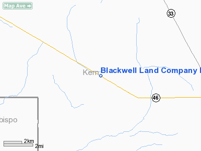
Blackwell Land Company Inc Airport |
Location
& QuickFacts
|
FAA
Information Effective: |
2006-06-08 |
|
Airport
Identifier: |
36CN |
|
Longitude/Latitude: |
120-00-33.5010W/35-38-10.8690N
-120.009306/35.636353 (Estimated) |
|
Elevation: |
760 ft / 231.65 m (Estimated) |
|
Land: |
0 acres |
|
From
nearest city: |
15 nautical miles NW of Lost Hills, CA |
|
Location: |
Kern County, CA |
|
Magnetic Variation: |
15E (1985) |
Owner
& Manager
|
Ownership: |
Privately owned |
|
Owner: |
Blackwell Land Co., Inc. |
|
Address: |
|
|
Manager: |
Michael A. Neal |
|
Address: |
Po Box 2393
Bakersfield, CA 93303 |
|
Phone number: |
805-397-2622 |
Airport
Operations and Facilities
|
Airport Use: |
Private |
|
Wind indicator: |
Yes |
|
Segmented Circle: |
No |
|
Control Tower: |
No |
|
Attendance Schedule: |
UNATNDD |
|
Landing fee charge: |
No |
|
Sectional chart: |
Los Angeles |
|
Region: |
AWP - Western-Pacific |
|
Boundary ARTCC: |
ZLA - Los Angeles |
|
Tie-in FSS: |
RIU - Rancho Murieta |
|
FSS on Airport: |
No |
|
FSS Phone: |
916-354-0161 |
|
FSS Toll Free: |
1-800-WX-BRIEF |
Airport
Services
|
Airframe
Repair: |
NONE |
|
Power
Plant Repair: |
NONE |
|
Runway
Information
Runway E/W
|
Dimension: |
4200 x 40 ft / 1280.2 x 12.2 m |
|
Surface: |
ASPH-TRTD, |
|
|
Runway E |
Runway W |
|
Traffic
Pattern: |
Right |
Right |
|
Radio Navigation
Aids
|
ID |
Type |
Name |
Ch |
Freq |
Var |
Dist |
|
COR |
NDB |
Salyer Farms |
|
205.00 |
16E |
34.6 nm |
|
NLC |
TACAN |
Lemoore |
080X |
|
16E |
42.6 nm |
|
ROM |
VOR |
Priest |
|
110.00 |
16E |
44.0 nm |
|
GLJ |
VOR |
Guadalupe |
|
111.00 |
16E |
48.2 nm |
|
AVE |
VORTAC |
Avenal |
118X |
117.10 |
16E |
1.6 nm |
|
PRB |
VORTAC |
Paso Robles |
090X |
114.30 |
16E |
30.3 nm |
|
FLW |
VORTAC |
Fellows |
122X |
117.50 |
16E |
33.4 nm |
|
MQO |
VORTAC |
Morro Bay |
071X |
112.40 |
16E |
43.4 nm |
|
EHF |
VORTAC |
Shafter |
101X |
115.40 |
14E |
45.5 nm |
|
BFL |
VOT |
Bakersfield |
|
111.20 |
|
48.8 nm |
Remarks
- SOLID
RAIL 18 INCHES HIGH EXTENDING THE LENGTH OF RWY BTN RWY & HWY 46.
- RWY
IS CLOSE TO HWY 46 WITH PLINES BTN HWY & RWY, NO PROTECTIVE FENCE
TO KEEP VEHICLES OFF RWY.
Blackwell Land Company Inc Airport
Address:
Kern County, CA
Tel:
805-397-2622
Images
and information placed above are from
http://www.airport-data.com/airport/36CN/
We
thank them for the data!
| General
Info |
| Country |
United
States |
| State |
CALIFORNIA
|
| FAA ID |
36CN
|
| Latitude |
35-38-10.869N
|
| Longitude |
120-00-33.501W
|
| Elevation |
760 feet
|
| Near City |
LOST HILLS
|
We don't guarantee the information is fresh and accurate. The data may
be wrong or outdated.
For more up-to-date information please refer to other sources.
|
|


