 |
|
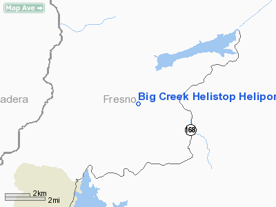
Big Creek Helistop Heliport |
Location
& QuickFacts
|
FAA
Information Effective: |
2006-06-08 |
|
Airport
Identifier: |
CN28 |
|
Longitude/Latitude: |
119-15-05.4440W/37-12-03.8040N
-119.251512/37.201057 (Estimated) |
|
Elevation: |
4960 ft / 1511.81 m (Estimated) |
|
Land: |
0 acres |
|
From
nearest city: |
1 nautical miles W of Big Creek, CA |
|
Location: |
Fresno County, CA |
|
Magnetic Variation: |
15E (1985) |
Owner
& Manager
|
Ownership: |
Privately owned |
|
Owner: |
Southern California Edison Co |
|
Address: |
54205 Poplar Road
Big Creek, CA 93605 |
|
Phone
number: |
559-893-3646 |
|
Manager: |
Art Bradbury |
|
Address: |
2161 East Avion St
Ontario, CA 91761 |
|
Phone number: |
909-974-4691 |
Airport
Operations and Facilities
|
Airport
Use: |
Private |
|
Wind
indicator: |
Yes |
|
Segmented
Circle: |
No |
|
Control
Tower: |
No |
|
Attendance
Schedule: |
UNATNDD |
|
Landing
fee charge: |
No |
|
Sectional
chart: |
San Francisco |
|
Region: |
AWP - Western-Pacific |
|
Boundary
ARTCC: |
ZOA - Oakland |
|
Tie-in
FSS: |
RIU - Rancho Murieta |
|
FSS
on Airport: |
No |
|
FSS
Phone: |
916-354-0161 |
|
FSS
Toll Free: |
1-800-WX-BRIEF |
|
Runway Information
Helipad H1
|
Dimension: |
65
x 65 ft / 19.8 x 19.8 m
HELIPAD IS A 65' RADIUS AREA BLACKTOP ON GRANITE. |
|
Surface: |
ASPH, |
|
|
Runway H1 |
Runway |
|
Traffic
Pattern: |
Left |
Left |
|
Radio Navigation
Aids
|
ID |
Type |
Name |
Ch |
Freq |
Var |
Dist |
|
CUK |
NDB |
Academy |
|
266.00 |
14E |
33.8 nm |
|
FCH |
NDB |
Chandler |
|
344.00 |
15E |
40.1 nm |
|
BIH |
VOR/DME |
Bishop |
033X |
109.60 |
15E |
43.6 nm |
|
FRA |
VORTAC |
Friant |
103X |
115.60 |
17E |
17.5 nm |
|
CZQ |
VORTAC |
Clovis |
076X |
112.90 |
15E |
33.1 nm |
Remarks
Big Creek Helistop Heliport
Address:
Fresno County, CA
Tel:
559-893-3646,
909-974-4691
Images
and information placed above are from
http://www.airport-data.com/airport/CN28/
We
thank them for the data!
| General
Info |
| Country |
United
States |
| State |
CALIFORNIA
|
| FAA ID |
CN28
|
| Latitude |
37-12-03.804N
|
| Longitude |
119-15-05.444W
|
| Elevation |
4960 feet
|
| Near City |
BIG CREEK
|
We don't guarantee the information is fresh and accurate. The data may
be wrong or outdated.
For more up-to-date information please refer to other sources.
|
|


