 |
|
| Bicycle Lake Army Airfield |
| IATA: none – ICAO: KBYS – FAA LID: BYS |
| Summary |
| Airport type |
Military |
| Operator |
United States Army |
| Location |
Fort Irwin, California |
| Elevation AMSL |
2350 ft / 716 m |
| Coordinates |
35°16′50″N 116°37′48″W / 35.2805303°N 116.6300294°W / 35.2805303; -116.6300294Coordinates: 35°16′50″N 116°37′48″W / 35.2805303°N 116.6300294°W / 35.2805303; -116.6300294 |
| Runways |
| Direction |
Length |
Surface |
| ft |
m |
| 4/22 |
9,500 |
2,896 |
Gravel |
| 13/31 |
5,800 |
1,768 |
Gravel |
| Sources: FAA |
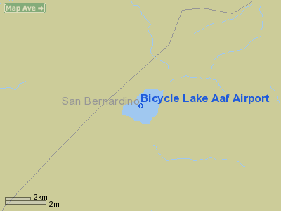
Bicycle Lake Army Airfield (ICAO: KBYS, FAA LID: BYS) is a military airport located on the Bicycle dry lake bed, three miles (5 km) northeast of the Fort Irwin cantonment area, in the Mojave Desert of San Bernardino County, California, United States. It is owned by the United States Army.
The above content comes from Wikipedia and is published under free licenses – click here to read more.
Location
& QuickFacts
|
FAA
Information Effective: |
2006-06-08 |
|
Airport
Identifier: |
BYS |
|
Longitude/Latitude: |
116-37-48.1060W/35-16-49.9090N
-116.630029/35.280530 (Estimated) |
|
Elevation: |
2350 ft / 716.28 m (Estimated) |
|
Land: |
0 acres |
|
From
nearest city: |
3 nautical miles NE of Fort Irwin/barstow,
CA |
|
Location: |
San Bernardino County, CA |
|
Magnetic Variation: |
14E (1985) |
Owner
& Manager
|
Ownership: |
Army owned |
|
Owner: |
Us Army Atca-aso |
|
Address: |
Cameron Station
Alexandria, VA 22314 |
|
Address: |
|
Airport
Operations and Facilities
|
Airport
Use: |
Private |
|
Segmented
Circle: |
No |
|
Control
Tower: |
No |
|
Attendance
Schedule: |
ALL/ALL/ALL |
|
Beacon
Color: |
Split-Clear-Green (lighted military airport) |
|
Sectional
chart: |
Los Angeles |
|
Region: |
AWP - Western-Pacific |
|
Boundary
ARTCC: |
ZLA - Los Angeles |
|
Tie-in
FSS: |
RAL - Riverside |
|
FSS
on Airport: |
No |
|
FSS
Phone: |
951-351-3020 |
|
FSS
Toll Free: |
1-800-WX-BRIEF |
Airport
Services
|
Fuel
available: |
A1+
FUEL AVBL 0730-2100. |
|
Runway Information
Runway 04/22
|
Dimension: |
9500 x 175 ft / 2895.6 x 53.3 m |
|
Surface: |
GRAVEL, |
|
Edge
Lights: |
Low |
|
|
Runway 04 |
Runway 22 |
|
Traffic
Pattern: |
Left |
Left |
|
Runway 13/31
|
Dimension: |
5800 x 175 ft / 1767.8 x 53.3 m |
|
Surface: |
GRAVEL, |
|
|
Runway 13 |
Runway 31 |
|
Traffic
Pattern: |
Left |
Left |
|
Radio Navigation
Aids
|
ID |
Type |
Name |
Ch |
Freq |
Var |
Dist |
|
DAG |
VORTAC |
Daggett |
079X |
113.20 |
15E |
19.3 nm |
|
HEC |
VORTAC |
Hector |
074X |
112.70 |
15E |
30.2 nm |
Remarks
- ARPT
CLOSED TO ARMY FW.
- PPR
72 HR PRIOR TO ENTERING R2502, DSN 470-4320, C760-380-4320. CTC DESERT
RADIO AFFS (24 HR) PRIOR TO ENTERING RSTD AREA.
- REMOTE
WX BRIEFING SVC AVBL DAVIS MONTHAN AFB, DSN 228-6598, C520-228-6598.
- LTD
FCST SVC, BICYCLE LAKE DSN 470-4328.
- LDG
AREAS SUBJECT TO BROWN-OUT CONDITIONS; OCCASIONAL BLOWING SAND/DUST.
- MAIN
POST HELIPAD RSTRD TO MEDEVAC AND VIP ACFT.
- HI
VOLTAGE RADAR TRANS VCNTY GOLDSTONE LAKE.
- EXTV
LOW LEVEL JET ACFT TFC.
- SFC
TO SFC AND AIR TO GND GUNNERY. C-17/C-30 ONLY.
- CLSD
TO ARMY FW ACFT.
Bicycle Lake Aaf Airport
Address:
San Bernardino County, CA
Tel:
Images
and information placed above are from
http://www.airport-data.com/airport/BYS/
We
thank them for the data!
| General
Info |
| Country |
United
States |
| State |
CALIFORNIA
|
| FAA ID |
BYS
|
| Latitude |
35-16-49.909N
|
| Longitude |
116-37-48.106W
|
| Elevation |
2350 feet
|
| Near City |
FORT IRWIN/BARSTOW
|
We don't guarantee the information is fresh and accurate. The data may
be wrong or outdated.
For more up-to-date information please refer to other sources.
|
|


