 |
|
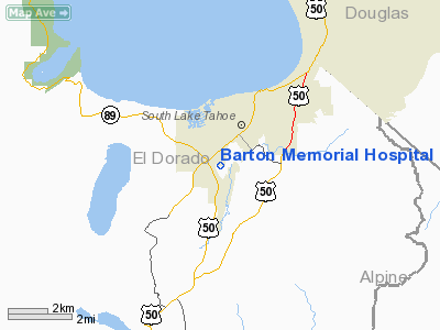
Barton Memorial Hospital Heliport |
|
|
Location
& QuickFacts
|
FAA
Information Effective: |
2006-06-08 |
|
Airport
Identifier: |
CA43 |
|
Longitude/Latitude: |
119-59-48.6000W/38-54-40.7000N
-119.996833/38.911306 (Estimated) |
|
Elevation: |
6298 ft / 1919.63 m (Estimated) |
|
Land: |
0 acres |
|
From
nearest city: |
2 nautical miles SW of South Lake Tahoe,
CA |
|
Location: |
El Dorado County, CA |
|
Magnetic Variation: |
16E (1985) |
Owner
& Manager
|
Ownership: |
Privately owned |
|
Owner: |
Barton Memorial Hospital |
|
Address: |
2170 South St
South Lake Tahoe, CA |
|
Phone
number: |
530-542-3000 |
|
Manager: |
Rich Belli |
|
Address: |
P O Box 9578
South Lake Tahoe, CA 96158 |
|
Phone number: |
530-542-3000 |
Airport
Operations and Facilities
|
Airport
Use: |
Private
MEDICAL. |
|
Wind
indicator: |
Yes |
|
Segmented
Circle: |
No |
|
Control
Tower: |
No |
|
Attendance
Schedule: |
ALL/ALL/ALL |
|
Lighting
Schedule: |
RDO-CTL
ACTVT RY H1 PERIMETER LGTS, LDIN LGTS AND WIND CONE - 123.05. |
|
Landing fee charge: |
No |
|
Sectional chart: |
San Francisco |
|
Region: |
AWP - Western-Pacific |
|
Boundary ARTCC: |
ZOA - Oakland |
|
Tie-in FSS: |
RNO - Reno |
|
FSS on Airport: |
No |
|
FSS Phone: |
775-858-1300 |
|
FSS Toll Free: |
1-800-WX-BRIEF |
Airport
Services
|
Airframe
Repair: |
NONE |
|
Power
Plant Repair: |
NONE |
|
Runway Information
Helipad H1
|
Dimension: |
42 x 42 ft / 12.8 x 12.8 m |
|
Surface: |
MATS,
ALUMINUM ROOFTOP. |
|
|
Runway H1 |
Runway |
|
Traffic
Pattern: |
Left |
Left |
|
Approach
lights: |
LDIN |
|
|
Radio Navigation
Aids
|
ID |
Type |
Name |
Ch |
Freq |
Var |
Dist |
|
SWR |
VOR/DME |
Squaw Valley |
079X |
113.20 |
16E |
20.6 nm |
|
HNW |
VOR/DME |
Hangtown |
102X |
115.50 |
17E |
37.0 nm |
|
FMG |
VORTAC |
Mustang |
126X |
117.90 |
16E |
40.5 nm |
Remarks
- PLINE
AND TREES TO NORTH AND SOUTH OF HELIPAD. APCH ON MAGNETIC BEARINGS OF
077 DEG OR 251 DEG, DEP ON RECIPROCAL BEARINGS
Operational Statistics
|
Aircraft
Operations: |
5/Month |
|
Air Taxi: |
100.0% |
Barton Memorial Hospital Heliport
Address:
El Dorado County, CA
Tel:
530-542-3000
Images
and information placed above are from
http://www.airport-data.com/airport/CA43/
We
thank them for the data!
| General
Info |
| Country |
United
States |
| State |
CALIFORNIA
|
| FAA ID |
CA43
|
| Latitude |
38-54-40.700N
|
| Longitude |
119-59-48.600W
|
| Elevation |
6298 feet
|
| Near City |
SOUTH
LAKE TAHOE |
We don't guarantee the information is fresh and accurate. The data may
be wrong or outdated.
For more up-to-date information please refer to other sources.
|
|


