 |
|
History
During World War II the airfield was used by the United States Army Air Force Fourth Air Force The base was first constructed by the Douglas Aircraft Company to modify the A-20 "Havoc" light bombers then being sent to the USSR under the Lend Lease program. Later the base was used for training P-38 fighter aircraft in gunnery and using the new rockets fitted under the P-38s' wings.
The various aircraft accident reports show the base was used by transient aircraft from all branches of the military. After the end of WW 2, the base shut down as an active airfield, but was used by the USMC as an open air storage area. There is a military presence at the airport today, and it is not uncommon to see uniformed personnel refueling their helicopters at the fuel island.
Today the Army has based several UH-60 Blackhawks there operating under the NTC aviation company which on paper is based in Fort Irwin.
Facilities and aircraft
Barstow-Daggett Airport covers an area of 1,087 acres (440 ha) at an elevation of 1,930 feet (588 m) above mean sea level. It has two asphalt paved runways: 8/26 is 6,402 by 150 feet (1,951 x 46 m) and 4/22 is 5,123 by 100 feet (1,561 x 30 m).
For the 12-month period ending February 16, 2006, the airport had 36,500 aircraft operations, an average of 100 per day: 51% general aviation and 49% military. At that time there were 59 aircraft based at this airport: 32% single-engine, 3% multi-engine, 1.7% jet, 2% helicopter, 2% ultralight and 59% military.
The above content comes from Wikipedia and is published under free licenses – click here to read more.
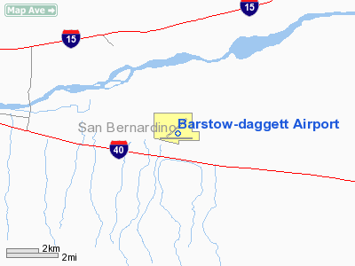
Location
& QuickFacts
|
FAA
Information Effective: |
2006-06-08 |
|
Airport
Identifier: |
DAG |
|
Longitude/Latitude: |
116-47-12.0750W/34-51-13.3680N
-116.786687/34.853713 (Estimated) |
|
Elevation: |
1927 ft / 587.35 m (Surveyed) |
|
Land: |
1087 acres |
|
From
nearest city: |
4 nautical miles E of Daggett, CA |
|
Location: |
San Bernardino County, CA |
|
Magnetic Variation: |
15E (1975) |
Owner
& Manager
|
Ownership: |
Publicly owned |
|
Owner: |
County Of San Bernardino |
|
Address: |
825 E. Third St.
San Bernardino, CA 92415 |
|
Phone
number: |
909-387-2877 |
|
Manager: |
Terry Stover |
|
Address: |
21600 Corwin Road
Apple Valley, CA 92307 |
|
Phone number: |
760-247-2371
ALSO PHONE 760-254-2422. |
Airport
Operations and Facilities
|
Airport
Use: |
Open to public |
|
Wind
indicator: |
Yes |
|
Segmented
Circle: |
Yes |
|
Control
Tower: |
No |
|
Attendance
Schedule: |
ALL/ALL/0630-1700 |
|
Lighting
Schedule: |
DUSK-DAWN
ACTVT MIRL RY 8/26 AND RY 4/22 - CTAF. VASI
RY 22 OPER CONT. |
|
Beacon
Color: |
Clear-Green (lighted land airport) |
|
Landing
fee charge: |
No |
|
Sectional
chart: |
Los Angeles |
|
Region: |
AWP - Western-Pacific |
|
Traffic
Pattern Alt: |
1000 ft |
|
Boundary
ARTCC: |
ZLA - Los Angeles |
|
Tie-in
FSS: |
RAL - Riverside |
|
FSS
on Airport: |
No |
|
FSS
Phone: |
951-351-3020 |
|
FSS
Toll Free: |
1-800-WX-BRIEF |
|
NOTAMs
Facility: |
DAG (NOTAM-d service avaliable) |
|
Federal Agreements: |
NP3 |
Airport
Communications
|
CTAF: |
123.000 |
|
Unicom: |
123.000 |
Airport
Services
|
Fuel
available: |
100LLA |
|
Bottled
Oxygen: |
NONE |
|
Bulk
Oxygen: |
NONE |
|
Runway Information
Runway 04/22
|
Dimension: |
5119 x 100 ft / 1560.3 x 30.5 m |
|
Surface: |
ASPH, Good Condition |
|
Weight
Limit: |
Single wheel: 30000 lbs.
Dual wheel: 105000 lbs.
Dual
tandem wheel: 190000 lbs. |
|
Edge
Lights: |
Medium |
|
|
Runway 04 |
Runway 22 |
|
Longitude: |
116-47-33.6170W |
116-46-46.2150W |
|
Latitude: |
34-51-07.3210N |
34-51-39.5190N |
|
Elevation: |
1920.00 ft |
1906.00 ft |
|
Alignment: |
51 |
127 |
|
Traffic
Pattern: |
Left |
Left |
|
Markings: |
Basic, Good Condition |
Non-precision instrument, Good Condition |
|
Crossing
Height: |
0.00 ft |
40.00 ft |
|
VASI: |
|
4-box on right side |
|
Visual
Glide Angle: |
0.00� |
3.00� |
|
Runway
End Identifier: |
No |
No |
|
Centerline
Lights: |
No |
No |
|
Touchdown
Lights: |
No |
No |
|
Obstruction: |
75 ft pline, 2625.0 ft from runway, 300 ft
left of centerline, 32:1 slope to clear |
, 50:1 slope to clear
BERM & BRUSH 55 FT RIGHT, 6 FT HIGH, 70 FT FROM RY END. |
|
Runway 08/26
|
Dimension: |
6400 x 150 ft / 1950.7 x 45.7 m |
|
Surface: |
ASPH, Good Condition |
|
Weight
Limit: |
Single wheel: 30000 lbs.
Dual wheel: 170000 lbs.
Dual
tandem wheel: 320000 lbs. |
|
Edge
Lights: |
Medium |
|
|
Runway 08 |
Runway 26 |
|
Longitude: |
116-47-52.1920W |
116-46-35.4060W |
|
Latitude: |
34-51-05.3470N |
34-51-05.3040N |
|
Elevation: |
1927.00 ft |
1906.00 ft |
|
Alignment: |
90 |
127 |
|
Traffic
Pattern: |
Left |
Left |
|
Markings: |
Basic, Good Condition |
Basic, Good Condition |
|
Runway
End Identifier: |
No |
No |
|
Centerline
Lights: |
No |
No |
|
Touchdown
Lights: |
No |
No |
|
Radio Navigation
Aids
|
ID |
Type |
Name |
Ch |
Freq |
Var |
Dist |
|
NXP |
TACAN |
Coyote |
063X |
|
14E |
45.7 nm |
|
VCV |
VOR/DME |
Victorville |
031X |
109.40 |
14E |
33.6 nm |
|
DAG |
VORTAC |
Daggett |
079X |
113.20 |
15E |
12.2 nm |
|
HEC |
VORTAC |
Hector |
074X |
112.70 |
15E |
16.3 nm |
|
EDW |
VORTAC |
Edwards |
111X |
116.40 |
15E |
47.3 nm |
Remarks
- E-W
TWY PARALLEL TO RWY 08/26 WT BRG CPTY LIMITED TO S-12.
- PAEW
INVOF ARMY RAMP. EXTSV MILITARY HELICOPTER TRAFFIC INVOF ARPT.
Based Aircraft
|
Aircraft
based on field: |
97 |
|
Single
Engine Airplanes: |
57 |
|
Multi
Engine Airplanes: |
1 |
|
Helicopters: |
1 |
|
Military: |
35 |
|
Ultralights: |
3 |
Operational Statistics
|
Aircraft
Operations: |
100/Day |
|
General
Aviation Local: |
17.3% |
|
General
Aviation Itinerant: |
33.4% |
|
Military: |
49.3% |
Barstow-daggett Airport
Address:
San Bernardino County, CA
Tel:
909-387-2877,
760-247-2371
Images
and information placed above are from
http://www.airport-data.com/airport/DAG/
We
thank them for the data!
| General
Info |
| Country |
United
States |
| State |
CALIFORNIA
|
| FAA ID |
DAG
|
| Latitude |
34-51-13.368N
|
| Longitude |
116-47-12.075W
|
| Elevation |
1927 feet
|
| Near City |
DAGGETT
|
We don't guarantee the information is fresh and accurate. The data may
be wrong or outdated.
For more up-to-date information please refer to other sources.
|
|


