 |
|
Location
& QuickFacts
|
FAA
Information Effective: |
2006-06-08 |
|
Airport
Identifier: |
76CA |
|
Longitude/Latitude: |
120-05-03.6690W/38-08-39.7070N
-120.084352/38.144363 (Estimated) |
|
Elevation: |
5760 ft / 1755.65 m (Estimated) |
|
Land: |
0 acres |
|
From
nearest city: |
4 nautical miles NE of Long Barn, CA |
|
Location: |
Tuolumne County, CA |
|
Magnetic Variation: |
16E (1985) |
Owner
& Manager
|
Ownership: |
Publicly owned |
|
Owner: |
Usda Forest Service |
|
Address: |
19777 Greenley Rd
Sonora, CA 95372 |
|
Phone number: |
209-532-3671 |
|
Manager: |
Forest Supervisor |
|
Address: |
19777 Greenley Rd
Sonora, CA 95372 |
|
Phone number: |
209-532-3671 |
Airport
Operations and Facilities
|
Airport
Use: |
Private |
|
Wind
indicator: |
Yes |
|
Segmented
Circle: |
No |
|
Control
Tower: |
No |
|
Attendance
Schedule: |
JUN-OCT/ALL/0900-1800 |
|
Landing
fee charge: |
No |
|
Sectional
chart: |
San Francisco |
|
Region: |
AWP - Western-Pacific |
|
Boundary
ARTCC: |
ZOA - Oakland |
|
Tie-in
FSS: |
RIU - Rancho Murieta |
|
FSS
on Airport: |
No |
|
FSS
Phone: |
916-354-0161 |
|
FSS
Toll Free: |
1-800-WX-BRIEF |
|
Runway Information
Helipad H1
|
Dimension: |
200 x 50 ft / 61.0 x 15.2 m |
|
Surface: |
ASPH, |
|
|
Runway H1 |
Runway |
|
Traffic
Pattern: |
Left |
Left |
|
Radio Navigation
Aids
|
ID |
Type |
Name |
Ch |
Freq |
Var |
Dist |
|
HNW |
VOR/DME |
Hangtown |
102X |
115.50 |
17E |
46.9 nm |
|
LIN |
VORTAC |
Linden |
095X |
114.80 |
17E |
43.7 nm |
Remarks
Based Aircraft
|
Aircraft
based on field: |
1 |
|
Helicopters: |
1 |
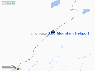
Bald Mountain Heliport
Address:
Tuolumne County, CA
Tel:
209-532-3671
Images
and information placed above are from
http://www.airport-data.com/airport/76CA/
We
thank them for the data!
| General
Info |
| Country |
United
States |
| State |
CALIFORNIA
|
| FAA ID |
76CA
|
| Latitude |
38-08-39.707N
|
| Longitude |
120-05-03.669W
|
| Elevation |
5760 feet
|
| Near City |
LONG BARN
|
We don't guarantee the information is fresh and accurate. The data may
be wrong or outdated.
For more up-to-date information please refer to other sources.
|
|


