 |
|
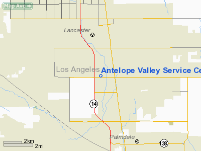
Antelope Valley Service Center Heliport |
Location
& QuickFacts
|
FAA
Information Effective: |
2006-06-08 |
|
Airport
Identifier: |
CL40 |
|
Longitude/Latitude: |
118-08-44.2620W/34-38-50.9530N
-118.145628/34.647487 (Estimated) |
|
Elevation: |
2522 ft / 768.71 m (Estimated) |
|
Land: |
0 acres |
|
From
nearest city: |
0 nautical miles N of Lancaster, CA |
|
Location: |
Los Angeles County, CA |
|
Magnetic Variation: |
14E (1985) |
Owner
& Manager
|
Ownership: |
Privately owned |
|
Owner: |
Southern California Edison Co |
|
Address: |
42062 Tenth St West
Lancaster, CA 93539 |
|
Phone
number: |
661-726-5649 |
|
Manager: |
Art Bradbury |
|
Address: |
2161 East Avion St
Ontario, CA 91761 |
|
Phone number: |
909-974-4691 |
Airport
Operations and Facilities
|
Airport
Use: |
Private |
|
Wind
indicator: |
Yes |
|
Segmented
Circle: |
No |
|
Control
Tower: |
No |
|
Attendance
Schedule: |
UNATNDD |
|
Sectional
chart: |
Los Angeles |
|
Region: |
AWP - Western-Pacific |
|
Boundary
ARTCC: |
ZLA - Los Angeles |
|
Tie-in
FSS: |
RAL - Riverside |
|
FSS
Phone: |
951-351-3020 |
|
FSS
Toll Free: |
1-800-WX-BRIEF |
|
Runway Information
Helipad H1
|
Dimension: |
20 x 20 ft / 6.1 x 6.1 m |
|
Surface: |
ASPH, |
|
|
Runway H1 |
Runway |
|
Traffic
Pattern: |
Left |
Left |
|
Radio Navigation
Aids
|
ID |
Type |
Name |
Ch |
Freq |
Var |
Dist |
|
GWF |
NDB |
Gen William J Fox |
|
282.00 |
15E |
6.5 nm |
|
PAI |
NDB |
Pacoima |
|
370.00 |
15E |
26.8 nm |
|
EMT |
NDB |
El Monte |
|
359.00 |
15E |
34.1 nm |
|
CPM |
NDB |
Compton |
|
378.00 |
15E |
45.9 nm |
|
VNY |
VOR/DME |
Van Nuys |
078X |
113.10 |
15E |
30.7 nm |
|
VCV |
VOR/DME |
Victorville |
031X |
109.40 |
14E |
37.5 nm |
|
SMO |
VOR/DME |
Santa Monica |
045X |
110.80 |
15E |
41.3 nm |
|
PMD |
VORTAC |
Palmdale |
092X |
114.50 |
15E |
4.2 nm |
|
LHS |
VORTAC |
Lake Hughes |
021X |
108.40 |
15E |
21.4 nm |
|
EDW |
VORTAC |
Edwards |
111X |
116.40 |
15E |
28.6 nm |
|
GMN |
VORTAC |
Gorman |
108X |
116.10 |
16E |
36.6 nm |
|
POM |
VORTAC |
Pomona |
041X |
110.40 |
15E |
38.6 nm |
|
FIM |
VORTAC |
Fillmore |
072X |
112.50 |
15E |
40.4 nm |
|
LAX |
VORTAC |
Los Angeles |
083X |
113.60 |
15E |
45.2 nm |
Remarks
Antelope Valley Service Center Heliport
Address:
Los Angeles County, CA
Tel:
661-726-5649,
909-974-4691
Images
and information placed above are from
http://www.airport-data.com/airport/CL40/
We
thank them for the data!
| General
Info |
| Country |
United
States |
| State |
CALIFORNIA
|
| FAA ID |
CL40
|
| Latitude |
34-38-50.953N
|
| Longitude |
118-08-44.262W
|
| Elevation |
2522 feet
|
| Near City |
LANCASTER
|
We don't guarantee the information is fresh and accurate. The data may
be wrong or outdated.
For more up-to-date information please refer to other sources.
|
|


