 |
|
|
|
|
|
Location
& QuickFacts
|
FAA
Information Effective: |
2006-06-08 |
|
Airport
Identifier: |
CA65 |
|
Longitude/Latitude: |
121-51-43.8380W/36-58-13.8240N
-121.862177/36.970507 (Estimated) |
|
Elevation: |
480 ft / 146.30 m (Estimated) |
|
Land: |
0 acres |
|
From
nearest city: |
5 nautical miles NW of Watsonville, CA |
|
Location: |
Santa Cruz County, CA |
|
Magnetic Variation: |
16E (1985) |
Owner
& Manager
|
Ownership: |
Privately owned |
|
Owner: |
Michael J. Ryan |
|
Address: |
2666 Hwy 1
Watsonville, CA 95076 |
|
Phone
number: |
408-688-5055 |
|
Manager: |
Michael J. Ryan |
|
Address: |
P.o. Box 2266
Aptos, CA 95001 |
|
Phone number: |
408-688-5055 |
Airport
Operations and Facilities
|
Airport Use: |
Private |
|
Wind indicator: |
Yes |
|
Segmented Circle: |
Yes |
|
Control Tower: |
No |
|
Attendance Schedule: |
ALL/ALL/DAWN-DUSK |
|
Landing fee charge: |
No |
|
Sectional chart: |
San Francisco |
|
Region: |
AWP - Western-Pacific |
|
Boundary ARTCC: |
ZOA - Oakland |
|
Tie-in FSS: |
OAK - Oakland |
|
FSS on Airport: |
No |
|
FSS Phone: |
510-273-6111 |
|
FSS Toll Free: |
1-800-WX-BRIEF |
Airport
Services
|
Airframe
Repair: |
NONE |
|
Power
Plant Repair: |
NONE |
|
Runway Information
Helipad H1
|
Dimension: |
100 x 100 ft / 30.5 x 30.5 m |
|
Surface: |
ASPH, |
|
|
Runway H1 |
Runway |
|
Traffic
Pattern: |
Left |
Left |
|
Radio Navigation
Aids
|
ID |
Type |
Name |
Ch |
Freq |
Var |
Dist |
|
PDG |
NDB |
Pajar |
|
327.00 |
17E |
4.3 nm |
|
UAD |
NDB |
Chualar |
|
263.00 |
16E |
34.3 nm |
|
LV |
NDB |
Reiga |
|
374.00 |
16E |
44.2 nm |
|
TCY |
NDB |
Tracy |
|
203.00 |
15E |
47.8 nm |
|
NUQ |
TACAN |
Moffett |
123X |
|
17E |
29.3 nm |
|
SJC |
VOR/DME |
San Jose |
088X |
114.10 |
16E |
24.6 nm |
|
SFO |
VOR/DME |
San Francisco |
105X |
115.80 |
17E |
46.0 nm |
|
SNS |
VORTAC |
Salinas |
120X |
117.30 |
17E |
22.3 nm |
|
OSI |
VORTAC |
Woodside |
086X |
113.90 |
17E |
32.3 nm |
|
OAK |
VORTAC |
Oakland |
115X |
116.80 |
17E |
48.6 nm |
|
BSR |
VORTAC |
Big Sur |
087X |
114.00 |
16E |
48.6 nm |
|
SFO |
VOT |
San Francisco Intl |
|
111.00 |
|
46.1 nm |
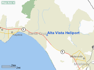
Alta Vista Heliport
Address:
Santa Cruz County, CA
Tel:
408-688-5055
Images
and information placed above are from
http://www.airport-data.com/airport/CA65/
We
thank them for the data!
| General
Info |
| Country |
United
States |
| State |
CALIFORNIA
|
| FAA ID |
CA65
|
| Latitude |
36-58-13.824N
|
| Longitude |
121-51-43.838W
|
| Elevation |
480 feet
|
| Near City |
WATSONVILLE
|
We don't guarantee the information is fresh and accurate. The data may
be wrong or outdated.
For more up-to-date information please refer to other sources.
|
|


