 |
|
| Alpine County Airport |
| IATA: none – ICAO: none – FAA LID: M45 |
| Summary |
| Airport type |
Public |
| Owner |
Alpine County |
| Serves |
Markleeville, California |
| Elevation AMSL |
5,867 ft / 1,788 m |
| Coordinates |
38°44′05″N 119°46′01″W / 38.73472°N 119.76694°W / 38.73472; -119.76694 |
| Runways |
| Direction |
Length |
Surface |
| ft |
m |
| 17/35 |
4,443 |
1,354 |
Asphalt |
| Statistics (2007) |
| Aircraft operations |
650 |
| Source: Federal Aviation Administration |
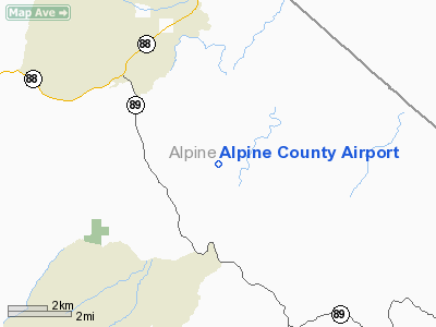
Alpine County Airport (FAA LID: M45) is a county-owned public-use airport located three nautical miles (6 km) north of the central business district of Markleeville, in Alpine County, California, United States.
It is in the eastern Sierra Nevada range and serves as a general aviation airport. The airport has a single runway, with an apron to park small light aircraft. The airport has no buildings, no lights and is rarely used, averaging only 54 aircraft movements per month
Facilities and aircraft
Alpine County Airport covers an area of 300 acres (121 ha) at an elevation of 5,867 feet (1,788 m) above mean sea level. It has one asphalt paved runway, designated 17/35, which measures 4,443 by 50 feet (1,354 x 15 m). For the 12-month period ending August 15, 2007, the airport had 650 aircraft operations, an average of 54 per month, all of which were general aviation.
The airport is closed during snow, due to no snow removal. Runway 17/35 is limited to 4800 lb single wheel and 9600 lb dual wheel aircraft
The above content comes from Wikipedia and is published under free licenses – click here to read more.
Location
& QuickFacts
|
FAA
Information Effective: |
2006-06-08 |
|
Airport
Identifier: |
M45 |
|
Longitude/Latitude: |
119-46-01.4000W/38-44-05.1000N
-119.767056/38.734750 (Estimated) |
|
Elevation: |
5867 ft / 1788.26 m (Estimated) |
|
Land: |
300 acres |
|
From
nearest city: |
3 nautical miles N of Markleeville, CA |
|
Location: |
Alpine County, CA |
|
Magnetic Variation: |
16E (1985) |
Owner
& Manager
|
Ownership: |
Publicly owned |
|
Owner: |
Alpine County |
|
Address: |
50 Diamond Valley Rd
Markleeville, CA 96120 |
|
Phone
number: |
530-694-2140 |
|
Manager: |
Leonard R.turnbeaugh
TRANSPORTATION DIRECTOR. |
|
Address: |
50 Diamond Valley Rd
Markleeville, CA 96120 |
|
Phone number: |
530-694-2140 |
Airport
Operations and Facilities
|
Airport
Use: |
Open to public |
|
Wind
indicator: |
Yes |
|
Segmented
Circle: |
Yes
SEGMENTED CIRCLE LOCATED WITHIN RUNWAY OBJECT FREE AREA |
|
Control
Tower: |
No |
|
Attendance
Schedule: |
UNATNDD |
|
Landing
fee charge: |
No |
|
Sectional
chart: |
San Francisco |
|
Region: |
AWP - Western-Pacific |
|
Traffic
Pattern Alt: |
800 ft |
|
Boundary
ARTCC: |
ZOA - Oakland |
|
Tie-in
FSS: |
RNO - Reno |
|
FSS
on Airport: |
No |
|
FSS
Phone: |
775-858-1300 |
|
FSS
Toll Free: |
1-800-WX-BRIEF |
|
NOTAMs
Facility: |
RNO (NOTAM-d service avaliable) |
|
Federal Agreements: |
GSY |
Airport
Communications
Airport
Services
|
Airframe
Repair: |
NONE |
|
Power
Plant Repair: |
NONE |
|
Bottled
Oxygen: |
NONE |
|
Bulk
Oxygen: |
NONE |
|
Runway Information
Runway 17/35
|
Dimension: |
4443 x 50 ft / 1354.2 x 15.2 m |
|
Surface: |
ASPH, Fair Condition |
|
Weight
Limit: |
Single wheel: 12000 lbs. |
|
|
Runway 17 |
Runway 35 |
|
Longitude: |
119-45-59.5314W |
119-46-03.1882W |
|
Latitude: |
38-44-27.0296N |
38-43-43.2224N |
|
Elevation: |
5827.00 ft |
5872.00 ft |
|
Alignment: |
127 |
4 |
|
Traffic
Pattern: |
Left |
Right |
|
Markings: |
Basic, Fair Condition |
Basic, Fair Condition |
|
Runway
End Identifier: |
No |
No |
|
Centerline
Lights: |
No |
No |
|
Touchdown
Lights: |
No |
No |
|
Obstruction: |
150 ft hill, 3200.0 ft from runway, 425 ft
left of centerline, 20:1 slope to clear |
, 50:1 slope to clear
+10' TREES 40' FM THR 100' L; +6' TREES 30' FM THR 75' R. |
|
Radio Navigation
Aids
|
ID |
Type |
Name |
Ch |
Freq |
Var |
Dist |
|
SWR |
VOR/DME |
Squaw Valley |
079X |
113.20 |
16E |
35.6 nm |
|
HNW |
VOR/DME |
Hangtown |
102X |
115.50 |
17E |
46.1 nm |
|
FMG |
VORTAC |
Mustang |
126X |
117.90 |
16E |
48.2 nm |
Remarks
- LARGE
STONES ALONG EDGE OF RWY OFF GRADED SFC.
- NO
SNOW REMOVAL, ARPT CLOSED WHEN SNOW ON RUNWAY.
- TREES
PENETRATING TRANSITIONAL SFCS E & W OF RY.
Operational Statistics
|
Aircraft
Operations: |
13/Week |
|
General
Aviation Itinerant: |
100.0% |
Alpine County Airport
Address:
Alpine County, CA
Tel:
530-694-2140
Images
and information placed above are from
http://www.airport-data.com/airport/M45/
We
thank them for the data!
| General
Info |
| Country |
United
States |
| State |
CALIFORNIA
|
| FAA ID |
M45
|
| Latitude |
38.734750
38� 44' 05.10" N |
| Longitude |
-119.767056
119� 46' 01.40" W |
| Elevation |
5867 feet
1788 meters |
| Magnetic
Variation |
014� E
(01/06) |
| Operating
Agency |
U.S.CIVIL
AIRPORT WHEREIN PERMIT COVERS USE BY TRANSIT MILITARY AIRCRAFT
|
| Daylight
Savings Time |
First
Sunday in April at 0200 to last Sunday in October at 0200 local time
(Exception Arizona and that portion of Indiana in the Eastern Time
Zone) |
We don't guarantee the information is fresh and accurate. The data may
be wrong or outdated.
For more up-to-date information please refer to other sources.
|
|


