 |
|
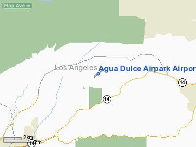
Agua Dulce Airpark Airport |
| Agua Dulce Airpark |
| IATA: none – ICAO: none – FAA LID: L70 |
| Summary |
| Airport type |
Public |
| Owner |
Wayne & Connie Spears |
| Location |
Agua Dulce, California |
| Elevation AMSL |
2,660 ft / 811 m |
| Coordinates |
34°30′09″N 118°18′53″W / 34.5025°N 118.31472°W / 34.5025; -118.31472 |
| Website |
www.L70airport.com |
| Runways |
| Direction |
Length |
Surface |
| ft |
m |
| 4/22 |
4,600 |
1,402 |
Asphalt |
| Statistics (2006) |
| Aircraft operations |
2,880 |
| Source: FAA and airport website |
Agua Dulce Airpark (FAA LID: L70), also known as Agua Dulce Airport, is a public-use airport located 2 miles (3.2 km) east of the central business district of Agua Dulce, in Los Angeles County, California, United States.
The airport was built in 1958 by Jim Annin and two partners. In the 1990s, local residents fought an attempt by Los Angeles County to buy the airpark and convert it to a regional airport. In October 2005, former airport owner Barry Kirschner sold the property to Wayne and Connie Spears, owners of Spears Manufacturing and Spears Motorsports. Facilities and aircraft
Agua Dulce Airpark covers an area of 190 acres (77 ha) which contains one asphalt paved runway (4/22) measuring 4,600 x 50 ft (1,402 x 15 m). For the 12-month period ending May 15, 2006, the airport had 2,880 aircraft operations: 62% transient general aviation and 38% local general aviation.
Filming location
The airport has been used as a filming location for projects including:
- The 1983 video for the "Weird Al" Yankovic song, "I Love Rocky Road", was filmed at this airport.
- The Macgyver tv series used the airport as the "Sparrow Ridge Airport", Arizona, in Season 1, episode 6, "Last Stand" (1985).
- For the 1997 film, Fire Down Below, a gas station/minimart set was built on the runway.
- The 2000 film, Space Cowboys, used this location as the fictional Bonneville Pass Airport.
- The "Roswell" TV series used this in at least five episodes, over three seasons (1999-2002): The gas station and the Cafe exterior in season 1, the airport as a background and the interior of the Cafe in season 2, the hill that faces the runway in season 3. Also, the view in the distance is used as a distant shot of the town of "Roswell" in promotional materials.
The above content comes from Wikipedia and is published under free licenses – click here to read more.
Location
& QuickFacts
|
FAA
Information Effective: |
2006-06-08 |
|
Airport
Identifier: |
L70 |
|
Longitude/Latitude: |
118-18-52.7200W/34-30-09.2500N
-118.314644/34.502569 (Estimated) |
|
Elevation: |
2660 ft / 810.77 m (Estimated) |
|
Land: |
190 acres |
|
From
nearest city: |
2 nautical miles E of Agua Dulce, CA |
|
Location: |
Los Angeles County, CA |
|
Magnetic Variation: |
14E (1985) |
Owner
& Manager
|
Ownership: |
Privately owned |
|
Owner: |
Land Sea Leasing Corporation |
|
Address: |
33638 Agua Dulce Canyon Road
Agua Dulce, CA 91390 |
|
Phone
number: |
818-364-1611 |
|
Manager: |
Kenneth E. Ruggles
BARRY KIRSHNER - EXT 106 |
|
Address: |
15853 Olden Street, P. O. Box 9203
Sylmar, CA 91392 |
|
Phone number: |
661-268-8835 |
Airport
Operations and Facilities
|
Airport
Use: |
Open to public |
|
Wind
indicator: |
Yes |
|
Segmented
Circle: |
Yes |
|
Control
Tower: |
No |
|
Attendance
Schedule: |
ALL/ALL/0800-1800
AIRPORT UNATNDD CHRISTMAS DAY; THANKSGIVING DAY AND NEW
YEARS DAY. |
|
Landing
fee charge: |
No |
|
Sectional
chart: |
Los Angeles |
|
Region: |
AWP - Western-Pacific |
|
Traffic
Pattern Alt: |
800 ft |
|
Boundary
ARTCC: |
ZLA - Los Angeles |
|
Tie-in
FSS: |
RAL - Riverside |
|
FSS
on Airport: |
No |
|
FSS
Phone: |
951-351-3020 |
|
FSS
Toll Free: |
1-800-WX-BRIEF |
|
NOTAMs
Facility: |
RAL (NOTAM-d service avaliable) |
|
Federal Agreements: |
N |
Airport
Communications
Airport
Services
|
Fuel
available: |
100LLA
SELF SERVICE |
|
Bottled
Oxygen: |
NONE |
|
Bulk
Oxygen: |
NONE |
|
Runway Information
Runway 04/22
|
Dimension: |
4600 x 50 ft / 1402.1 x 15.2 m |
|
Surface: |
ASPH, Good Condition |
|
|
Runway 04 |
Runway 22 |
|
Longitude: |
118-19-09.2900W |
118-18-24.6200W |
|
Latitude: |
34-29-58.9300N |
34-30-26.7400N |
|
Elevation: |
2640.00 ft |
2552.00 ft |
|
Traffic
Pattern: |
Left |
Right |
|
Markings: |
Basic, Good Condition |
Basic, Good Condition |
|
Displaced
threshold: |
580.00 ft |
838.00 ft |
|
Runway
End Identifier: |
No |
No |
|
Centerline
Lights: |
No |
No |
|
Touchdown
Lights: |
No |
No |
|
Obstruction: |
15 ft bldg, 240.0 ft from runway, 85 ft right
of centerline, 2:1 slope to clear
RWY 04 APCH RATIO TO DSPLCD THLD 20:1 (DSPLCD THLD IS 5 FT
HIGHER THAN EOR); APCH RATIO TO DSPLCD THLD OVER +15 FT HILL
300 FT FM DSPLCD THLD 150 FT RIGHTR 20:1.
RWY 04 +15 FT HANGER 140-160 FT FM EOR 80 FT RIGHT. |
4 ft fence, 200.0 ft from runway, 35 ft right
of centerline
APCH RATIO TO DSPLCD THR 50:1; APCH RATIO TO DSPLCD THR OVER
+300 FT HILL 4700 FT FROM DSPLCD THR 0FT LEFT AND RIGHT 15:1.
+4 FT FENCE 0 FT - 200 FT FROM EOR DIAGONALLY FROM 50 FT LEFT
TO 35 FT RIGHT. |
|
Radio Navigation
Aids
|
ID |
Type |
Name |
Ch |
Freq |
Var |
Dist |
|
GWF |
NDB |
Gen William J Fox |
|
282.00 |
15E |
15.0 nm |
|
PAI |
NDB |
Pacoima |
|
370.00 |
15E |
15.4 nm |
|
EMT |
NDB |
El Monte |
|
359.00 |
15E |
28.6 nm |
|
CPM |
NDB |
Compton |
|
378.00 |
15E |
37.0 nm |
|
NTD |
TACAN |
Point Mugu |
043X |
|
15E |
46.1 nm |
|
VNY |
VOR/DME |
Van Nuys |
078X |
113.10 |
15E |
18.9 nm |
|
SMO |
VOR/DME |
Santa Monica |
045X |
110.80 |
15E |
30.4 nm |
|
CMA |
VOR/DME |
Camarillo |
105X |
115.80 |
15E |
42.4 nm |
|
VTU |
VOR/DME |
Ventura |
019X |
108.20 |
15E |
43.3 nm |
|
VCV |
VOR/DME |
Victorville |
031X |
109.40 |
14E |
46.1 nm |
|
PMD |
VORTAC |
Palmdale |
092X |
114.50 |
15E |
14.6 nm |
|
LHS |
VORTAC |
Lake Hughes |
021X |
108.40 |
15E |
16.9 nm |
|
FIM |
VORTAC |
Fillmore |
072X |
112.50 |
15E |
29.4 nm |
|
GMN |
VORTAC |
Gorman |
108X |
116.10 |
16E |
32.5 nm |
|
LAX |
VORTAC |
Los Angeles |
083X |
113.60 |
15E |
34.7 nm |
|
POM |
VORTAC |
Pomona |
041X |
110.40 |
15E |
36.6 nm |
|
EDW |
VORTAC |
Edwards |
111X |
116.40 |
15E |
40.7 nm |
|
SLI |
VORTAC |
Seal Beach |
104X |
115.70 |
15E |
45.1 nm |
|
LAX |
VOT |
San Pedro Hill |
|
113.90 |
|
45.5 nm |
Remarks
- RIDGE
SOUTH OF AIRPORT PARALLEL TO RY VIOLATES 7:1 TRANSITIONAL SURFACE.
- FORMATION
ARRIVALS AND DEPARTURES PROHIBITED.
- 10-25
FT WIDE DITCH AT 170 FT ALONG SE EDGE OF RY.
- NO
NIGHT OPNS PERMITTED.
- TGL
NOT PERMITTED.
- ULTRALIGHTS
PROHIBITED
- AVOID
FLYING WITHIN 1000 FT OF SCHOOL APRXLY ONE MILE SOUTHWEST. RY 04 DEP
AVOID FLYING OVER HOMES 2,000 FT NE OF RY END.
Based Aircraft
|
Aircraft
based on field: |
32 |
|
Single
Engine Airplanes: |
29 |
|
Multi
Engine Airplanes: |
2 |
|
Helicopters: |
1 |
Operational Statistics
|
Aircraft
Operations: |
56/Week |
|
General
Aviation Local: |
37.5% |
|
General
Aviation Itinerant: |
62.5% |
Agua Dulce Airpark Airport
Address:
Los Angeles County, CA
Tel:
818-364-1611,
661-268-8835
Images
and information placed above are from
http://www.airport-data.com/airport/L70/
We
thank them for the data!
| General
Info |
| Country |
United
States |
| State |
CALIFORNIA
|
| FAA ID |
L70
|
| Latitude |
34-30-14.972N
|
| Longitude |
118-18-46.282W
|
| Elevation |
2660 feet
|
| Near City |
AGUA DULCE
|
We don't guarantee the information is fresh and accurate. The data may be wrong or outdated.
For more up-to-date information please refer to other sources.
|
|


