 |
|
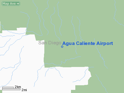
| Agua Caliente Airport |
| IATA: none – ICAO: none – FAA LID: L54 |
| Summary |
| Airport type |
Public |
| Owner/Operator |
County of San Diego |
| Serves |
Agua Caliente Springs, California |
| Elevation AMSL |
1,220 ft / 372 m |
| Coordinates |
32°57′22″N 116°17′44″W / 32.95611°N 116.29556°W / 32.95611; -116.29556 |
| Website |
co.san-diego.ca.us/... |
| Runways |
| Direction |
Length |
Surface |
| ft |
m |
| 11/29 |
2,500 |
762 |
Asphalt |
| Source: Federal Aviation Administration |
Agua Caliente Airport (FAA LID: L54), also known as Agua Caliente Airstrip, is a public airport located 1 nautical mile (1.85 km) northeast of Agua Caliente Springs, serving San Diego County, California, USA. This general aviation airport covers 160 acres (650,000 m) and has one runway. Agua Caliente translates to "Hot Water" from Spanish.
Uses
There is an overage of one operation per day here. That one operation per day is a general aviation transient. There is one aircraft based here.
The above content comes from Wikipedia and is published under free licenses – click here to read more.
Location
& QuickFacts
|
FAA
Information Effective: |
2006-06-08 |
|
Airport
Identifier: |
L54 |
|
Longitude/Latitude: |
116-17-36.0470W/32-57-00.1800N
-116.293346/32.950050 (Estimated) |
|
Elevation: |
1220 ft / 371.86 m (Estimated) |
|
Land: |
20 acres |
|
From
nearest city: |
1 nautical miles NE of Agua Caliente Springs,
CA |
|
Location: |
San Diego County, CA |
|
Magnetic Variation: |
13E (1985) |
Owner
& Manager
|
Ownership: |
Publicly owned |
|
Owner: |
County Of San Diego |
|
Address: |
1960 Joe Crosson Drive
El Cajon, CA 92020-1236 |
|
Phone
number: |
619-956-4800 |
|
Manager: |
Roger Griffiths |
|
Address: |
1960 Joe Crosson Drive
El Cajon, CA 92020-1236 |
|
Phone number: |
619-956-4805 |
Airport
Operations and Facilities
|
Airport
Use: |
Open to public |
|
Wind
indicator: |
Yes |
|
Segmented
Circle: |
Yes |
|
Control
Tower: |
No |
|
Attendance
Schedule: |
UNATNDD |
|
Landing
fee charge: |
No |
|
Sectional
chart: |
Los Angeles |
|
Region: |
AWP - Western-Pacific |
|
Traffic
Pattern Alt: |
800 ft |
|
Boundary
ARTCC: |
ZLA - Los Angeles |
|
Tie-in
FSS: |
SAN - San Diego |
|
FSS
on Airport: |
No |
|
FSS
Phone: |
858-277-7043 |
|
FSS
Toll Free: |
1-800-WX-BRIEF |
|
NOTAMs
Facility: |
SAN (NOTAM-d service avaliable) |
Airport
Communications
Airport
Services
|
Airframe
Repair: |
NONE |
|
Power
Plant Repair: |
NONE |
|
Bottled
Oxygen: |
NONE |
|
Bulk
Oxygen: |
NONE |
|
Runway Information
Runway 11/29
|
Dimension: |
2500 x 60 ft / 762.0 x 18.3 m |
|
Surface: |
ASPH, Good Condition |
|
Surface
Treatment: |
Aggregate Friction Seal Coat |
|
Weight
Limit: |
Single wheel: 12000 lbs. |
|
|
Runway 11 |
Runway 29 |
|
Traffic
Pattern: |
Left |
Right |
|
Markings: |
Basic, Good Condition |
Basic, Good Condition |
|
Runway
End Identifier: |
No |
No |
|
Centerline
Lights: |
No |
No |
|
Touchdown
Lights: |
No |
No |
|
Obstruction: |
460 ft hill, 2500.0 ft from runway, 5:1 slope
to clear
+3 FT BERM 60 FT L/R & 25 FT FM THLD. |
, 50:1 slope to clear |
|
Radio Navigation
Aids
|
ID |
Type |
Name |
Ch |
Freq |
Var |
Dist |
|
SAN |
FAN MARKER |
Encat |
|
|
15E |
42.8 nm |
|
UN |
NDB |
Tijuana |
|
381.00 |
14E |
45.0 nm |
|
NJK |
TACAN |
El Centro |
047X |
|
13E |
31.7 nm |
|
NKX |
TACAN |
Miramar |
033X |
|
15E |
43.7 nm |
|
NRS |
TACAN |
Imperial Beach |
029X |
|
14E |
47.3 nm |
|
NZY |
TACAN |
North Island |
117X |
|
14E |
48.9 nm |
|
NKX |
UHF/NDB |
Miramar |
|
352.00 |
15E |
43.0 nm |
|
TIJ |
VOR/DME |
Tijuana |
112X |
116.50 |
14E |
41.5 nm |
|
JLI |
VORTAC |
Julian |
087X |
114.00 |
15E |
18.7 nm |
|
PGY |
VORTAC |
Poggi |
035X |
109.80 |
14E |
40.2 nm |
|
TRM |
VORTAC |
Thermal |
109X |
116.20 |
13E |
41.3 nm |
|
IPL |
VORTAC |
Imperial |
106X |
115.90 |
14E |
41.4 nm |
|
MZB |
VORTAC |
Mission Bay |
125X |
117.80 |
15E |
48.1 nm |
|
SEE |
VOT |
Gillespie Field |
|
110.00 |
|
35.2 nm |
|
SAN |
VOT |
Mount Soledad |
|
109.00 |
|
48.9 nm |
Remarks
- HAZARDOUS
DURING RAINS OR FLASH FLOODS.
- OBSTRN
PART 77-MTNS S & W OF RWY, DIRT BERM, DITCH, SAND BOTH SIDES OF
RWY.
- ACFT
TIED DOWN WITHIN PRIMARY SFC.
- WIND
PERMITING USE OF RY 29 FOR LANDING AND RY 11 FOR DEPARTURE RECOMMENDED
DUE TO 460 FT HILL 1/2 MILE WEST OF AIRPORT.
- ESTABD
PRIOR TO 5/15/59.
Based Aircraft
|
Aircraft
based on field: |
1 |
|
Single
Engine Airplanes: |
1 |
Operational Statistics
|
Aircraft
Operations: |
13/Week |
|
General
Aviation Local: |
7.7% |
|
General
Aviation Itinerant: |
92.3% |
Agua Caliente Airport
Address:
San Diego County, CA
Tel:
619-956-4800,
619-956-4805
Images
and information placed above are from
http://www.airport-data.com/airport/L54/
We
thank them for the data!
| General
Info |
| Country |
United
States |
| State |
CALIFORNIA
|
| FAA ID |
L54
|
| Latitude |
32-57-00.180N
|
| Longitude |
116-17-36.047W
|
| Elevation |
1220 feet
|
| Near City |
AGUA CALIENTE
SPRINGS |
We don't guarantee the information is fresh and accurate. The data may be wrong or outdated.
For more up-to-date information please refer to other sources.
|
|


