 |
|
|
|
Location
& QuickFacts
|
FAA
Information Effective: |
2006-06-08 |
|
Airport
Identifier: |
CA54 |
|
Longitude/Latitude: |
121-19-39.7900W/37-40-13.7470N
-121.327719/37.670485 (Estimated) |
|
Elevation: |
81 ft / 24.69 m (Estimated) |
|
Land: |
0 acres |
|
From
nearest city: |
5 nautical miles SE of Tracy, CA |
|
Location: |
San Joaquin County, CA |
|
Magnetic Variation: |
16E (1985) |
Owner
& Manager
|
Ownership: |
Privately owned |
|
Owner: |
C M Trinkle |
|
Address: |
31244 S Hwy 33
Tracy, CA 95376 |
|
Phone number: |
209-835-2838 |
|
Manager: |
Dwayne Boys |
|
Address: |
31244 S. Highway 33
Tracy, CA 95376 |
|
Phone number: |
209-835-2838 |
Airport
Operations and Facilities
|
Airport Use: |
Private |
|
Wind indicator: |
Yes |
|
Segmented Circle: |
No |
|
Control Tower: |
No |
|
Attendance Schedule: |
ALL/ALL/DAWN-DUSK |
|
Landing fee charge: |
No |
|
Sectional chart: |
San Francisco |
|
Region: |
AWP - Western-Pacific |
|
Boundary ARTCC: |
ZOA - Oakland |
|
Tie-in FSS: |
RIU - Rancho Murieta |
|
FSS on Airport: |
No |
|
FSS Phone: |
916-354-0161 |
|
FSS Toll Free: |
1-800-WX-BRIEF |
Airport
Services
|
Airframe
Repair: |
NONE |
|
Power
Plant Repair: |
NONE |
|
Runway Information
Runway 09/27
|
Dimension: |
1600 x 30 ft / 487.7 x 9.1 m |
|
Surface: |
ASPH, |
|
|
Runway 09 |
Runway 27 |
|
Traffic
Pattern: |
Left |
Left |
|
Radio Navigation
Aids
|
ID |
Type |
Name |
Ch |
Freq |
Var |
Dist |
|
TCY |
NDB |
Tracy |
|
203.00 |
15E |
5.7 nm |
|
LV |
NDB |
Reiga |
|
374.00 |
16E |
17.0 nm |
|
NUQ |
TACAN |
Moffett |
123X |
|
17E |
37.6 nm |
|
SUU |
TACAN |
Travis |
113X |
|
17E |
45.3 nm |
|
TZZ |
VOR |
Travis |
|
116.40 |
17E |
46.5 nm |
|
MOD |
VOR/DME |
Modesto |
093X |
114.60 |
17E |
17.8 nm |
|
SJC |
VOR/DME |
San Jose |
088X |
114.10 |
16E |
34.4 nm |
|
CCR |
VOR/DME |
Concord |
117X |
117.00 |
17E |
40.8 nm |
|
SFO |
VOR/DME |
San Francisco |
105X |
115.80 |
17E |
49.9 nm |
|
ECA |
VORTAC |
Manteca |
107X |
116.00 |
17E |
12.3 nm |
|
LIN |
VORTAC |
Linden |
095X |
114.80 |
17E |
28.7 nm |
|
OAK |
VORTAC |
Oakland |
115X |
116.80 |
17E |
42.7 nm |
|
SAC |
VORTAC |
Sacramento |
099X |
115.20 |
17E |
47.7 nm |
|
OSI |
VORTAC |
Woodside |
086X |
113.90 |
17E |
48.4 nm |
|
SFO |
VOT |
San Francisco Intl |
|
111.00 |
|
50.0 nm |
Remarks
- FIRST
REPORTED 9 JAN 1963. ARPT 15 NM S OF FRESNO AIR TRML.
Based Aircraft
|
Aircraft
based on field: |
9 |
|
Single
Engine Airplanes: |
9 |
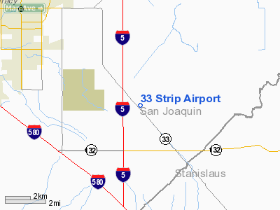
33 Strip Airport
Address:
San Joaquin County, CA
Tel:
209-835-2838
Images
and information placed above are from
http://www.airport-data.com/airport/CA54/
We
thank them for the data!
| General
Info |
| Country |
United
States |
| State |
CALIFORNIA
|
| FAA ID |
CA54
|
| Latitude |
37-40-13.747N
|
| Longitude |
121-19-39.790W
|
| Elevation |
81 feet
|
| Near City |
TRACY
|
We don't guarantee the information is fresh and accurate. The data may be wrong or outdated.
For more up-to-date information please refer to other sources.
|
|


