 |
|
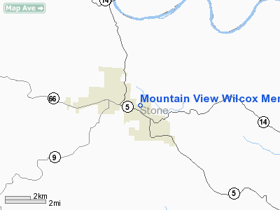
Mountain View Wilcox Memorial Field Airport |
Coordinates: 35°51′52″N 092°05′25″W / 35.86444°N 92.09028°W / 35.86444; -92.09028
Mountain View Airport
Harry E. Wilcox Memorial Field |
| IATA: none – ICAO: none – FAA LID: 7M2 |
| Summary |
| Airport type |
Public |
| Owner |
City of Mountain View |
| Serves |
Mountain View, Arkansas |
| Elevation AMSL |
805 ft / 245 m |
| Runways |
| Direction |
Length |
Surface |
| ft |
m |
| 9/27 |
4,502 |
1,372 |
Asphalt |
| Statistics (2005) |
| Aircraft operations |
11,000 |
| Source: Federal Aviation Administration |
Mountain View Airport (FAA LID: 7M2), also known as Harry E. Wilcox Memorial Field, is a public airport located two miles (3 km) east of the central business district of Mountain View, a city in Stone County, Arkansas, United States. It is owned by the City of Mountain View.
Facilities and aircraft
Mountain View Airport covers an area of 88 acres (36 ha) which contains one asphalt paved runway (9/27) measuring 4,502 x 70 ft (1,372 x 21 m). For the 12-month period ending January 31, 2005, the airport had 11,000 aircraft operations, an average of 30 per day: 95% general aviation and 5% military.
The above content comes from Wikipedia and is published under free licenses – click here to read more.
Location & QuickFacts
|
FAA Information Effective: |
2005-10-27 |
|
Airport Identifier: |
7M2 |
|
Longitude/Latitude: |
092-05-25.2190W/35-51-52.1290N
-92.090339/35.864480 (Estimated) |
|
Elevation: |
805
ft / 245.36 m (Estimated) |
|
Land: |
88 acres |
|
From nearest city: |
2
nautical miles E of Mountain View, AR |
|
Location: |
Stone County,
AR |
|
Magnetic Variation: |
02E
(2000) |
Owner & Manager
|
Ownership: |
Publicly
owned |
|
Owner: |
City
Of Mountain View |
|
Address: |
City
Hall
Mountain View, AR 72560 |
|
Phone number: |
870-269-3804 |
|
Manager: |
Victor
Setser |
|
Address: |
1501
Airport Drive
Mountain View, AR 72560 |
|
Phone number: |
870-269-3142 |
Airport Operations and Facilities
|
Airport Use: |
Open to
public |
|
Wind indicator: |
Yes |
|
Segmented Circle: |
No |
|
Control Tower: |
No |
|
Attendance Schedule: |
ALL/MON-FRI/0800-1700 |
|
Lighting Schedule: |
DUSK-DAWN |
|
Beacon Color: |
Clear-Green
(lighted land airport) |
|
Landing fee charge: |
No |
|
Sectional chart: |
Memphis |
|
Region: |
ASW
- Southwest |
|
Traffic Pattern Alt: |
1000 ft |
|
Boundary ARTCC: |
ZME
- Memphis |
|
Tie-in FSS: |
JBR - Jonesboro |
|
FSS on Airport: |
No |
|
FSS Phone: |
870-935-3471 |
|
FSS Toll Free: |
1-800-WX-BRIEF |
|
NOTAMs Facility: |
JBR
(NOTAM-d service avaliable) |
Airport
Communications
|
CTAF: |
122.700 |
|
Unicom: |
122.700 |
Airport
Services
|
Fuel available: |
100LL
SELF-SERVICE FUEL AVBL 24 HRS WITH CREDIT CARD. |
|
Airframe Repair: |
MAJOR |
|
Power Plant Repair: |
MAJOR |
Runway Information
Runway 09/27
|
Dimension: |
4502
x 70 ft / 1372.2 x 21.3 m |
|
Surface: |
ASPH,
Good Condition |
|
Edge Lights: |
Medium |
|
|
Runway 09 |
Runway 27 |
|
Longitude: |
092-05-52.5400W |
092-04-57.8960W |
|
Latitude: |
35-51-53.1200N |
35-51-51.1360N |
|
Elevation: |
804.00
ft |
780.00
ft |
|
Alignment: |
93 |
127 |
|
Traffic Pattern: |
Left |
Left |
|
Markings: |
Non-precision
instrument, Good Condition
RY 09/27 MARKINGS FADED. |
Non-precision
instrument, Good Condition |
|
Crossing Height: |
54.00
ft |
49.00
ft |
|
VASI: |
2-box on left
side |
2-box on left
side |
|
Visual Glide Angle: |
4.00° |
4.00° |
|
Obstruction: |
24
ft bldg, 520.0 ft from runway, 110 ft right of centerline,
13:1 slope to clear |
355
ft tower, 5280.0 ft from runway, 14:1 slope to clear |
|
Radio Navigation Aids
|
ID |
Type |
Name |
Ch |
Freq |
Var |
Dist |
|
VLX |
NDB |
Wilcox |
|
348.00 |
02E |
0.3 nm |
|
INY |
NDB |
Independence
County |
|
317.00 |
03E |
17.4
nm |
|
HBZ |
NDB |
Heber Springs |
|
256.00 |
03E |
21.4 nm |
|
AJX |
NDB |
Ash
Flat |
|
344.00 |
03E |
30.2
nm |
|
SRC |
NDB |
Searcy |
|
323.00 |
02E |
42.9 nm |
|
EWP |
NDB |
Newport |
|
400.00 |
04E |
46.3
nm |
|
CWS |
NDB |
Conway |
|
302.00 |
05E |
49.7 nm |
|
FLP |
VOR/DME |
Flippin |
075X |
112.80 |
03E |
31.7
nm |
Remarks
- PAY PHONE
AVBL 24 HRS.
- RY 27 HAS A 15 FT DROPOFF 400 FT FM THLD.
- PRE DATES
THE ACT.
Mountain View Wilcox Memorial Field Airport
Address: Stone County, AR
Tel: 870-269-3142
|
General Info |
| Country |
United
States |
| State |
ARKANSAS
|
| FAA
ID |
7M2
|
| Latitude |
35-51-52.266N
|
| Longitude |
092-05-31.545W
|
| Elevation |
802
feet |
| Near
City |
MOUNTAIN
VIEW |
We don't guarantee the information is fresh and accurate. The data may be wrong or outdated.
For more up-to-date information please refer to other sources.
|
|


