 |
|
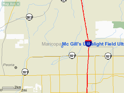
Mc Gill's Ultralight Field Ultralight |
|
|
Location
& QuickFacts
| FAA Information Effective: |
2005-10-27 |
| Airport Identifier: |
2AZ7 |
| Longitude/Latitude: |
112-09-49.5570W/33-41-03.1380N
-112.163766/33.684205 (Estimated) |
| Elevation: |
1360
ft / 414.53 m (Estimated) |
| Land: |
160
acres |
| From nearest city: |
0
nautical miles N of Phoenix, AZ |
| Location: |
Maricopa
County, AZ |
| Magnetic Variation: |
13E
(1985) |
Owner
& Manager
| Ownership: |
Privately
owned |
| Owner: |
Eaa
Chapter 55, Lite Flyers |
| Address: |
4631
W. Hubbell Street
Phoenix, AZ 85035 |
| Phone number: |
602-272-1238 |
| Manager: |
Robert
L. Samson, Pres. |
| Address: |
4631
W. Hubbell Street
Phoenix, AZ 85035 |
| Phone number: |
602-272-1238 |
Airport
Operations and Facilities
| Airport Use: |
Private |
| Wind indicator: |
Yes |
| Segmented Circle: |
No |
| Control Tower: |
No |
| Attendance Schedule: |
UNATNDD |
| Sectional chart: |
Phoenix |
| Region: |
AWP
- Western-Pacific |
| Boundary ARTCC: |
ZAB
- Albuquerque |
| Tie-in FSS: |
PRC
- Prescott |
| FSS Phone: |
928-778-7810 |
| FSS Toll Free: |
1-800-WX-BRIEF |
Runway
Information
Runway
01/19
| Dimension: |
1900
x 75 ft / 579.1 x 22.9 m |
| Surface: |
DIRT,
|
| |
Runway
01 |
Runway
19 |
| Traffic Pattern: |
Left |
Left |
|
Runway
08/26
| Dimension: |
2400
x 75 ft / 731.5 x 22.9 m |
| Surface: |
DIRT,
|
| |
Runway
08 |
Runway
26 |
| Traffic Pattern: |
Left |
Left |
|
Runway
17L/35R
| Dimension: |
900
x 75 ft / 274.3 x 22.9 m |
| Surface: |
DIRT,
|
| |
Runway
17L |
Runway
35R |
| Traffic Pattern: |
Left |
Left |
|
Runway
17R/35L
| Dimension: |
1800
x 75 ft / 548.6 x 22.9 m |
| Surface: |
DIRT,
|
| |
Runway
17R |
Runway
35L |
| Traffic Pattern: |
Left |
Left |
|
Radio
Navigation Aids
| ID |
Type |
Name |
Ch |
Freq |
Var |
Dist |
| SDL |
NDB |
Scottsdale |
|
224.00 |
12E |
13.2
nm |
| FFZ |
NDB |
Falcon
Field |
|
281.00 |
12E |
25.4
nm |
| CHD |
NDB |
Chandler |
|
407.00 |
12E |
30.8
nm |
| LUF |
TACAN |
Luke |
077X |
|
13E |
14.0
nm |
| PXR |
VORTAC |
Phoenix |
103X |
115.60 |
12E |
17.9
nm |
| IWA |
VORTAC |
Willie |
080X |
113.30 |
13E |
34.4
nm |
| BXK |
VORTAC |
Buckeye |
043X |
110.60 |
14E |
35.9
nm |
| TFD |
VORTAC |
Stanfield |
095X |
114.80 |
12E |
49.7
nm |
| PHX |
VOT |
Phoenix
Sky Harbor |
|
109.00 |
|
16.9
nm |
Remarks
- PROVIDED
VFR/PRIVATE USE AND LETTER OF AGREEMENT DATED 6/9/83 WITH PHOENIX-DEAR
VALLEY TOWER REMAINS IN EFFECT.
Mc
Gill's Ultralight Field Ultralight
Address: Maricopa
County, AZ
Tel:
602-272-1238
Images
and information placed above are from
http://www.airport-data.com/airport/2AZ7/
We
thank them for the data!
| General
Info |
| Country |
United
States |
| State |
ARIZONA
|
| FAA ID |
2AZ7
|
| Latitude |
33-41-03.138N
|
| Longitude |
112-09-49.557W
|
| Elevation |
1360 feet
|
| Near City |
PHOENIX
|
We don't guarantee the information is fresh and accurate. The data may be wrong or outdated.
For more up-to-date information please refer to other sources.
|
|


