|
|
Mc Kinley National Park Airport |
| McKinley National Park Airport |
 |
| IATA: MCL – ICAO: PAIN – FAA LID: INR |
| Summary |
| Airport type |
Public |
| Owner |
U.S. National Park Service |
| Serves |
McKinley Park, Alaska |
| Elevation AMSL |
1,720 ft / 524 m |
| Coordinates |
63°43′57″N 148°54′38″W / 63.7325°N 148.91056°W / 63.7325; -148.91056 |
| Runways |
| Direction |
Length |
Surface |
| ft |
m |
| 16/34 |
3,000 |
914 |
Gravel |
| Statistics (2005) |
| Aircraft operations |
3,200 |
| Based aircraft |
7 |
| Source: Federal Aviation Administration |
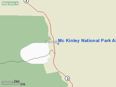
McKinley National Park Airport (IATA: MCL, ICAO: PAIN, FAA LID: INR, formerly 5MK) is a public-use airport located two nautical miles (3.7 km) of McKinley Park, in Denali Borough, Alaska, United States. It is owned by the U.S. National Park Service and is located at the Denali National Park and Preserve (previously Mount McKinley National Park).
Although most U.S. airports use the same three-letter location identifier for the FAA and IATA, this airport is assigned INR by the FAA and MCL by the IATA. The airport's ICAO identifier is PAIN.
Facilities and aircraft
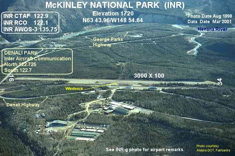
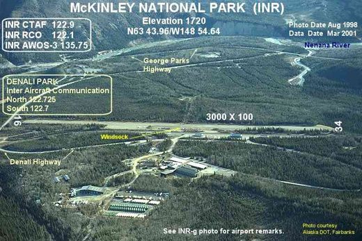
McKinley National Park Airport has one runway designated 16/34 with a gravel surface measuring 3,000 by 68 feet (914 x 21 m). For the 12-month period ending December 31, 2005, the airport had 3,200 aircraft operations, an average of 266 per month: 69% general aviation and 31% air taxi. At that time there were 7 aircraft based at this airport: 57% single-engine, 29% multi-engine and 14% helicopter.
The above content comes from Wikipedia and is published under free licenses – click here to read more.
Location
& QuickFacts
|
FAA
Information Effective: |
2006-02-16 |
|
Airport
Identifier: |
INR |
|
Longitude/Latitude: |
148-54-38.2980W/63-43-57.3540N
-148.910638/63.732598 (Estimated) |
|
Elevation: |
1720 ft / 524.26 m (Estimated) |
|
Land: |
0 acres |
|
From
nearest city: |
2 nautical miles NE of Mckinley Park, AK |
|
Location: |
Yukon-koyukuk County, AK |
|
Magnetic Variation: |
27E (1985) |
Owner
& Manager
|
Ownership: |
Publicly owned |
|
Owner: |
U S Govt Natl Pk Service |
|
Address: |
Po Box 9
Denali Natl Park, AK 99755 |
|
Phone
number: |
907-683-2294 |
|
Manager: |
Paul Anderson |
|
Address: |
Po Box 9
Denali Natl Park, AK 99755 |
|
Phone number: |
907-683-9581 |
Airport
Operations and Facilities
|
Airport
Use: |
Open to public |
|
Wind
indicator: |
Yes |
|
Segmented
Circle: |
No |
|
Control
Tower: |
No |
|
Attendance
Schedule: |
UNATNDD |
|
Landing
fee charge: |
No |
|
Sectional
chart: |
Anchorage |
|
Region: |
AAL - Alaska |
|
Boundary
ARTCC: |
ZAN - Anchorage |
|
Tie-in
FSS: |
FAI - Fairbanks |
|
FSS
on Airport: |
No |
|
FSS
Phone: |
907-474-0788 |
|
FSS
Toll Free: |
1-866-248-6516 |
|
NOTAMs
Facility: |
INR (NOTAM-d service avaliable) |
Airport
Communications
Airport
Services
|
Airframe
Repair: |
NONE |
|
Power
Plant Repair: |
NONE |
|
Bottled
Oxygen: |
NONE |
|
Bulk
Oxygen: |
NONE |
|
Runway Information
Runway 16/34
|
Dimension: |
3000
x 68 ft / 914.4 x 20.7 m
ACFT PARKING ALONG SIDES OF RY 16/34 HAS REDUCED USABLE WIDTH TO
68 FT. |
|
Surface: |
GRAVEL, Good Condition
GRASS ENCROACHMENT ON BOTH SIDES OF RY. |
|
|
Runway 16 |
Runway 34 |
|
Traffic
Pattern: |
Left |
Right |
|
Obstruction: |
15 ft tree, 80.0 ft from runway, 80 ft left
of centerline, 5:1 slope to clear |
60 ft tree, 600.0 ft from runway, 50 ft right
of centerline, 10:1 slope to clear |
|
Radio Navigation
Aids
|
ID |
Type |
Name |
Ch |
Freq |
Var |
Dist |
|
UMM |
NDB |
Summit |
|
326.00 |
27E |
25.0 nm |
|
ICW |
NDB |
Ice Pool |
|
525.00 |
23E |
49.1 nm |
Remarks
- LITTLE
OR NO OVERRUN AT EITHER RWY END.
- WX
CAMERA AVBL ON INTERNET AT HTTP://AKWEATHERCAMS.FAA.GOV
- WINTER
MAINT. CANYON S & W OF ARPT SUBJECT TO STRONG DOWNDRAFTS.
- COMMERCIAL
OR BUSINESS USE OF THIS AIRSTRIP IS PROHIBITED EXCEPT UNDER PERMIT WITH
THE NATIONAL PARK SERVICE.
- RWY-34
MTN LCTD AT 10,500 FT FROM RY END.
- FREQUENT
PEDESTRIAN TFC ON RY.
- ALL
TRAFFIC PATTERNS TO EAST SIDE DUE TO TERRAIN CLEARANCE.
- FREQS
122.725 NORTH/ 122.7 SOUTH IS DESIGNATED FOR INTER ACFT COMMUNICATION
IN DENALI NATIONAL PARK.
Based Aircraft
|
Aircraft
based on field: |
7 |
|
Single
Engine Airplanes: |
4 |
|
Multi
Engine Airplanes: |
2 |
|
Helicopters: |
1 |
Operational Statistics
|
Aircraft
Operations: |
62/Week |
|
Air Taxi: |
31.3% |
|
General
Aviation Local: |
15.6% |
|
General
Aviation Itinerant: |
53.1% |
Mc Kinley National Park Airport
Address:
Yukon-koyukuk County, AK
Tel:
907-683-2294,
907-683-9581
Images
and information placed above are from
http://www.airport-data.com/airport/INR/
We
thank them for the data!
| General
Info |
| Country |
United
States |
| State |
ALASKA
|
| FAA ID |
INR
|
| Latitude |
63-43-57.354N
|
| Longitude |
148-54-38.298W
|
| Elevation |
1720 feet
|
| Near City |
MC KINLEY
PARK |
We don't guarantee the information is fresh and accurate. The data may
be wrong or outdated.
For more up-to-date information please refer to other sources.
|
|