 |
|
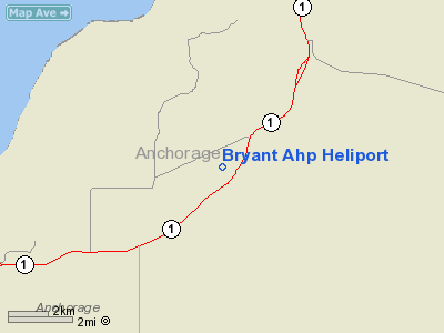
| Bryant Army Heliport |
| IATA: FRN – ICAO: PAFR – FAA LID: FRN |
| Summary |
| Airport type |
Military |
| Owner |
U.S. Government |
| Location |
Fort Richardson / Anchorage, Alaska |
| Elevation AMSL |
378 ft / 115 m |
| Coordinates |
61°15′45″N 149°39′17″W / 61.2625°N 149.65472°W / 61.2625; -149.65472 |
| Runways |
| Direction |
Length |
Surface |
| ft |
m |
| 16/34 |
4,175 |
1,273 |
Asphalt |
| Source: Federal Aviation Administration |
Bryant Army Heliport (IATA: FRN, ICAO: PAFR, FAA LID: FRN) is a U.S. Army heliport located at Fort Richardson, near the city of Anchorage in the U.S. state of Alaska. It has one runway designated 16/34 with a 4,175 x 100 ft (1,273 x 30 m) asphalt surface.
The above content comes from Wikipedia and is published under free licenses – click here to read more.
Location & QuickFacts
|
FAA
Information Effective: |
2005-10-27 |
|
Airport Identifier: |
FRN |
|
Longitude/Latitude: |
149-39-16.9330W/61-15-45.0280N
-149.654704/61.262508 (Estimated) |
|
Elevation: |
378 ft / 115.21 m
(Surveyed) |
|
Land: |
0
acres |
|
From nearest city: |
0 nautical miles
E of Fort Richardson(anchorage), AK |
|
Location: |
Anchorage
County, AK |
|
Magnetic Variation: |
25E (1985) |
Owner & Manager
|
Ownership: |
Army
owned |
|
Owner: |
Us Govt Usa |
|
Address: |
Headquarters
Ft. Richardson, AK 99505 |
|
Phone number: |
907-384-2558 |
|
Manager: |
Oic
Heliport Operations |
|
Address: |
Headquarters Company
Ft Richardson, AK 99505 |
|
Phone number: |
907-384-2558
OR 9208 |
Airport Operations and Facilities
|
Wind indicator: |
Yes |
|
Segmented Circle: |
Yes |
|
Control Tower: |
No |
|
Attendance Schedule: |
ALL/0730-1800/MON-FRI
EXCP HOLS |
|
Lighting Schedule: |
DUSK-DAWN
ACTVT MIRL RY 16/34 - CTAF. |
|
Beacon Color: |
Clear-Green
(lighted land airport) |
|
Landing fee charge: |
No |
|
Sectional chart: |
Anchorage |
|
Region: |
AAL - Alaska |
|
Traffic Pattern Alt: |
1400
ft |
|
Boundary ARTCC: |
ZAN - Anchorage |
|
Tie-in FSS: |
ENA
- Kenai |
|
FSS Phone: |
800-478-3576 |
|
FSS Toll Free: |
1-800-WX-BRIEF |
|
NOTAMs Facility: |
PAFR (NOTAM-d service
avaliable) |
Airport Services
|
Fuel
available: |
B+ |
|
Airframe
Repair: |
NONE |
|
Power
Plant Repair: |
NONE |
|
Bottled Oxygen: |
NONE |
|
Bulk Oxygen: |
NONE |
Runway Information
Runway 16/34
|
Dimension: |
4175
x 100 ft / 1272.5 x 30.5 m |
|
Surface: |
ASPH,
|
|
Weight Limit: |
Single wheel: 38000 lbs.
Dual wheel: 54000 lbs. |
|
Edge Lights: |
Medium |
|
|
Runway 16 |
Runway 34 |
|
Traffic Pattern: |
Left |
Left |
|
Markings: |
Basic, Good Condition |
Basic, Good Condition |
|
VASI: |
|
2-box on left side |
|
Runway End Identifier: |
No |
|
|
Centerline Lights: |
No |
No |
|
Touchdown Lights: |
No |
No |
|
Decleard distances: |
Take off run available 3475.00 ft
Take off distance available 4175.00 ft
Actual stop distance available 4175.00 ft
Landing distance available 3600.00 ft |
Take off run available 3600.00 ft
Take off distance available 4175.00 ft
Actual stop distance available 4175.00 ft
Landing distance available 3475.00 ft |
|
Radio Navigation Aids
|
ID |
Type |
Name |
Ch |
Freq |
Var |
Dist |
|
CMQ |
NDB |
Campbell Lake |
|
338.00 |
21E |
12.6
nm |
|
BOB |
NDB |
Bruck |
|
387.00 |
21E |
16.2
nm |
|
EDF |
TACAN |
Elmendorf |
081X |
|
21E |
3.3
nm |
|
ANC |
VOR/DME |
Anchorage |
090X |
114.30 |
25E |
17.3
nm |
|
BGQ |
VORTAC |
Big
Lake |
072X |
112.50 |
25E |
20.5
nm |
|
MRI |
VOT |
Merrill |
|
111.00 |
|
6.2
nm |
|
ANC |
VOT |
Anchorage |
|
108.40 |
|
10.8
nm |
Remarks
-
RECOMMEND VISUAL INSPECTION
OF RY.
-
MOOSE OCCASIONALLY ON
OR NEAR RY.
-
RY 16/34 TFC PAT R/W
1100 FT MSL; FIXED WING 1400 FT MSL.
-
LGTD 190 FT ANTENNAS
AT NATIONAL GUARD ARMORY E OF RY 16/34.
-
ARMY AVIATION SUPPORT
FACILITY C907-428-6333.
-
24 HR PPR.
-
NOT REQUIRED UNDER FAR
157.
Based Aircraft
|
Aircraft
based on field: |
70 |
|
Single Engine Airplanes: |
15 |
|
Multi Engine Airplanes: |
3 |
|
Military: |
52 |
Bryant
Ahp Heliport
Address: Anchorage
County, AK
Tel:907-384-2558
Images
and information placed above are from
http://www.airport-data.com/airport/FRN/
We
thank them for the data!
| General
Info |
| Country |
United
States |
| State |
ALASKA
|
| FAA ID |
FRN
|
| Latitude |
61-15-45.028N
|
| Longitude |
149-39-16.933W
|
| Elevation |
378 feet
|
| Near City |
FORT RICHARDSON(ANCHORAGE)
|
We don't guarantee the information is fresh and accurate. The data may be wrong or outdated.
For more up-to-date information please refer to other sources.
|
|


