 |
|
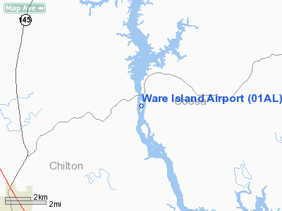
Location
& QuickFacts
|
FAA Information Effective: |
2007-01-18 |
|
Airport
Identifier: |
01AL |
|
Airport
Status: |
Operational |
|
Longitude/Latitude: |
086-30-49.9260W/32-56-45.4420N
-86.513868/32.945956 (Estimated) |
|
Elevation: |
344 ft / 104.85 m (Surveyed) |
|
Land: |
23
acres |
|
From
nearest city: |
9 nautical miles NE of Clanton, AL |
|
Location: |
Chilton County, AL |
|
Magnetic Variation: |
00W (1985) |
Owner
& Manager
|
Ownership: |
Privately owned |
|
Owner: |
Richard & Betty Meyer |
|
Address: |
1000 Ware Island
Clanton, AL 35046 |
|
Phone number: |
205-956-0260
ARPT PHONE NUMBER 256-249-4167. |
|
Address: |
|
Airport
Operations and Facilities
|
Airport Use: |
Private |
|
Wind
indicator: |
Yes |
|
Segmented
Circle: |
No |
|
Control
Tower: |
No |
|
Lighting
Schedule: |
PHONE REQ
FOR LIRL RY N/S CALL 205-934-3016. |
|
Landing fee charge: |
No |
|
Sectional chart: |
Atlanta |
|
Region: |
ASO - Southern |
|
Boundary ARTCC: |
ZTL - Atlanta |
|
Tie-in FSS: |
ANB - Anniston |
|
FSS on Airport: |
No |
|
FSS Toll Free: |
1-800-WX-BRIEF |
Airport
Services
|
Airframe Repair: |
NONE |
|
Power Plant Repair: |
NONE |
|
Runway
Information
Runway N/S
|
Dimension: |
2500 x 160 ft / 762.0 x 48.8 m |
|
Surface: |
TURF, |
|
Edge
Lights: |
Low |
|
|
Runway N |
Runway S |
|
Traffic
Pattern: |
Right |
Right |
|
Radio Navigation
Aids
|
ID |
Type |
Name |
Ch |
Freq |
Var |
Dist |
|
GGY |
NDB |
Gragg-wade |
|
338.00 |
01E |
7.4 nm |
|
SCD |
NDB |
Sylacauga |
|
284.00 |
03W |
16.9 nm |
|
DER |
NDB |
Alexander City |
|
382.00 |
01W |
28.2 nm |
|
BEQ |
NDB |
Bessemer |
|
368.00 |
00E |
30.1 nm |
|
BH |
NDB |
Mcden |
|
224.00 |
01W |
37.9 nm |
|
PLR |
NDB |
Pell City |
|
257.00 |
01E |
39.2 nm |
|
SE |
NDB |
Pollk |
|
344.00 |
01W |
45.7 nm |
|
MXF |
TACAN |
Maxwell |
097X |
|
03E |
34.8 nm |
|
JYU |
VOR/DME |
Junior |
083X |
113.60 |
01W |
43.5 nm |
|
TDG |
VOR/DME |
Talladega |
025X |
108.80 |
02E |
44.6 nm |
|
OKW |
VORTAC |
Brookwood |
047X |
111.00 |
00E |
41.1 nm |
|
MGM |
VORTAC |
Montgomery |
058X |
112.10 |
03E |
44.6 nm |
|
VUZ |
VORTAC |
Vulcan |
091X |
114.40 |
02E |
47.7 nm |
|
BHM |
VOT |
Birmingham Muni |
|
110.00 |
|
39.0 nm |
Remarks
Based
Aircraft
|
Aircraft
based on field: |
3 |
|
Single
Engine Airplanes: |
3 |
Operational Statistics
|
Aircraft
Operations: |
34/Month |
|
General
Aviation Itinerant: |
100.0% |
Ware Island Airport
Address:
Chilton County, AL
Tel:
205-956-0260
Images
and information placed above are from
http://www.airport-data.com/airport/01AL/
We
thank them for the data!
| General
Info |
| Country |
United
States |
| State |
ALABAMA
|
| FAA ID |
01AL
|
| Latitude |
32-56-45.442N
|
| Longitude |
086-30-49.926W
|
| Elevation |
344 feet
|
| Near City |
CLANTON
|
We don't guarantee the information is fresh and accurate. The data may
be wrong or outdated.
For more up-to-date information please refer to other sources.
|
|


