|
|
The Albertville Municipal - Thomas J Brumlik Field Airport |
Albertville Regional Airport
Thomas J. Brumlik Field |
 |
| IATA: none – ICAO: none – FAA LID: 8A0 |
| Summary |
| Airport type |
Public |
| Owner |
City of Albertville |
| Serves |
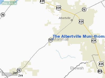
Albertville, Alabama |
| Elevation AMSL |
1,032 ft / 315 m |
| Coordinates |
34°13′45″N 086°15′21″W / 34.22917°N 86.25583°W / 34.22917; -86.25583 |
| Runways |
| Direction |
Length |
Surface |
| ft |
m |
| 5/23 |
6,114 |
1,864 |
Asphalt |
| Statistics (2007) |
| Aircraft operations |
25,400 |
| Based aircraft |
53 |
| Source: Federal Aviation Administration |
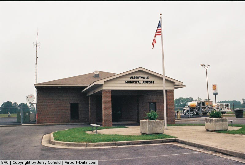
Albertville Regional Airport (FAA LID: 8A0), also known as Thomas J. Brumlik Field, is a city-owned, public-use airport located three miles (5 km) southwest of the central business district of Albertville, in Marshall County, Alabama, United States. It was formerly known as Albertville Municipal Airport. History
Albertville Municipal Airport was activated by the FAA in July 1962.
Facilities and aircraft
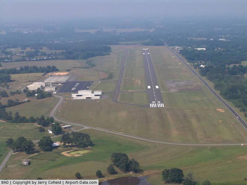
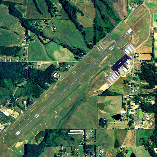
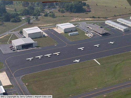
The airport covers an area of 77 acres (31 ha) and contains a single asphalt runway, 5/23, measuring 6,114 by 100 feet (1,864 by 30 m). It's markings are meant for non-precision flying.
For the 12-month period ending July 19, 2007, the airport had 25,400 aircraft operations, an average of 69 per day: 22% local general aviation and 78% itinerant general aviation. At that time there were 53 aircraft based at this airport: 72% single-engine, 17% multi-engine, 6% jet and 6% helicopter.
The above content comes from Wikipedia and is published under free licenses – click here to read more.
|
 |
(Click on the photo to enlarge) |
|
 |
(Click on the photo to enlarge) |
|
 |
(Click on the photo to enlarge) |
|
 |
(Click on the photo to enlarge) |
Location
& QuickFacts
|
FAA Information Effective: |
2007-01-18 |
|
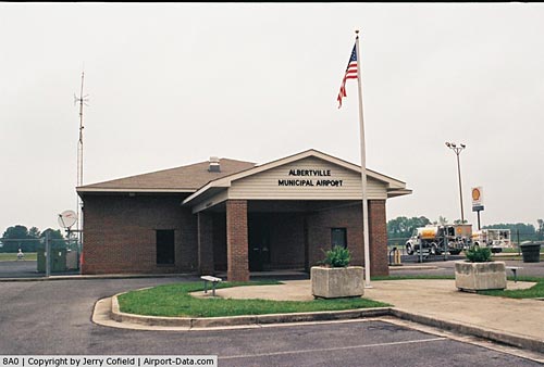
Airport
Identifier: |
8A0 |
|
Airport
Status: |
Operational |
|
Longitude/Latitude: |
086-15-20.7290W/34-13-44.7950N
-86.255758/34.229110 (Estimated) |
|
Elevation: |
1032 ft / 314.55 m (Surveyed) |
|
Land: |
77
acres |
|
From
nearest city: |
3 nautical miles SW of Albertville, AL |
|
Location: |
Marshall County, AL |
|
Magnetic Variation: |
02W (1995) |
Owner
& Manager
|
Ownership: |
Publicly owned |
|
Owner: |
City Of Albertville |
|
Address: |
Po Box 1248
Albertville, AL 35950 |
|
Phone number: |
205-891-8200 |
|
Manager: |
Phillip Hyatt |
|
Address: |
300 Alldredge Drive
Albertville, AL 35950 |
|
Phone number: |
205-878-1433 |
Airport
Operations and Facilities
|
Airport Use: |
Open to public |
|
Wind
indicator: |
Yes |
|
Segmented
Circle: |
Yes |
|
Control
Tower: |
No |
|
Lighting
Schedule: |
DUSK-DAWN
MIRL RY 05/23 PRESET MED INTST DUSK-2300; TO INCR INTST
- CTAF.
AFTER 2300, ACTVT MIRL 05/23, PAPI RYS 05
& 23 AND REIL RY 23 - CTAF. |
|
Beacon
Color: |
Clear-Green (lighted land airport) |
|
Landing
fee charge: |
No |
|
Sectional
chart: |
Atlanta |
|
Region: |
ASO - Southern |
|
Boundary
ARTCC: |
ZTL - Atlanta |
|
Tie-in
FSS: |
ANB - Anniston |
|
FSS
on Airport: |
No |
|
FSS
Toll Free: |
1-800-WX-BRIEF |
|
NOTAMs
Facility: |
8A0 (NOTAM-d service avaliable) |
|
Federal Agreements: |
NGY |
Airport
Communications
|
CTAF: |
123.000 |
|
Unicom: |
123.000 |
Airport
Services
|
Fuel available: |
100LLA
JET A PREMIXED WITH PRIST. |
|
Airframe Repair: |
MAJOR |
|
Power Plant Repair: |
MAJOR |
|
Runway Information
Runway 05/23
|
Dimension: |
6116 x 100 ft / 1864.2 x 30.5 m |
|
Surface: |
ASPH, Good Condition |
|
Weight
Limit: |
Single wheel: 18000 lbs. |
|
Edge
Lights: |
Medium |
|
|
Runway 05 |
Runway 23 |
|
Longitude: |
086-15-47.9111W |
086-14-53.5273W |
|
Latitude: |
34-13-24.6869N |
34-14-04.8966N |
|
Elevation: |
1003.00
ft |
1032.00
ft |
|
Alignment: |
48 |
127 |
|
Traffic
Pattern: |
Left |
Left |
|
Markings: |
Non-precision instrument, Poor Condition
RY 05/23 MARKINGS FADED. |
Non-precision instrument, Poor Condition |
|
Displaced
threshold: |
0.00 ft |
577.00
ft |
|
VASI: |
2-light PAPI on left side |
2-light PAPI on left side |
|
Runway
End Identifier: |
|
Yes |
|
Obstruction: |
26 ft trees, 900.0 ft from runway, 60 ft left
of centerline, 26:1 slope to clear |
, 50:1 slope to clear |
|
Radio Navigation
Aids
|
ID |
Type |
Name |
Ch |
Freq |
Var |
Dist |
|
ARF |
NDB |
Saratoga |
|
296.00 |
02W |
2.1 nm |
|
CPP |
NDB |
Cole Spring |
|
230.00 |
01W |
29.4 nm |
|
FTP |
NDB |
Fort Payne |
|
426.00 |
01W |
33.8 nm |
|
HUA |
NDB |
Redstone |
|
287.00 |
00W |
35.4 nm |
|
PLR |
NDB |
Pell City |
|
257.00 |
01E |
40.3 nm |
|
CWH |
NDB |
Capshaw |
|
350.00 |
01W |
41.8 nm |
|
GAD |
VOR/DME |
Gadsden |
070X |
112.30 |
02E |
17.4 nm |
|
TDG |
VOR/DME |
Talladega |
025X |
108.80 |
02E |
40.7 nm |
|
DCU |
VOR/DME |
Decatur |
075X |
112.80 |
01W |
42.2 nm |
|
RQZ |
VORTAC |
Rocket |
059X |
112.20 |
02E |
38.9 nm |
|
VUZ |
VORTAC |
Vulcan |
091X |
114.40 |
02E |
46.5 nm |
|
BHM |
VOT |
Birmingham Muni |
|
110.00 |
|
47.2 nm |
Based Aircraft
|
Aircraft
based on field: |
53 |
|
Single
Engine Airplanes: |
38 |
|
Multi
Engine Airplanes: |
9 |
|
Jet Engine
Airplanes: |
3 |
|
Helicopters: |
3 |
Operational Statistics
Time Period: 1998-01-21
- 1999-01-20
|
Aircraft
Operations: |
70/Day |
|
General
Aviation Local: |
21.7% |
|
General
Aviation Itinerant: |
78.3% |
The Albertville Municipal-thomas J Brumlik
Field Airport
Address:
Marshall County, AL
Tel:
205-891-8200, 205-878-1433
Images
and information placed above are from
http://www.airport-data.com/airport/8A0/
We
thank them for the data!
| General
Info |
| Country |
United
States |
| State |
ALABAMA
|
| FAA ID |
8A0
|
| Latitude |
34-13-44.795N
|
| Longitude |
086-15-20.729W
|
| Elevation |
1032 feet
|
| Near City |
ALBERTVILLE
|
We don't guarantee the information is fresh and accurate. The data may
be wrong or outdated.
For more up-to-date information please refer to other sources.
|
|