 |
|
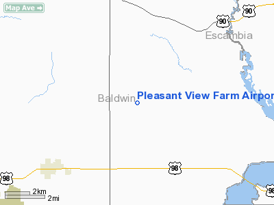
Pleasant View Farm Airport |
Location
& QuickFacts
|
FAA Information Effective: |
2007-01-18 |
|
Airport
Identifier: |
AL04 |
|
Airport
Status: |
Operational |
|
Longitude/Latitude: |
087-31-29.9340W/30-27-45.7080N
-87.524982/30.462697 (Estimated) |
|
Elevation: |
105 ft / 32.00 m (Estimated) |
|
Land: |
80
acres |
|
From
nearest city: |
5 nautical miles NE of Elberta, AL |
|
Location: |
Baldwin County, AL |
|
Magnetic Variation: |
01E (1985) |
Owner
& Manager
|
Ownership: |
Privately owned |
|
Owner: |
Dan Mc Connell/john Ward |
|
Address: |
10751 Beulah Rd
Pensacola, FL 32526 |
|
Phone
number: |
904-944-1721 |
|
Manager: |
Dan Mc Connell/john Ward |
|
Address: |
29378 Co Rd 91 Ext
Elberta, AL 36530 |
|
Phone number: |
205-986-8538 |
Airport
Operations and Facilities
|
Airport Use: |
Private |
|
Wind
indicator: |
Yes |
|
Segmented
Circle: |
No |
|
Control
Tower: |
No |
|
Sectional
chart: |
New Orleans |
|
Region: |
ASO - Southern |
|
Boundary
ARTCC: |
ZJX - Jacksonville |
|
Tie-in
FSS: |
ANB - Anniston |
|
FSS
Toll Free: |
1-800-WX-BRIEF |
|
Runway Information
Runway 01/19
|
Dimension: |
2500 x 100 ft / 762.0 x 30.5 m |
|
Surface: |
TURF, |
|
|
Runway 01 |
Runway 19 |
|
Traffic
Pattern: |
Left |
Left |
|
Displaced
threshold: |
340.00
ft |
300.00
ft |
|
Obstruction: |
10
ft trees |
15
ft road |
|
Runway 09/27
|
Dimension: |
1320 x 75 ft / 402.3 x 22.9 m |
|
Surface: |
TURF, |
|
|
Runway 09 |
Runway 27 |
|
Traffic
Pattern: |
Left |
Left |
|
Markings: |
Nonstandard,
/27 - NSTD WHITE MARKERS. |
Nonstandard, |
|
Obstruction: |
|
50 ft trees, 40.0 ft from runway |
|
Runway 17/35
|
Dimension: |
2650 x 100 ft / 807.7 x 30.5 m |
|
Surface: |
TURF, |
|
|
Runway 17 |
Runway 35 |
|
Traffic
Pattern: |
Left |
Left |
|
Markings: |
Nonstandard,
/35 - NSTD WHITE MARKERS. |
Nonstandard, |
|
Displaced
threshold: |
300.00
ft |
340.00
ft |
|
Obstruction: |
15
ft road |
17 ft road, 0.0 ft from runway |
|
Radio Navigation
Aids
|
ID |
Type |
Name |
Ch |
Freq |
Var |
Dist |
|
ESU |
NDB |
Summerdale |
|
204.00 |
01E |
10.6 nm |
|
PKZ |
NDB |
Pickens |
|
326.00 |
01E |
18.0 nm |
|
MO |
NDB |
Wisle |
|
248.00 |
02E |
44.1 nm |
|
NPA |
TACAN |
Pensacola |
119X |
|
01E |
12.5 nm |
|
NSE |
TACAN |
Whiting |
070X |
|
01E |
30.6 nm |
|
NGS |
TACAN |
Santa Rosa |
063X |
|
01E |
31.8 nm |
|
HRT |
TACAN |
Hurlburt |
045X |
|
00E |
43.3 nm |
|
NUN |
VOR |
Saufley |
|
108.80 |
01E |
9.8 nm |
|
BFM |
VORTAC |
Brookley |
075X |
112.80 |
04E |
28.9 nm |
|
SJI |
VORTAC |
Semmes |
100X |
115.30 |
05E |
46.0 nm |
|
CEW |
VORTAC |
Crestview |
106X |
115.90 |
03E |
48.9 nm |
Remarks
- OPNS
CONDUCTED IN VFR WX, LIMITED TO PVT USE.
Based
Aircraft
|
Aircraft
based on field: |
11 |
|
Single
Engine Airplanes: |
5 |
|
Gliders: |
6 |
Pleasant View Farm Airport
Address:
Baldwin County, AL
Tel:
904-944-1721,
205-986-8538
Images
and information placed above are from
http://www.airport-data.com/airport/AL04/
We
thank them for the data!
| General
Info |
| Country |
United
States |
| State |
ALABAMA
|
| FAA ID |
AL04
|
| Latitude |
30-27-45.708N
|
| Longitude |
087-31-29.934W
|
| Elevation |
105 feet
|
| Near City |
ELBERTA
|
We don't guarantee the information is fresh and accurate. The data may
be wrong or outdated.
For more up-to-date information please refer to other sources.
|
|


