 |
|
| Fish River Seaplane Base |
| IATA: none – ICAO: none – FAA LID: 5AL |
| Summary |
| Airport type |
Public |
| Owner |
Stephen M. Albers |
| Serves |
Fairhope, Alabama |
| Elevation AMSL |
3 ft / 1 m |
| Coordinates |
30°27′00″N 087°48′28″W / 30.45°N 87.80778°W / 30.45; -87.80778 |
| Runways |
| Direction |
Length |
Surface |
| ft |
m |
| 16W/34W |
4,395 |
1,340 |
Water |
| Source: Federal Aviation Administration |
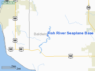
Fish River Seaplane Base (FAA LID: 5AL) is a public-use seaplane base located nine nautical miles (17 km) southeast of the central business district of Fairhope, a city in Baldwin County, Alabama, United States. It has one landing area (16W/34W) measuring 4,395 x 200 feet (1,340 x 61 m).
The above content comes from Wikipedia and is published under free licenses – click here to read more.
Location
& QuickFacts
|
FAA Information Effective: |
2007-01-18 |
|
Airport
Identifier: |
5AL |
|
Airport
Status: |
Operational |
|
Longitude/Latitude: |
087-48-28.0000W/30-27-00.0000N
-87.807778/30.450000 (Estimated) |
|
Elevation: |
3
ft / 0.91 m (Estimated) |
|
Land: |
0
acres |
|
From
nearest city: |
9 nautical miles SE of Fairhope, AL |
|
Location: |
Baldwin County, AL |
|
Magnetic Variation: |
00W (2000) |
Owner
& Manager
|
Ownership: |
Publicly owned |
|
Owner: |
Stephen M. Albers |
|
Address: |
54 N. Church St #5
Fairhope, AL 36532 |
|
Phone
number: |
251-928-1473 |
|
Manager: |
Stephen M. Albers |
|
Address: |
54 N. Church St #5
Fairhope, AL 36532 |
|
Phone number: |
251-928-1473 |
Airport
Operations and Facilities
|
Airport Use: |
Open to public |
|
Segmented Circle: |
No |
|
Control Tower: |
No |
|
Sectional chart: |
New Orleans |
|
Region: |
ASO - Southern |
|
Boundary ARTCC: |
ZJX - Jacksonville |
|
Tie-in FSS: |
ANB - Anniston |
|
FSS Toll Free: |
1-800-WX-BRIEF |
|
NOTAMs Facility: |
ANB |
Airport
Communications
Airport
Services
|
Fuel available: |
100LLMOGAS
CALL AHEAD FOR AVAILABILITY AT 251-928-1473. |
|
Runway
Information
Runway 16W/34W
|
Dimension: |
4395 x 200 ft / 1339.6 x 61.0 m |
|
Surface: |
WATER, |
|
|
Runway 16W |
Runway 34W |
|
Traffic
Pattern: |
Left |
Left |
|
Obstruction: |
86 ft trees, 100.0 ft from runway |
84 ft trees, 0.0 ft from runway |
|
Radio Navigation
Aids
|
ID |
Type |
Name |
Ch |
Freq |
Var |
Dist |
|
ESU |
NDB |
Summerdale |
|
204.00 |
01E |
5.2 nm |
|
MO |
NDB |
Wisle |
|
248.00 |
02E |
31.7 nm |
|
PKZ |
NDB |
Pickens |
|
326.00 |
01E |
32.6 nm |
|
NPA |
TACAN |
Pensacola |
119X |
|
01E |
26.1 nm |
|
NSE |
TACAN |
Whiting |
070X |
|
01E |
44.1 nm |
|
NGS |
TACAN |
Santa Rosa |
063X |
|
01E |
46.1 nm |
|
NUN |
VOR |
Saufley |
|
108.80 |
01E |
24.5 nm |
|
BFM |
VORTAC |
Brookley |
075X |
112.80 |
04E |
16.1 nm |
|
SJI |
VORTAC |
Semmes |
100X |
115.30 |
05E |
33.0 nm |
Remarks
- TURNING
BASINS ARE AVBL AT BOTH ENDS OF THE SEALANE. GOOD ANCHORAGE AVBL IN
TURNING BASINS.
- PRVDD
VFR OPNS.
Based
Aircraft
|
Aircraft
based on field: |
1 |
|
Single
Engine Airplanes: |
1 |
Fish River Seaplane Base
Address:
Baldwin County, AL
Tel:
251-928-1473
Images
and information placed above are from
http://www.airport-data.com/airport/5AL/
We
thank them for the data!
We don't guarantee the information is fresh and accurate. The data may
be wrong or outdated.
For more up-to-date information please refer to other sources.
|
|


