|
|
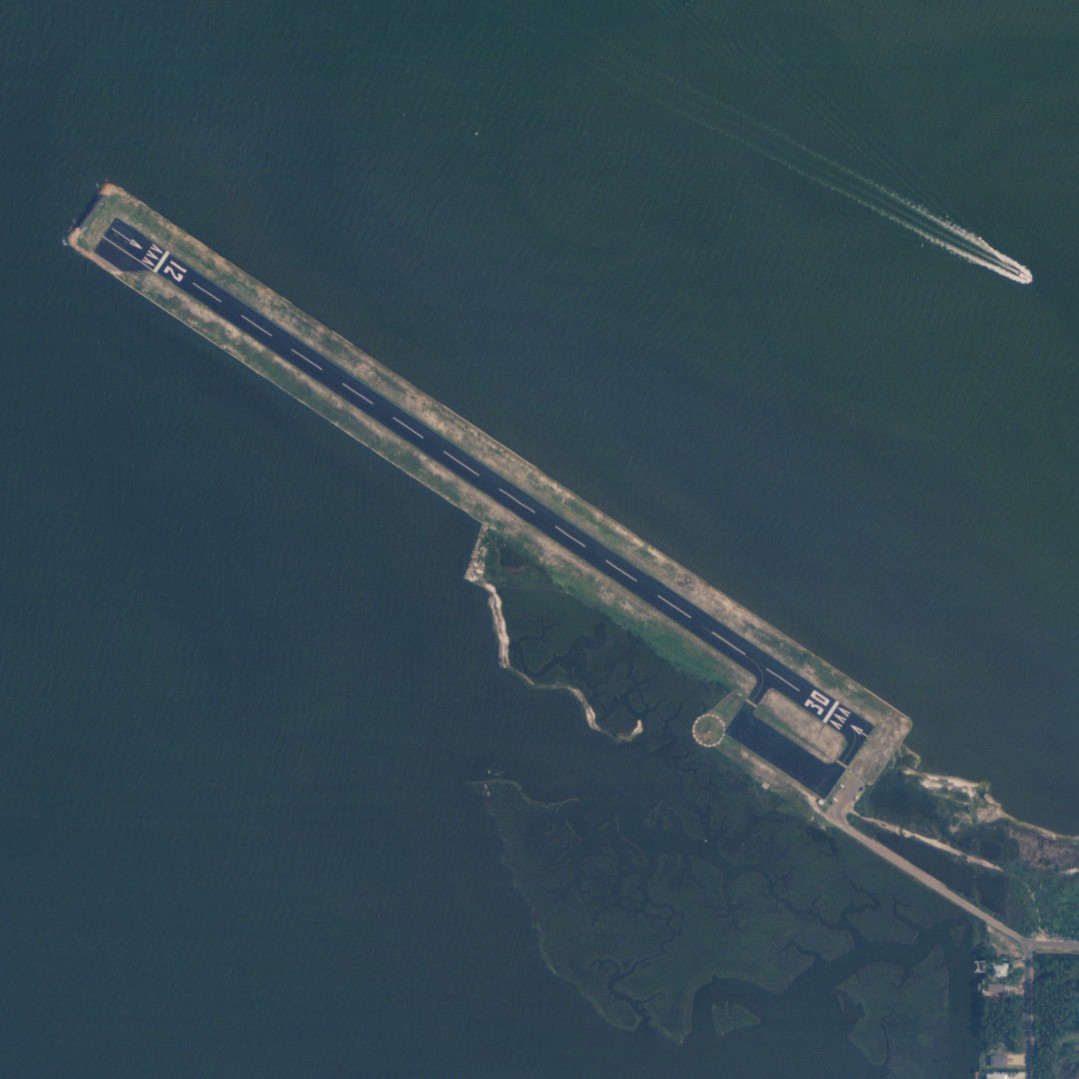
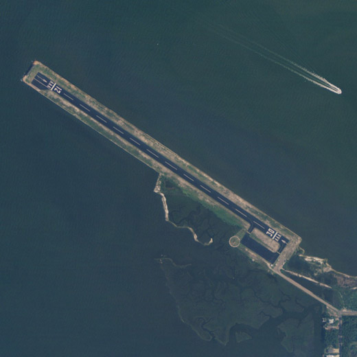
| Dauphin Island Airport |
 |
| NAIP aerial image, 23 June 2006 |
| IATA: none – ICAO: none – FAA LID: 4R9 |
| Summary |
| Airport type |
Public |
| Owner |
Mobile County |
| Serves |
Dauphin Island, Alabama |
| Elevation AMSL |
5 ft / 2 m |
| Coordinates |
30°15′38″N 088°07′39″W / 30.26056°N 88.1275°W / 30.26056; -88.1275 |
| Runways |
| Direction |
Length |
Surface |
| ft |
m |
| 12/30 |
3,000 |
914 |
Asphalt |
| Statistics (2009) |
| Aircraft operations |
3,650 |
| Source: Federal Aviation Administration |
Dauphin Island Airport (FAA LID: 4R9) is a county-owned public-use airport in Mobile County, Alabama, United States. It is just northwest of the central business district of Dauphin Island, Alabama, a town located on a barrier island also named Dauphin Island. The airport is on the Mobile Bay, west of the Aloe Bay Channel. According to the FAA's National Plan of Integrated Airport Systems for 2009–2013, it is categorized as a general aviation facility.
Facilities and aircraft
Dauphin Island Airport covers an area of 22 acres (9 ha) at an elevation of 5 feet (2 m) above mean sea level. It has one asphalt paved runway designed 12/30 which measures 3,000 by 80 feet (914 x 24 m). The runway has precision approach path indicator (PAPI) lights and it can accommodate single-engine and light twin-engine aircraft. For the 12-month period ending April 8, 2009, the airport had 3,650 general aviation aircraft operations, an average of 10 per day.
The above content comes from Wikipedia and is published under free licenses – click here to read more.
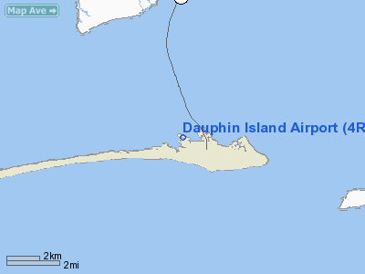
Location
& QuickFacts
|
FAA Information Effective: |
2007-01-18 |
|
Airport
Identifier: |
4R9 |
|
Airport
Status: |
Operational |
|
Longitude/Latitude: |
088-07-38.9000W/30-15-37.7700N
-88.127472/30.260492 (Estimated) |
|
Elevation: |
5
ft / 1.52 m (Surveyed) |
|
Land: |
22
acres |
|
From
nearest city: |
0 nautical miles NW of Dauphin Island, AL |
|
Location: |
Mobile County, AL |
|
Magnetic Variation: |
02E (1985) |
Owner
& Manager
|
Ownership: |
Publicly owned |
|
Owner: |
Mobile County |
|
Address: |
205 Government Street
Mobile, AL 36644 |
|
Phone number: |
251-574-8606 |
|
Manager: |
William Meredith |
|
Address: |
11562 Fairway Dr
Irvington, AL 36544 |
|
Phone number: |
251-574-8606 |
Airport
Operations and Facilities
|
Airport Use: |
Open to public |
|
Wind
indicator: |
Yes |
|
Segmented
Circle: |
Yes |
|
Control
Tower: |
No |
|
Lighting
Schedule: |
DUSK-DAWN
ACTVT MIRL RY 12/30 AND PVASI RYS 12 & 30 - CTAF. |
|
Beacon
Color: |
Clear-Green (lighted land airport) |
|
Landing
fee charge: |
No |
|
Sectional
chart: |
New Orleans |
|
Region: |
ASO - Southern |
|
Boundary
ARTCC: |
ZHU - Houston |
|
Tie-in
FSS: |
ANB - Anniston |
|
FSS
on Airport: |
No |
|
FSS
Toll Free: |
1-800-WX-BRIEF |
|
NOTAMs
Facility: |
ANB (NOTAM-d service
avaliable) |
|
Federal Agreements: |
NGY |
Airport
Communications
|
CTAF: |
122.800 |
|
Unicom: |
122.800 |
Airport
Services
|
Airframe Repair: |
NONE |
|
Power Plant Repair: |
NONE |
|
Bottled
Oxygen: |
NONE |
|
Bulk
Oxygen: |
NONE |
|
Runway Information
Runway 12/30
|
Dimension: |
3000 x 80 ft / 914.4 x 24.4 m |
|
Surface: |
ASPH, Fair Condition |
|
Weight
Limit: |
Single wheel: 30000 lbs. |
|
Edge
Lights: |
Medium |
|
|
Runway 12 |
Runway 30 |
|
Longitude: |
088-07-53.1900W |
088-07-24.6100W |
|
Latitude: |
30-15-45.9300N |
30-15-29.6100N |
|
Elevation: |
5.00 ft |
5.00 ft |
|
Traffic
Pattern: |
Left |
Left |
|
Markings: |
Basic, Fair Condition |
Basic, Fair Condition |
|
Displaced
threshold: |
202.00
ft |
140.00
ft |
|
VASI: |
pulsating/steady burning on left side |
pulsating/steady burning on right side |
|
Obstruction: |
, 50:1 slope to clear
RY 12 APCH SLOPE 50:1 TO DSPLCD THLD. |
41 ft trees, 963.0 ft from runway, 18:1 slope
to clear
RY 30 APCH SLOPE 26:1 TO DSPLCD THLD. |
|
Radio Navigation
Aids
|
ID |
Type |
Name |
Ch |
Freq |
Var |
Dist |
|
ESU |
NDB |
Summerdale |
|
204.00 |
01E |
25.3 nm |
|
MO |
NDB |
Wisle |
|
248.00 |
02E |
31.4 nm |
|
NPA |
TACAN |
Pensacola |
119X |
|
01E |
42.5 nm |
|
BIX |
TACAN |
Keesler |
055X |
|
01E |
42.5 nm |
|
NUN |
VOR |
Saufley |
|
108.80 |
01E |
43.0 nm |
|
GPT |
VOR/DME |
Gulfport |
27X |
109.00 |
02E |
49.9 nm |
|
BFM |
VORTAC |
Brookley |
075X |
112.80 |
04E |
21.5 nm |
|
SJI |
VORTAC |
Semmes |
100X |
115.30 |
05E |
30.4 nm |
Remarks
- BIRDS
ON & INVOF ARPT.
- EXTSV
BANNER TOW OPNS ARND IS CST LN & N TO MOBILE.
- VFR
ONLY.
Operational
Statistics
Time Period: 2005-05-02
- 2006-05-01
|
Aircraft
Operations: |
71/Week |
|
General
Aviation Local: |
40.0% |
|
General
Aviation Itinerant: |
60.0% |
Dauphin Island Airport
Address:
Mobile County, AL
Tel:
251-574-8606
Images
and information placed above are from
http://www.airport-data.com/airport/4R9/
We
thank them for the data!
| General
Info |
| Country |
United
States |
| State |
ALABAMA
|
| FAA ID |
4R9
|
| Latitude |
30-15-37.731N
|
| Longitude |
088-07-38.999W
|
| Elevation |
5 feet
|
| Near City |
DAUPHIN
ISLAND |
We don't guarantee the information is fresh and accurate. The data may
be wrong or outdated.
For more up-to-date information please refer to other sources.
|
|