 |
|
| Entebbe International Airport |
 |
| IATA: EBB – ICAO: HUEN |
| Summary |
| Airport type |
Civilian and Military |
| Operator |
Civil Aviation Authority of Uganda |
| Serves |
Entebbe, Kampala, Mukono |
| Location |
Entebbe, Uganda |
| Elevation AMSL |
3,782 ft / 1,153 m |
| Coordinates |
00°02′40″N 32°26′33″E / 0.04444°N 32.4425°E / 0.04444; 32.4425 |
| Runways |
| Direction |
Length |
Surface |
| m |
ft |
| 17/35 |
3,658 |
12,000 |
Asphalt |
| 12/30 |
2,408 |
7,900 |
Asphalt |
| Source: DAFIF |
Entebbe International Airport (IATA: EBB, ICAO: HUEN) is the principal international airport of Uganda. It is located near the town of Entebbe, on the shores of Lake Victoria, and about 35 km (21 miles) from the capital, Kampala. The main offices of the Civil Aviation Authority of Uganda are located at the airport.
The airport was first constructed in 1928/1929: the first aircraft to use the new airfield were RAF Fairey IIIs of the Cairo-Cape flight which landed on the 900 yards (820 m) grass runway on 17 February 1929. In January 1932 Imperial Airways began to use Entebbe on their Cape-to-Cairo mail services: at this stage, radio was installed. By 1935, the grass runway surfaces had been replaced by murram. In 1944-45 the main runway (12/30) was asphalted and extended to 1,600 yards (1,500 m).
On 10 November 1951 the airport was formally re-opened after the facilities had been extended further: runway 12/30 was now 3,300 yards (3,000 m), in preparation for services by the de Havilland Comet. Finally, the existing control tower of the “old airport” was constructed in 1957/58.
The current passenger terminal building was constructed in the mid to late 1970s, together with runway 17/35: the old runway 12/30 was shortened to its current length. The Old Entebbe airport is now used by Uganda's military forces and was the scene of a hostage rescue operation by Israeli Sayeret Matkal, dubbed Operation Entebbe, in 1976, after an Arab-German hijacking of Air France Flight 139 out of Tel Aviv.
The scene of that particular rescue was "the old airport", which was recently demolished except for its control tower. In late 2007, a domestic terminal was constructed at the site of the old airport, leaving the "new airport" to handle International flights exclusively. Entebbe International Airport served 720,000 International passengers in 2007. (+10.7% vs. 2006). The unofficial figure of arrivals in 2008 is estimated at 850,000 (+18.1% vs. 2006)
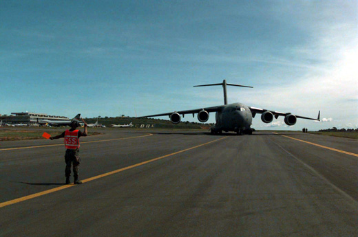
Entebbe Airport is a Cooperative Security Location of the United States military. Entebbe airport uses the jetway boarding bridge system. Airlines and destinations
Scheduled passenger airlines
| Airlines |
Destinations |
| Air Burundi |
Bujumbura |
| Air Uganda |
Dar es Salaam, Juba, Kigali, Nairobi, Mombasa, Zanzibar |
| British Airways |
London-Heathrow |
| Brussels Airlines |
Brussels, Kigali, Nairobi |
| Eagle Air |
Arua, Gulu, Moyo, Kidepo, Kitgum, Pakuba, Juba, Yei, Bunia |
| EgyptAir |
Cairo |
| Emirates |
Dubai, Addis Ababa |
| Ethiopian Airlines |
Addis Ababa, Kigali |
| Feeder Airlines |
Juba |
| Fly540 |
Nairobi |
| Kenya Airways |
Nairobi |
| KLM |
Amsterdam |
| Precision Air |
Kilimanjaro, Mwanza |
| Royal Daisy Airlines |
Juba |
| RwandAir |
Kigali |
| South African Airways |
Johannesburg |
| Turkish Airlines |
Istanbul-Atatürk |
| United Airlines Limited |
Gulu, Arua,Khiswala-AYZ |
Cargo airlines
| Airlines |
Destinations |
| Avient Aviation |
Liège |
| Martinair |
Amsterdam |
| Uganda Air Cargo |
Dubai, Johannesburg, Frankfurt, London |
The above content comes from Wikipedia and is published under free licenses – click here to read more.
| General Info
|
| Country |
Uganda
|
| ICAO ID |
HUEN
|
| Time |
UTC+3
|
| Latitude |
0.042386
00° 02' 32.59" N
|
| Longitude |
32.443503
032° 26' 36.61" E
|
| Elevation |
3782 feet
1153 meters
|
| Type |
Joint (Civil and Military)
|
| Magnetic Variation |
000° E (01/06)
|
| Operating Agency |
MILITARY - CIVIL JOINT USE AIRPORT
|
| Near City |
Kampais
|
| International Clearance Status |
Airport of Entry
|
| Communications
|
| TWR |
118.1
|
| APP |
119.1
|
| Communications Remarks |
|
| APP |
(Opr unrel)
|
| Runways
|
| ID |
Dimensions |
Surface |
PCN |
ILS
|
| 12/30 |
7900 x 150 feet
2408 x 46 meters |
ASPHALT |
- |
NO
|
| 17/35 |
12000 x 150 feet
3658 x 46 meters |
ASPHALT |
- |
YES
|
| Navaids
|
| Type |
ID |
Name |
Channel |
Freq |
Distance From Field |
Bearing From Navaid
|
| VOR-DME |
NN |
ENTEBBE |
122X |
117.5 |
At Field |
-
|
| NDB |
PB |
PORT BELL |
- |
270 |
9.9 NM |
219.7
|
| Supplies/Equipment
|
| Fuel |
Jet A1, without icing nhibitor.
|
| Remarks
|
| CAUTION |
Twy A not vis fr twr. Bird haz on rwy 35.
|
| FUEL |
A1 (Total Uganda fone C2564 1231331) (NC-100LL)
|
| MISC |
180 turns on rwy 17-35 proh for all acft with GWT of more than 29,981 lb. All acft proh 180 turns on main apn.
|
| RSTD |
Avoid flt over State House 1.5 NM NNE. RWY 18-36 is a clsd rwy unusable.
|
The content above was published at Airports-Worldwide.com in 2010.
We don't guarantee the information is fresh and accurate. The data may be wrong or outdated.
For more up-to-date information please refer to other sources.
|
|


