Mae Fah Luang - Chiang Rai International Airport
ท่าอากาศยานแม่ฟ้าหลวงเชียงราย |
 |
| IATA: CEI – ICAO: VTCT |
| Summary |
| Airport type |
Public |
| Operator |
Airports of Thailand |
| Location |
Chiang Rai, Thailand |
| Elevation AMSL |
390 m / 1,280 ft |
| Coordinates |
19°57′08″N 99°52′58″E / 19.95222°N 99.88278°E / 19.95222; 99.88278 |
| Runways |
| Direction |
Length |
Surface |
| m |
ft |
| 03/21 |
3,000 |
9,843 |
Asphalt |
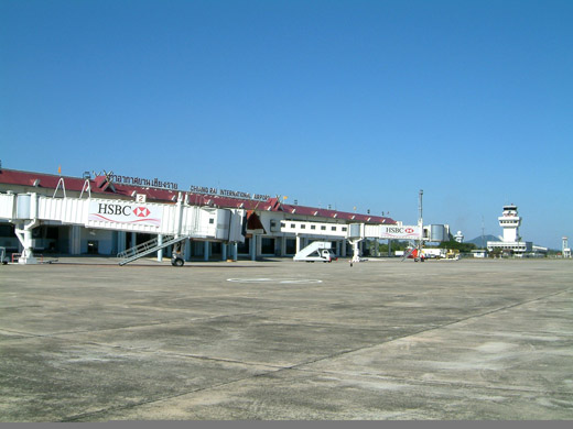
Mae Fah Luang - Chiang Rai International Airport (IATA: CEI, ICAO: VTCT) is located in the city of Chiang Rai in northern Thailand.
The airport is located about 10km from the city centre. Since 1998 it has been managed by the Airports of Thailand Public Company Limited (AOT).
Access to the airport is available from an access road linking the airport with Phahonyothin Road (Superhighway), which leads southbound to the city centre, Chiang Mai, Bus Terminal II and all the way to Bangkok and northbound to Mae Chan, Mae Sai and the Thai-Myanmar border.
A new road (Vhiangburapha Road) which can be accessed by turning left upon exiting the airport also leads southbound to the city centre and is a less congested route, as it is not used by intercity buses heading north. The road joins up with Phahonyothin Road via Pao Khun Road which passes Chiang Rai Provincial Stadium.
The airport handles over 500,000 passengers, 3,900 flights and 2,700 tons of cargo every year.
It consists of a single passenger terminal which features a Dairy Queen outlet as well as a Black Canyon Coffee, with both the international and domestic arrivals and departures handled on the same floor but in separate areas.
Although the airport is named Chiang Rai International Airport, and even though its facilities are capable of handling international flights, it is yet to be served by any international routes. The airport does however handle immigration from THAI flights with international connections to/from Bangkok-Suvarnabhumi. Airlines and destination
Domestic Airlines
- One-Two-Go Airlines (Bangkok-Don Mueang)
- Thai AirAsia (Bangkok-Suvarnabhumi)
- Thai Airways International (Bangkok-Suvarnabhumi)
The above content comes from Wikipedia and is published under free licenses – click here to read more.
| General Info
|
| Country |
Thailand
|
| ICAO ID |
VTCT
|
| Time |
UTC+7
|
| Latitude |
19.952342
19° 57' 08.43" N
|
| Longitude |
99.882928
099° 52' 58.54" E
|
| Elevation |
1280 feet
390 meters
|
| Type |
Civil
|
| Magnetic Variation |
000° W (01/06)
|
| Beacon |
Yes
|
| Operating Agency |
CIVIL GOVERNMENT, (LANDING FEES AND DIPLOMATIC CLEARANCE MAY BE REQUIRED)
|
| Operating Hours |
SEE REMARKS FOR OPERATING HOURS OR COMMUNICATIONS FOR POSSIBLE HOURS
|
| Communications
|
| TWR |
118.4
236.6
|
| RDO |
6667
5520
|
| ATIS |
277.0
|
| APP |
120.05
257.8
|
| Runways
|
| ID |
Dimensions |
Surface |
PCN |
ILS
|
| 03/21 |
9843 x 148 feet
3000 x 45 meters |
ASPHALT |
084FDXT |
YES
|
| Navaids
|
| Type |
ID |
Name |
Channel |
Freq |
Distance From Field |
Bearing From Navaid
|
| VOR-DME |
CTR |
CHIANG RAI |
112X |
116.5 |
At Field |
-
|
| NDB |
CT |
CHIANG RAI |
- |
277 |
At Field |
-
|
| Remarks
|
| CSTMS/IMG |
Avbl O/R.
|
| FUEL |
(NC-A1) Avbl H24.
|
| LGT |
PAPI MEHT Rwy 03 - 65', Rwy 21 - 61'.
|
| OPR HOURS |
Opr 2300-1500Z OT 1 hr PN to ATC.
|
The content above was published at Airports-Worldwide.com in 2010.
We don't guarantee the information is fresh and accurate. The data may be wrong or outdated.
For more up-to-date information please refer to other sources.
|


