|
|
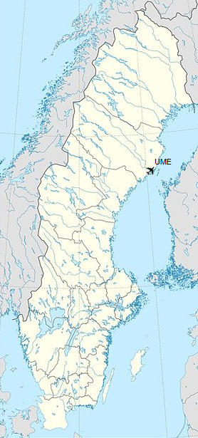
Umeå Airport (IATA: UME, ICAO: ESNU) is an airport located on the southern outskirts of the city of Umeå, Sweden. As of 2011, it is the 7th largest airport in Sweden.
The airport had 1,057,373 passengers in 2016. By road, the airport is located about 5.4 kilometres (3.4 mi) from Umeå city centre.
| Umeå Airport |
|
|
|
| Summary |
| Airport type |
Public |
| Operator |
Swedavia |
| Serves |
Umeå, Sweden |
| Elevation AMSL |
24 ft / 7 m |
| Coordinates |
63°47′31″N
020°16′58″E |
| Website |
swedavia.com/umea/ |
| Map |
|
|
| Runways |
| Direction |
Length |
Surface |
| ft |
m |
| 14/32 |
7,551 |
2,302 |
Asphalt |
|
| Statistics (2015) |
| Passengers total |
1,048,000 |
| International passengers |
75,500 |
| Domestic passengers |
972,500 |
|
History
The airport was inaugurated in May 1962, but had its first flight in 1961.
Airlines and destinations
| Destinations |
| BRA Braathens Regional Airlines |
Stockholm–Bromma |
| Direktflyg |
Östersund |
| Finnair |
Helsinki, Vaasa |
| Germania |
Seasonal charter: Düsseldorf |
| Norwegian Air Shuttle |
Stockholm–Arlanda
Seasonal: Alicante, Gran Canaria |
| Scandinavian Airlines |
Stockholm–Arlanda, Kiruna
Seasonal: Gothenburg |
Accidents and incidents
- On 21 September 1992, an Air Sweden IAI-1124 Westwind registered as SE-DLK was destroyed by a fire. The plane was departing to Arvidsjaur when takeoff was aborted due to an engine failure. None of the seven occupants were killed or injured, but the aircraft was written off.
The above content comes from Wikipedia and is published under free licenses – click here to read more.
| General Info
|
| Country |
Sweden
|
| ICAO ID |
ESNU
|
| Time |
UTC+1(+2DT)
|
| Latitude |
63.791828
63° 47' 30.58" N
|
| Longitude |
20.282758
020° 16' 57.93" E
|
| Elevation |
24 feet
7 meters
|
| Type |
Civil
|
| Magnetic Variation |
006° E (01/06)
|
| Operating Agency |
CIVIL GOVERNMENT, (LANDING FEES AND DIPLOMATIC CLEARANCE MAY BE REQUIRED)
|
| Operating Hours |
SEE REMARKS FOR OPERATING HOURS OR COMMUNICATIONS FOR POSSIBLE HOURS
|
| Daylight Saving Time |
Last Sunday in March to last Sunday in October
|
| Communications
|
| TWR |
119.8
118.075
|
| Communications Remarks |
|
| TWR |
Opr 0000-0120Z++, 0320-2400Z++ Mon-Fri; 0000-0120Z++, 0420-2120Z++ Sat; 0520-2400Z++ Sun.OT O/R. H24 for amblance and rescue flt only.
|
| Runways
|
| ID |
Dimensions |
Surface |
PCN |
ILS
|
| 14/32 |
7551 x 148 feet
2302 x 45 meters |
ASPHALT |
070FBXT |
YES
|
| Navaids
|
| Type |
ID |
Name |
Channel |
Freq |
Distance From Field |
Bearing From Navaid
|
| VOR-DME |
UME |
UMEA |
088X |
114.1 |
At Field |
-
|
| Supplies/Equipment
|
| Fuel |
Jet A1, without icing nhibitor.
100/130 MIL Spec, low lead, aviation gasoline (BLUE)
|
| Remarks
|
| CSTMS/IMG |
Avbl 0600-2000Z++.
|
| FUEL |
Avbl H24. (NC-100LL, A1)
|
| LGT |
PAPI Rwy 14 MEHT 61', Rwy 32 MEHT 55'.
|
| MISC |
Ldg fees. Increased charges outside arpt hr. Opr hr of Twr and svc may be reduced around hol by NOTAM.
|
| OPR HOURS |
Opr 0400-2300Z++ Mon-Fri, 0500-1330Z++ Sat, 0800-2300Z++ Sun, OT O/R.
|
| RSTD |
No turbine acft use 2100-0600Z++. Btn 2100-0600Z++, tkof Rwy 32 and ldg Rwy 14 proh exc for flt safety . Avoid using thrust reverse.
|
The content above was published at Airports-Worldwide.com in 2018.
We don't guarantee the information is fresh and accurate. The data may be wrong or outdated.
For more up-to-date information please refer to other sources.
|
|