|
|
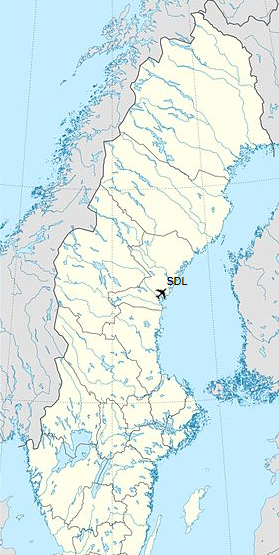
Sundsvall–Timrå Airport (IATA: SDL, ICAO: ESNN) is about 21 km north of Sundsvall, 8 km east of Timrå and 32 km south of Härnösand, Sweden. The airport is also known as Midlanda, referring to its geographically central location in Sweden. The airport was known under the name Sundsvall–Härnösand Airport until the municipalities of Sundsvall and Timrå obtained the ownership of the airport from Swedavia on June 17, 2013. Sundsvall–Timrå Airport is Norrland’s fourth-busiest airport and the country’s eleventh busiest. The airport counted 282,047 passengers in 2011.
It was built on delta land formed by much sediment and flood debris that washed down the Indalsälven river to the sea when the lake Ragundasjön drained suddenly and catastrophically in 1796.
| Sundsvall–Timrå Airport |
|
|
| Summary |
| Airport type |
Public |
| Owner |
Municipalities of Sundsvalland Timrå |
| Operator |
Midlanda Flygplats AB |
| Location |
Timrå, but mainly
serves Sundsvall and Härnösand, Sweden |
| Elevation AMSL |
16 ft / 5 m |
| Coordinates |
62°31′41″N
17°26′38″E |
| Website |
www.sdlairport.se |
| Map |
|
|
| Runways |
| Direction |
Length |
Surface |
| ft |
m |
| 16/34 |
6,857 |
2,090 |
Asphalt |
|
| Statistics (2011) |
| Passengers total |
282,047 |
| International passengers |
21,555 |
| Domestic passengers |
260,492 |
| Landings total |
3,756 |
|
Airlines and destinations
| Destinations |
| Aegean Airlines |
Seasonal charter: Chania |
| BRA Braathens Regional Airlines |
Gothenburg, Stockholm–Bromma
Seasonal: Visby |
| Scandinavian Airlines |
Stockholm–Arlanda |
| Scandjet |
Seasonal charter: Rijeka, Zadar |
The above content comes from Wikipedia and is published under free licenses – click here to read more.
| General Info
|
| Country |
Sweden
|
| ICAO ID |
ESNN
|
| Time |
UTC+1(+2DT)
|
| Latitude |
62.528125
62° 31' 41.25" N
|
| Longitude |
17.443928
017° 26' 38.14" E
|
| Elevation |
16 feet
5 meters
|
| Type |
Civil
|
| Magnetic Variation |
004° E (01/06)
|
| Operating Agency |
CIVIL GOVERNMENT, (LANDING FEES AND DIPLOMATIC CLEARANCE MAY BE REQUIRED)
|
| Operating Hours |
SEE REMARKS FOR OPERATING HOURS OR COMMUNICATIONS FOR POSSIBLE HOURS
|
| Daylight Saving Time |
Last Sunday in March to last Sunday in October
|
| Communications
|
TWR
Provides apch svc.
|
129.55
118.1
|
| ATIS |
127.4
|
| Runways
|
| ID |
Dimensions |
Surface |
PCN |
ILS
|
| 16/34 |
6857 x 148 feet
2090 x 45 meters |
ASPHALT |
050FBXT |
YES
|
| Navaids
|
| Type |
ID |
Name |
Channel |
Freq |
Distance From Field |
Bearing From Navaid
|
| VOR-DME |
SUN |
SUNDSVALL |
078X |
113.1 |
At Field |
-
|
| Supplies/Equipment
|
| Fuel |
Jet A1, without icing nhibitor.
100/130 MIL Spec, low lead, aviation gasoline (BLUE)
|
| Remarks
|
| CSTMS/IMG |
CSTMS avbl 0630-1500Z++ Mon-Fri, 4 hr PN for items other than luggage.
|
| FUEL |
Avbl 0600-2000Z++ Mon-Fri, 0600-1800Z++ Sat, 0700-2000Z++ Sun. (NC-100LL, A1)
|
| LGT |
PAPI Rwy 16 GS 3.25 MEHT 60.0', Rwy 34 MEHT 57.4'.
|
| MISC |
Ldg fees, INCR charges outside opr hr. OPS fone C+46 (0)60 19 76 00.
|
| OPR HOURS |
Opr 0500-2300Z++ Mon-Fri, 0630-1215Z++ Sat, 1200-2300Z++ Sun. OT O/R.
|
| RSTD |
Rpt Rwy 16 TORA 6397', Rwy 34 TORA 6364', Rwy 16-34 LDA 5905'. Tkof Rwy 34 nml not avbl to prop acft over AUW 15.4 or jet acft. Do not exceed idle reverse on ldg.
|
The content above was published at Airports-Worldwide.com in 2018.
We don't guarantee the information is fresh and accurate. The data may be wrong or outdated.
For more up-to-date information please refer to other sources.
|
|