|
|
Höga Kusten Airport (Kramfors Solleftea) |
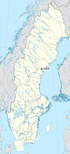
Höga Kusten Airport, translated High Coast Airport, by authorities such as IATA and Transportstyrelsen known as Kramfors-Sollefteå Airport, is an airport located between the towns of Kramfors and Sollefteå, Sweden (IATA: KRF, ICAO: ESNK). The airport is still named Kramfors on tickets and flight lists on other airports.
The number of passengers in 2012 was 18,455, dropping sharply from 62,000 in 2000. The reason for this is low price flights from larger relatively nearby airports like Örnsköldsvik Airport and Sundsvall-Härnösand Airport (travel has not been reduced overall during this period, but the Kramfors passengers have to a large extent chosen other routes). The figures were only 14,787 in 2008 due to the bankruptcy of the airline Nordic Regional.
Höga Kusten Airport
Kramfors/Sollefteå Flygplats |
|
|
|
| Summary |
| Airport type |
Public and other municipalities |
| Owner |
Kramfors Municipality and Sollefteå Municipality |
| Operator |
Höga Kusten Airport AB |
| Serves |
Kramfors, Sollefteå |
| Location |
Nyland, Sweden |
| Elevation AMSL |
10 m / 33 ft |
| Coordinates |
63°02′55″N
017°46′08″E |
| Website |
hogakustenairport.com |
| Map |
|
|
| Runways |
| Direction |
Length |
Surface |
| m |
ft |
| 17/35 |
2,001 |
6,565 |
Asphalt |
|
| Statistics (2016) |
|
|
Airlines and destinations
| Destinations |
| Amapola Flyg |
Hemavan, Stockholm–Arlanda |
Transportation
Ground transport is by taxi, shared taxi, rental car or own car.
There is (since August 2012) a railway station on the Ådalen Line 1½ km (1 mile) from the airport. Taxi transfer is available, which should be prebooked.
|
Höga Kusten airport, Sweden. |
|
Höga Kusten airport, Sweden. |
|
Höga Kusten airport, Rail station. |
The above content comes from Wikipedia and is published under free licenses – click here to read more.
| General Info
|
| Country |
Sweden
|
| ICAO ID |
ESNK
|
| Time |
UTC+1(+2DT)
|
| Latitude |
63.048597
63° 02' 54.95" N
|
| Longitude |
17.768856
017° 46' 07.88" E
|
| Elevation |
34 feet
10 meters
|
| Type |
Civil
|
| Magnetic Variation |
004° E (01/06)
|
| Operating Agency |
CIVIL GOVERNMENT, (LANDING FEES AND DIPLOMATIC CLEARANCE MAY BE REQUIRED)
|
| Near City |
Solleftea
|
| Operating Hours |
SEE REMARKS FOR OPERATING HOURS OR COMMUNICATIONS FOR POSSIBLE HOURS
|
| Daylight Saving Time |
Last Sunday in March to last Sunday in October
|
| Communications
|
| AFIS |
122.15
|
| Communications Remarks |
|
| AFIS |
Opr 0430-2050 Mon; 0430-0800Z++, 1315-2050Z++ Tue-Wed; 0430-2050Z++ Thu-Fri; 1530-1900Z++ Sun.
|
| Runways
|
| ID |
Dimensions |
Surface |
PCN |
ILS
|
| 17/35 |
6565 x 148 feet
2001 x 45 meters |
ASPHALT |
030FBXT |
YES
|
| Navaids
|
| Type |
ID |
Name |
Channel |
Freq |
Distance From Field |
Bearing From Navaid
|
| NDB |
LUE |
LUNDE |
- |
427 |
9.9 NM |
347.9
|
| Supplies/Equipment
|
| Fuel |
Jet A1, without icing nhibitor.
91/96 octane gasoline, leaded, No MIL Spec.
100/130 MIL Spec, low lead, aviation gasoline (BLUE)
|
| Oil |
O-123, 1065,(Dispersant)Reciprocating Engine Oil(MIL L 22851 Type III)
|
| Remarks
|
| FUEL |
Avbl dur AFIS hr. (NC-100LL, A1)
|
| LGT |
PAPI Rwys 17 and 35 GS 3.25 .
|
| MISC |
Ldg fees, INCR charges outside AFIS opr hr.
|
The content above was published at Airports-Worldwide.com in 2018.
We don't guarantee the information is fresh and accurate. The data may be wrong or outdated.
For more up-to-date information please refer to other sources.
|
|