 |
|
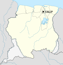
Johan A Pengel Intl Airport |
| Johan Adolf Pengel International Airport |
IATA: PBM – ICAO: SMJP
|
| Summary |
| Airport type |
Public |
| Operator |
Johan Adolf Pengel International Airport (JAPIA) Corporation |
| Serves |
Paramaribo |
| Location |
Zanderij |
| Elevation AMSL |
59 ft / 18 m |
| Coordinates |
05°27′10.19″N 55°11′16.02″W / 5.4528306°N 55.1877833°W / 5.4528306; -55.1877833Coordinates: 05°27′10.19″N 55°11′16.02″W / 5.4528306°N 55.1877833°W / 5.4528306; -55.1877833 |
| Runways |
| Direction |
Length |
Surface |
| ft |
m |
| 11/29 |
11,417 |
3480 |
Asphalt |
Johan Adolf Pengel International Airport (IATA: PBM, ICAO: SMJP), also known as Paramaribo-Zanderij International Airport, is an airport located in the town of Zanderij, 45 km south of Paramaribo. It is Suriname's main international gateway operated by Airport Management, Ltd./ NV Luchthavenbeheer. Airlines and destinations
| Airlines |
Destinations |
| Caribbean Airlines |
Port of Spain |
| Caricom Airways |
|
| Insel Air |
Curaçao |
| KLM |
Amsterdam |
| Meta Transportes Aéreos |
Belém, Boa Vista, Georgetown |
| Surinam Airways |
Amsterdam, Aruba, Belém, Curaçao, Miami, Port of Spain |
Charter
| Airlines |
Destinations |
| Blue Wing Airlines |
Paramaribo-Zorg en Hoop |
| Gum Air |
Paramaribo-Zorg en Hoop |
Cargo and destinations
- ABX Air (Miami) operating on behalf of Surinam Airways and Laparkan Shipping
- Amerijet (Port of Spain) operating on behalf of Telesis Aviation
Surinam Airways Flight PY764On June 7, 1989, a Douglas DC-8 of Surinam Airways from Amsterdam Airport Schiphol in the Netherlands crashed during approach to Johan Adolf Pengel International Airport, killing 176 of the 187 on-board. The crash was the worst ever aviation disaster in Suriname's history. Among the dead were fifteen Surinamese-Dutch professional football players.
History
Prior to World War II, Zandery Airport was a Pan American World Airways stop. After the fall of the Netherlands to Nazi forces in 1940, the United States obtained military basing rights to the airport from the Netherlands government-in-exile in London. The first American forces arrived at the airport on 30 November 1941 and expanded the facilities to be a transport base for sending Lend-Lease supplies to England via air routes across the South Atlantic Ocean.
With the United States entry into the war in December 1941, the importance of Zandery Field increased drastically, becoming a major transport base on the South Atlantic route of Air Transport Command ferrying supplies and personnel to Freetown Airport, Sierra Leone and onwards to the European and African theaters of the war. In addition, antisubmarine patrols were flown from the airfield over the southern Caribbean and South Atlantic coastlines.
Major USAAF units assigned to the airfield were:
- 35th Bombardment Squadron (25th Bombardment Group) 1 November 1941-7 October 1943 (B-25 Mitchell)
- Detachment operated from: Atkinson Field, British Guiana, 1 November 1942-7 October 1943
- Detachment operated from: Piarco Airport, Trinidad, 27 August-12 October 1943
- 99th Bombardment Squadron (9th Bombardment Group), 3 December 1941-31 October 1942 (B-18 Bolo)
- 22d Fighter Squadron (36th Fighter Group), 16 September 1942-16 September 1943) (P-39 Aircobras, later P-47 Thunderbolts)
- 23d Antisubmarine Squadron (Trinidad Detachment, Antilles Air Command), 15 August-December 1943 (A-29 Hudson)
With the end of World War II Zandery Airfield was reduced in scope to a skeleton staff. It was closed as a military facility on 30 April 1946 and turned over to Dutch authorities which returned it to a civil airport.
The above content comes from Wikipedia and is published under free licenses – click here to read more.
| General Info
|
| Country |
Suriname
|
| ICAO ID |
SMJP
|
| Time |
UTC-3
|
| Latitude |
5.452831
05° 27' 10.19" N
|
| Longitude |
-55.187783
055° 11' 16.02" W
|
| Elevation |
59 feet
18 meters
|
| Type |
Civil
|
| Magnetic Variation |
017° W (01/06)
|
| Beacon |
Yes
|
| Operating Agency |
CIVIL GOVERNMENT, (LANDING FEES AND DIPLOMATIC CLEARANCE MAY BE REQUIRED)
|
| Near City |
Zandery
|
| International Clearance Status |
Airport of Entry
|
| Communications
|
| PENGEL TWR |
118.5
|
| GND |
121.9
|
| PENGEL APP |
120.0
|
| Runways
|
| ID |
Dimensions |
Surface |
PCN |
ILS
|
| 11/29 |
11417 x 148 feet
3480 x 45 meters |
CONCRETE. |
052FAWT |
YES
|
| Navaids
|
| Type |
ID |
Name |
Channel |
Freq |
Distance From Field |
Bearing From Navaid
|
| VOR-DME |
ZY |
ZANDERIJ |
090X |
114.3 |
At Field |
-
|
| Supplies/Equipment
|
| Fuel |
Jet A1, without icing nhibitor.
100/130 octane gasoline, leaded, MIL-L-5572F (GREEN)
|
| Remarks
|
| CAUTION |
Lgtd dam 30 NM S may be mistaken for an afld. Sun 1100-2100Z gldr ops 3NM aroundafld sfc to 3000'.
|
| FUEL |
(NC-A1)
|
The content above was published at Airports-Worldwide.com in 2010.
We don't guarantee the information is fresh and accurate. The data may be wrong or outdated.
For more up-to-date information please refer to other sources.
|
|


