|
 |
|
||||
|
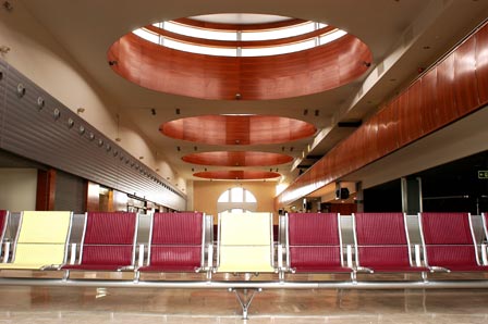
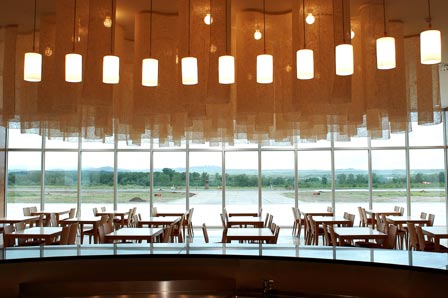
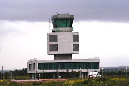
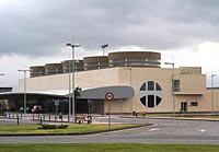
Opened in 2003, the airport has modern infrastructures and services that allow it to manage the air traffic demand within appropriate levels of safety and quality. In the six months of 2003 during which the new airport operated, 20,222 passengers passed through its facilities and 1,624 flights were operated. In 2004, it handled 38,385 passengers and 2,509 flight operations. In 2005, the airport reported 39,150 passengers and 3.064 flight operations. History The airfield had a 1,000 by 600 metre airstrip and was classified as a military airfield provisionally enabled as a civil airport. In 1929, an air wing of 16 De Havilland reconnaissance aircraft were stationed at Logroño. In March it was opened to official and private air traffic, in accordance with instructions for the organisation of commercial air traffic services at military airfields. On 5 February 1932, its name was changed from Recajo Airfield to Agoncillo Airfield. That same year the Logroño Aviation Club was founded, which initially used an airstrip on the grounds of Prado Viejo for its activities, where it remained until 20 December 1948, when it moved to Agoncillo Airfield. In 1936 the 23rd Reconnaissance Group was based at the airfield and in 1938 the Levante Regional Park, dedicated to repairing aircraft, engines and equipment, arrived; in 1939, the park took on the name Maestranza Aérea de Logroño, and operated until the 1950s. The airport opens to civil traffic Agoncillo Airfield opened again to civil air traffic, full domestic and international tourism and technical stopovers for commercial traffic, in July 1946. The airstrip measured 1,500 by 700 metres of natural terrain and a runway, called 11-29, measuring 1,500 by 40 metres. In 1950, Agoncillo was classified as a military base open to Class B civil traffic during daytime hours. For the approach, there is a radio beacon and direction finder located on the eastern edge of the airfield. There are three flight paths available for landing operations: 13-31, 2,100 metres long, 90-27, 1,950 metres long, and 17-35, 1,500 metres long. Air activity began to decline at the end of the 1960s, with the exception of a few aviation club flights. In the 1980s, activity began to recover, since Agoncillo began to be used for Civil Guard and Army helicopters. For this reason, in 1994, its facilities were transferred to the army and the Fuerzas Aeromóviles del Ejército de Tierra (FAMET, "Army Air Forces") were established there. Since 1996, the Government of La Rioja, encouraged by the experiences of Leon and Burgos, began actions to convert Agoncillo into Logroño Airport. After drafting the Directive Plan and several projects, the BOE ("Official State Bulletin") published on 21 September 1998 a resolution by the Secretary of State for Infrastructures and Transport declaring Logroño-Agoncillo Airport a general interest airport under the direct management of the State. Logroño-Agoncillo Airport - AENA airport Address: Ctra. Logroño-Zaragoza (Nal. 232) 26509 Agoncillo/La Rioja Telephone: 941 277 400 Fax: 941 277 410 URL: http://www.aena.es/logrono-agoncillo AENA accepts no responsibility for the information posted at this site neither for the possible damages caused for the use of this information. Images and information placed above are from http://www.aena.es/logrono-agoncillo We thank them for the data!
Runway 11/296562 x 148 feet
|
||||||||||||||||||||||||||||||||||||||||||||||||||||||||||||||||||||||||||||||||||||||||||||||||||||||||||||||||||||||||||||||||||||||||||||||||||||||||||||||||||||||||||||||||||||||||||||||||||||||||||||||
| Runway 11 | |
|---|---|
| Surface | ASPHALT |
| True Heading | 109.8 |
| Latitude | 42.463575 42° 27' 48.87" N |
| Longitude | -2.331933 002° 19' 54.96" W |
| Elevation | 1156.0 feet 352 meters |
| Slope | -0.2° |
| Landing Distance | 6562 feet 2000 meters |
| Takeoff Distance | 6759 feet 2060 meters |
| Overrun Length | 197 feet 60 meters |
| Overrun Surface | ASPHALT |
| Lighting System | MIRL PAPI |
| Runway 29 | |
|---|---|
| Surface | ASPHALT |
| True Heading | 289.8 |
| Latitude | 42.457478 42° 27' 26.92" N |
| Longitude | -2.309044 002° 18' 32.56" W |
| Elevation | 1140.0 feet 347 meters |
| Slope | 0.2° |
| Landing Distance | 6562 feet 2000 meters |
| Takeoff Distance | 6759 feet 2060 meters |
| Overrun Length | 197 feet 60 meters |
| Overrun Surface | ASPHALT |
| Lighting System | MIRL A2 PAPI |
| LOGRONO | |||||
|---|---|---|---|---|---|
| Type | ID | Channel | Freq | Country | State |
| VOR-DME | LPA | 101Y | 115.45 | Spain | - |
| Latitude | Longitude | Airport |
| 42.460536 42° 27' 37.93" N |
-2.326911 002° 19' 36.88" W |
LERJ |
| LOGRONO | |||||
|---|---|---|---|---|---|
| Type | ID | Channel | Freq | Country | State |
| NDB | EAG | - | 399 | Spain | - |
| Latitude | Longitude | Airport |
| 42.451342 42° 27' 04.83" N |
-2.314736 002° 18' 53.05" W |
LELO |
Logroño-Agoncillo Airport - AENA airport
The content above was published at Airports-Worldwide.com in 2006.
We don't guarantee the information is fresh and accurate. The data may be wrong or outdated.
For more up-to-date information please refer to other sources.

 |
|
Copyright 2004-2024 © by Airports-Worldwide.com, Vyshenskoho st. 36, Lviv 79010, Ukraine Legal Disclaimer |
 Logroño-Agoncillo
airport is located east of the capital
of La Rioja, in the town of Agoncillo.
Logroño-Agoncillo
airport is located east of the capital
of La Rioja, in the town of Agoncillo.