|
 |
|
||||
|
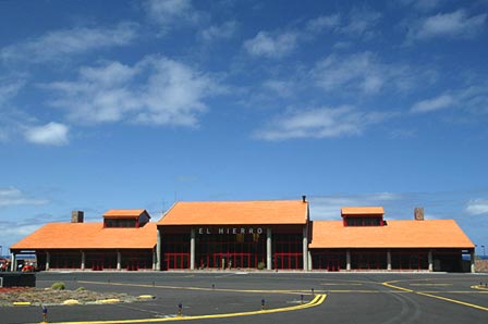
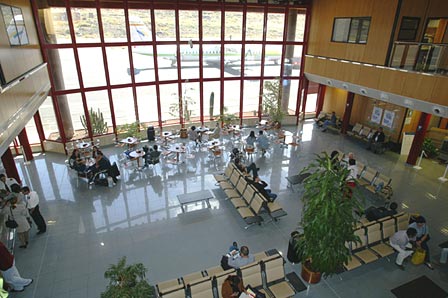
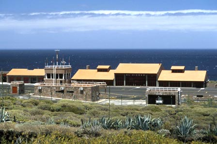
Air traffic is domesticl, with the main origin/destination of flights being Tenerife Norte Airport and, to a lesser extent, the airports of Gran Canaria and La Palma. In 2005, the airport handled 157,945 passengers, 4,300 operations and 174 tonnes of cargo. History Studies for the localisation of an airport began in 1962. Due to the complicated relief of the island, the options were limited and in the end an area on the coast was chosen, known as Llano de los Cangrejos, situated in the northeast of the island, close to its capital, Valverde. At the end of 1968 work began on runway 16-34, an aircraft platform and a passenger terminal. In 1972, a transmitter station was built, following which the airport was inaugurated on 12 December of that same year. It was opened to national domestic passenger and cargo traffic and classified as third category. In 1975 the first radio-electric facilities were installed in the airport and in 1977 the runway was extended. The airport's aeronautical limitations were published in 1986. In 1990 a new control tower was built and the passenger terminal renovated. During 1991 and 1992 the runway was extended. Finally, the current passenger terminal was built. The first aeronautical event on the island of El Hierro occurred on 12 December 1955 when a helicopter flew to the island, in what was also the first search and rescue operation in the Canary Islands, to airlift a sick person off the island. Studies for the localisation of an airport began in 1962. Due to the complicated relief of the island, the options were limited and in the end an area on the coast was chosen, known as Llano de los Cangrejos, situated in the northeast of the island, close to its capital, Valverde. At the end of 1968 work began on runway 16-34, an aircraft platform and a passenger terminal. In 1972, a transmitter station was built, following which the airport was inaugurated on 12 December of that same year. It was opened to national domestic passenger and cargo traffic and classified as third category. In 1975 the first radio-electric facilities were installed in the airport and in 1977 the runway was extended. The airport's aeronautical limitations were published in 1986. In 1990 a new control tower was built and the passenger terminal renovated. During 1991 and 1992 the runway was extended. Finally, the current passenger terminal was built. The first aeronautical event on the island of El Hierro occurred on 12 December 1955 when a helicopter flew to the island, in what was also the first search and rescue operation in the Canary Islands, to airlift a sick person off the island. Studies for the localisation of an airport began in 1962. Due to the complicated relief of the island, the options were limited and in the end an area on the coast was chosen, known as Llano de los Cangrejos, situated in the northeast of the island, close to its capital, Valverde. At the end of 1968 work began on runway 16-34, an aircraft platform and a passenger terminal. In 1972, a transmitter station was built, following which the airport was inaugurated on 12 December of that same year. It was opened to national domestic passenger and cargo traffic and classified as third category. In 1975 the first radio-electric facilities were installed in the airport and in 1977 the runway was extended. The airport's aeronautical limitations were published in 1986. In 1990 a new control tower was built and the passenger terminal renovated. During 1991 and 1992 the runway was extended. Finally, the current passenger terminal was built. El Hierro Airport - AENA airport Address: El Cangrejo s/n 38910 Valverde del Hierro/Sta. Cruz de Tenerife AENA accepts no responsibility for the information posted at this site neither for the possible damages caused for the use of this information. Images and information placed above are from http://www.aena.es/elhierro We thank them for the data!
Runway 16/344101 x 98 feet
|
||||||||||||||||||||||||||||||||||||||||||||||||||||||||||||||||||||||||||||||||||||||||||||||||||||||||||||||||||||||||||||||||||||||||||||||||||||||||||||||||||||||||||||||||||||||||||||||||||||||||||||||||
| Runway 16 | |
|---|---|
| Surface | ASPHALT |
| True Heading | 153.0 |
| Latitude | 27.819847 27° 49' 11.45" N |
| Longitude | -17.889975 017° 53' 23.91" W |
| Elevation | 71.0
feet 22 meters |
| Slope | 0.8° |
| Landing Distance | 4101
feet 1250 meters |
| Takeoff Distance | 4199
feet 1280 meters |
| Overrun Length | 98
feet 30 meters |
| Overrun Surface | ASPHALT |
| Lighting System | MIRL
PAPI |
| Runway 34 | |
|---|---|
| Surface | ASPHALT |
| True Heading | 333.0 |
| Latitude | 27.809847 27° 48' 35.45" N |
| Longitude | -17.884136 017° 53' 02.89" W |
| Elevation | 103.0
feet 31 meters |
| Slope | -0.8° |
| Landing Distance | 4101
feet 1250 meters |
| Takeoff Distance | 4199
feet 1280 meters |
| Overrun Length | 98
feet 30 meters |
| Overrun Surface | ASPHALT |
| Lighting System | MIRL
PAPI |
| HIERRO | |||||
|---|---|---|---|---|---|
| Type | ID | Channel | Freq | Country | State |
| NDB | HIE | - | 376 | Spain | - |
| Latitude | Longitude | Airport |
| 27.816172 27° 48' 58.22" N |
-17.886383 017° 53' 10.98" W |
GCHI |
| HIERRO | |||||
|---|---|---|---|---|---|
| Type | ID | Channel | Freq | Country | State |
| DME | HR | 079X | - | Spain | - |
| Latitude | Longitude | Airport |
| 27.816053 27° 48' 57.79" N |
-17.886433 017° 53' 11.16" W |
GCHI |
El Hierro Airport - AENA airport
The content above was published at Airports-Worldwide.com in 2006.
We don't guarantee the information is fresh and accurate. The data may be wrong or outdated.
For more up-to-date information please refer to other sources.

 |
|
Copyright 2004-2024 © by Airports-Worldwide.com, Vyshenskoho st. 36, Lviv 79010, Ukraine Legal Disclaimer |
 Introduction